 |
 |
 |
|
Polar
Satellite Precipitation Data Center
|
|
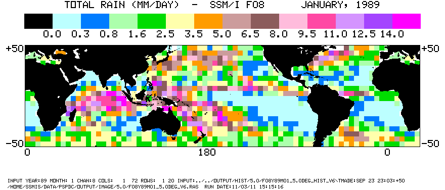
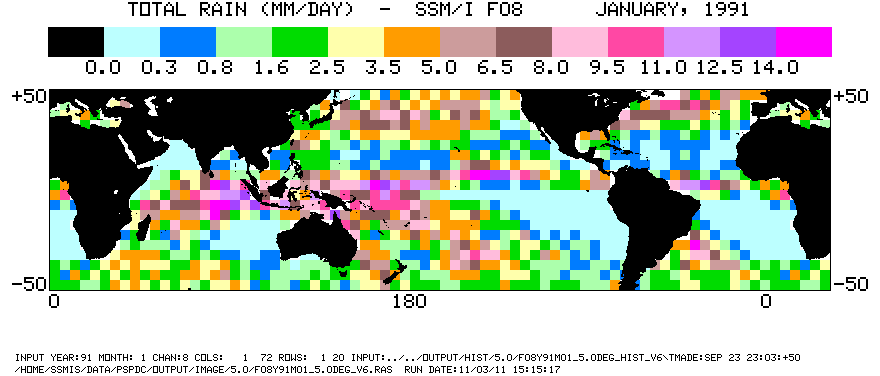
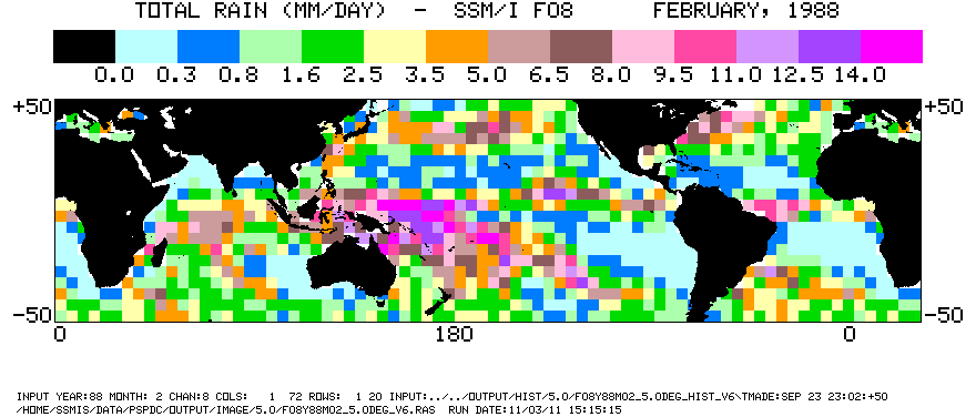
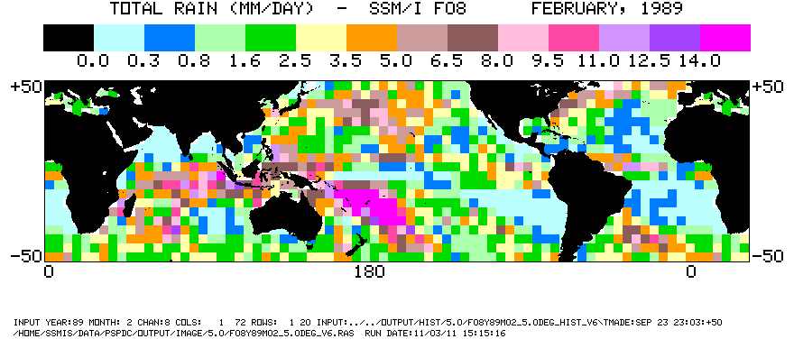
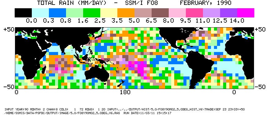
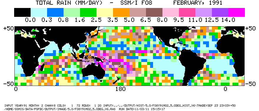
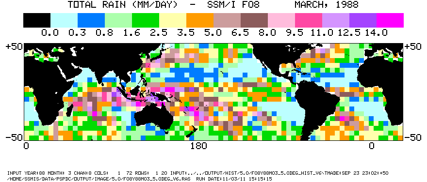
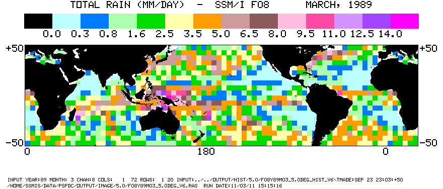
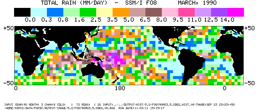
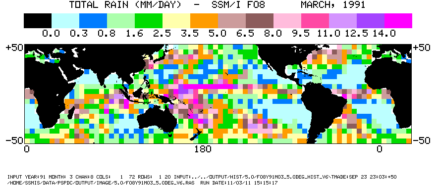
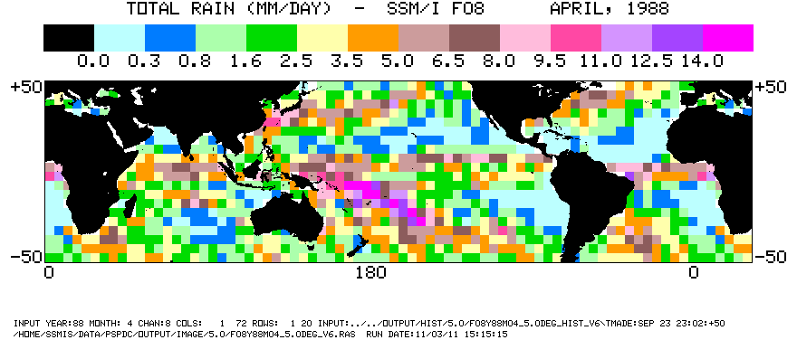
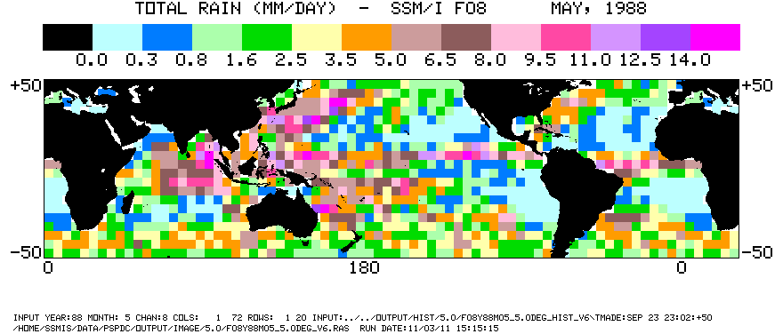
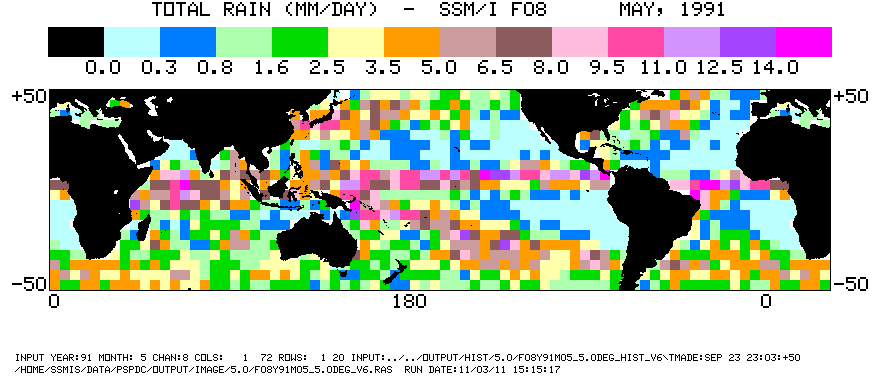
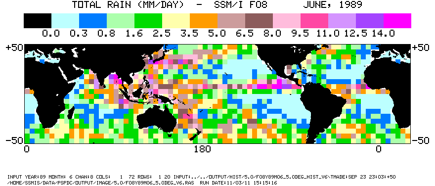
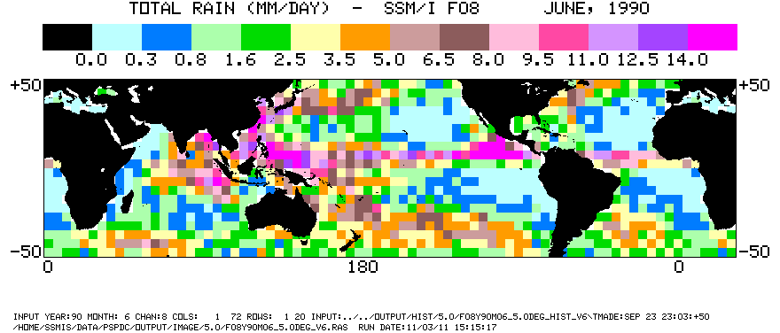
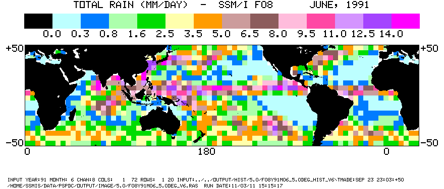
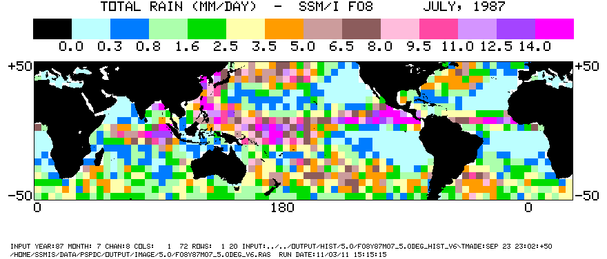
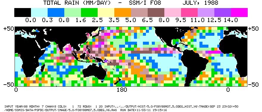
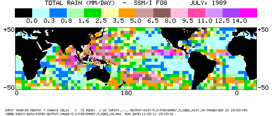
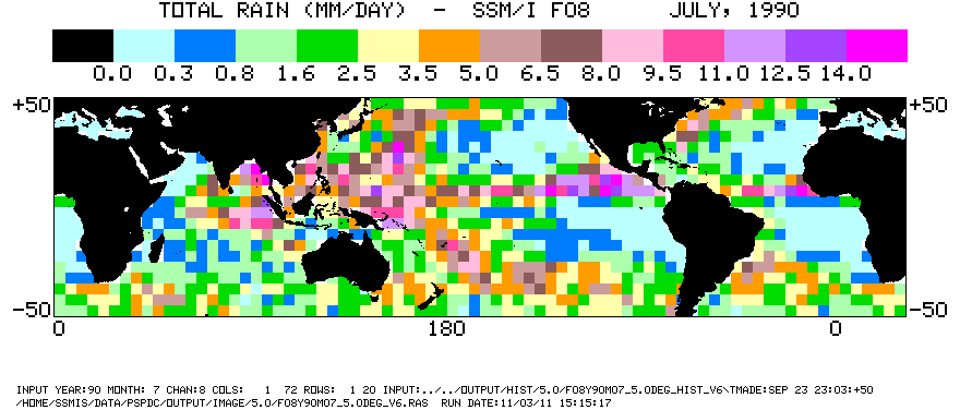
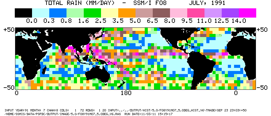
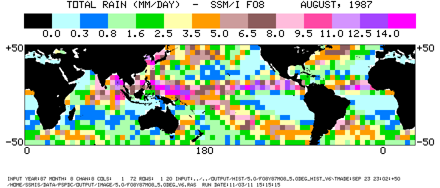
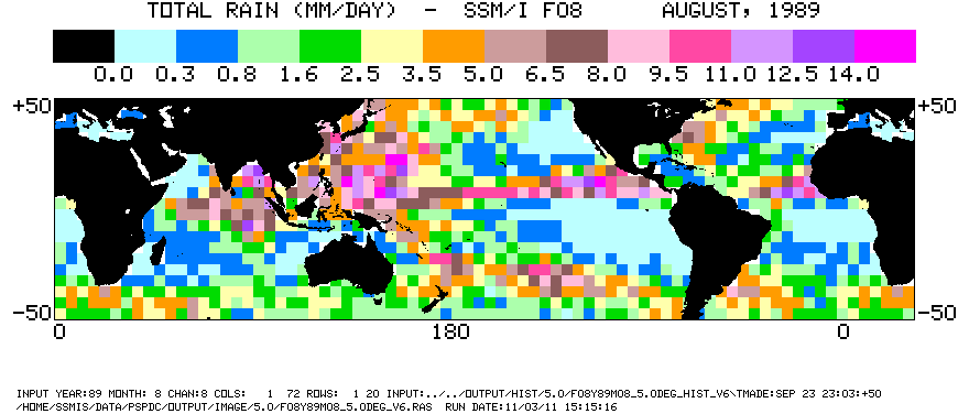
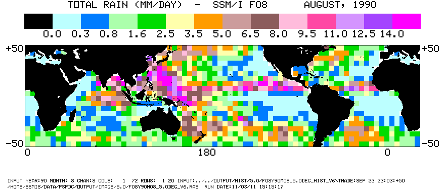
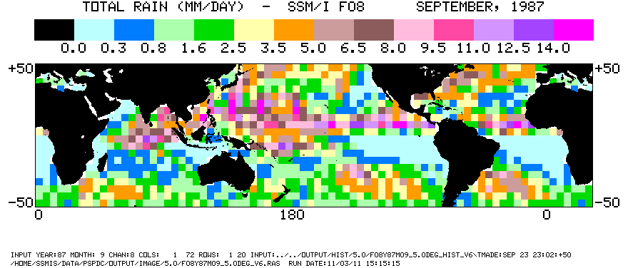
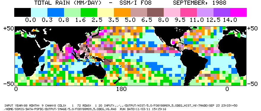
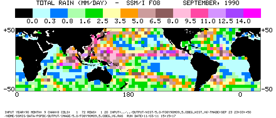
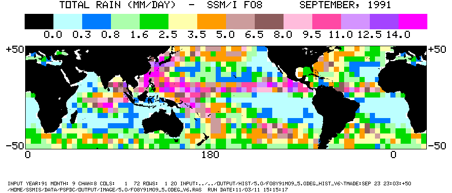
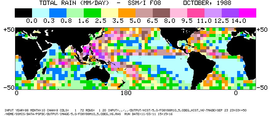
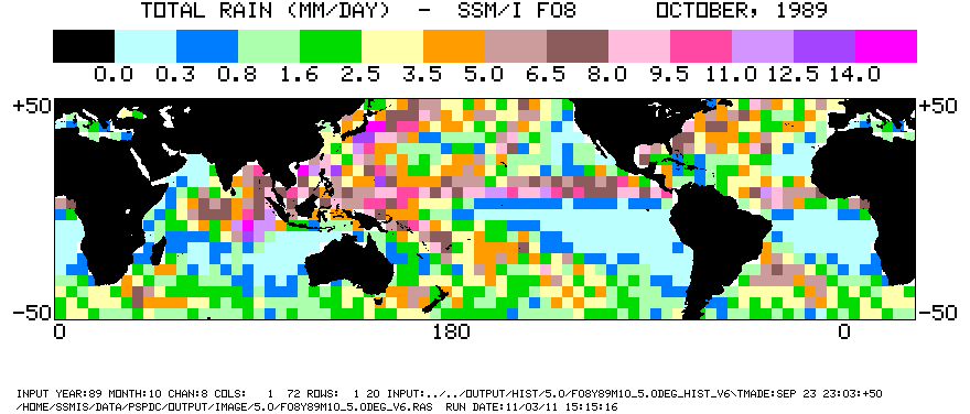
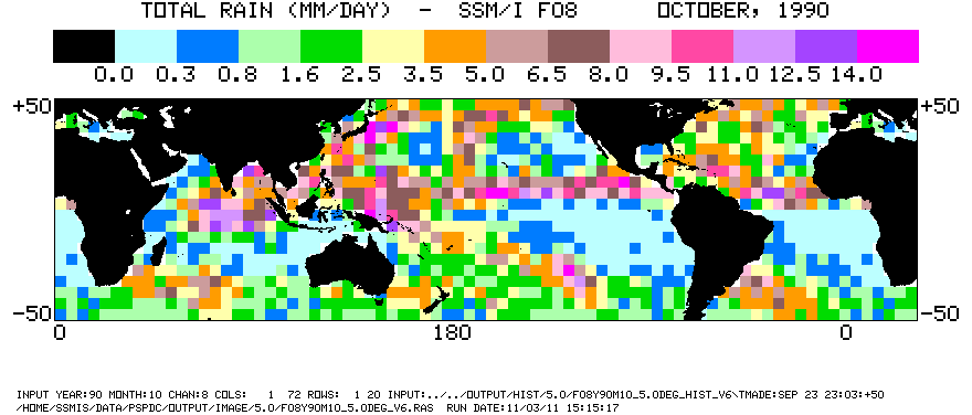
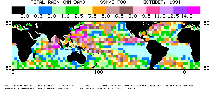
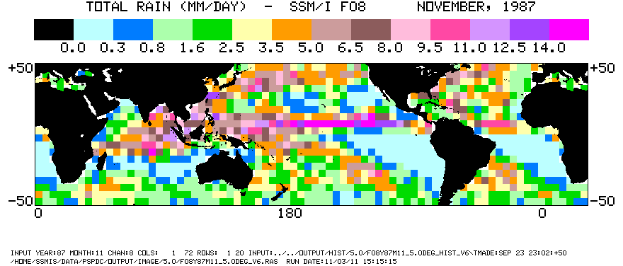
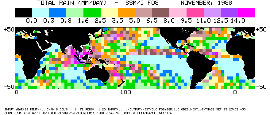
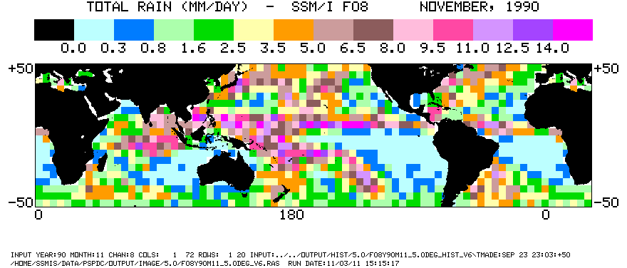
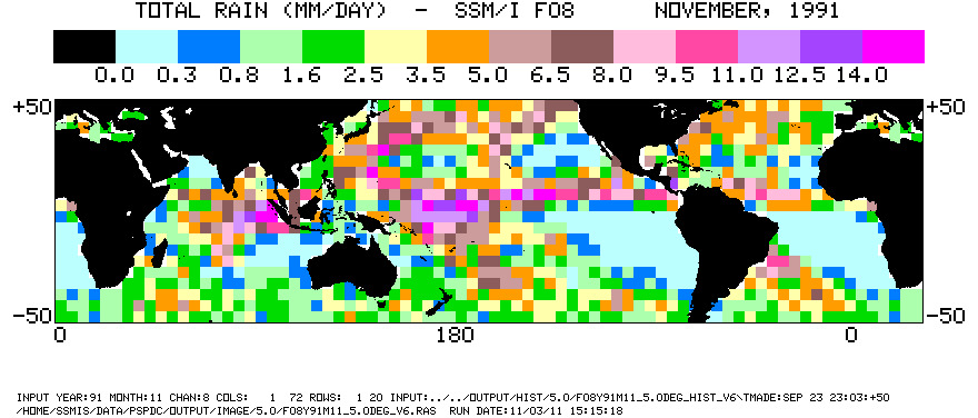
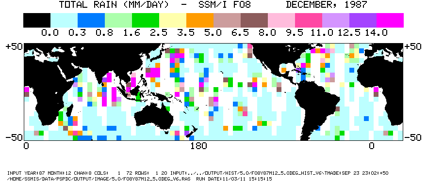
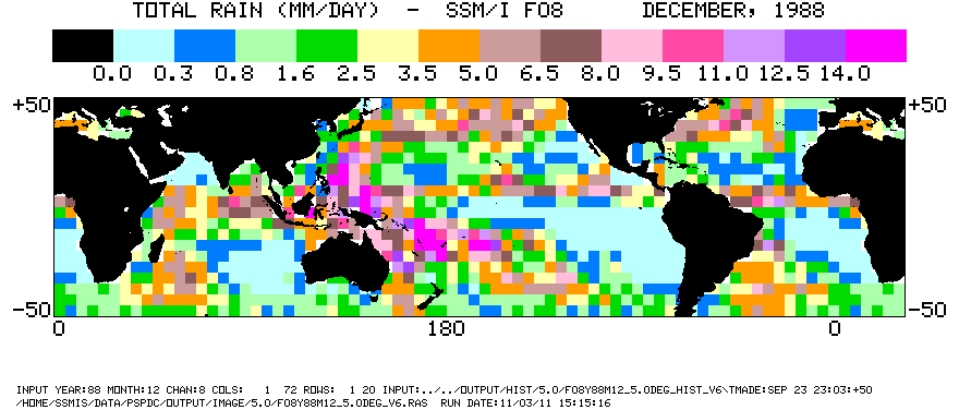
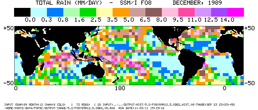
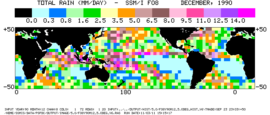
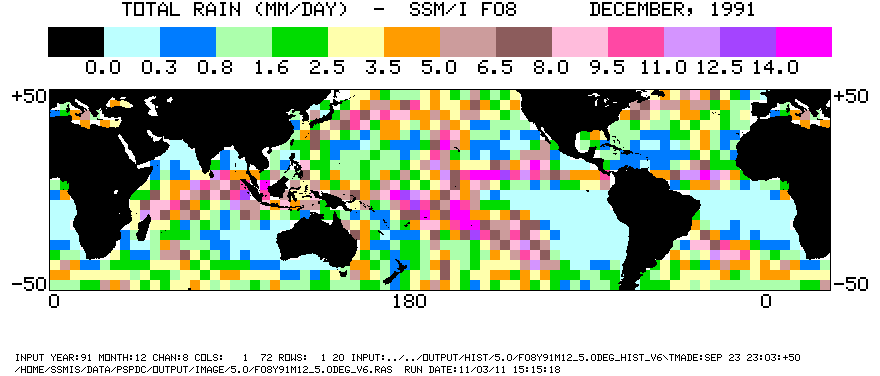
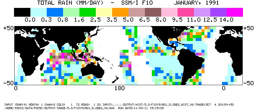
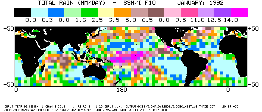
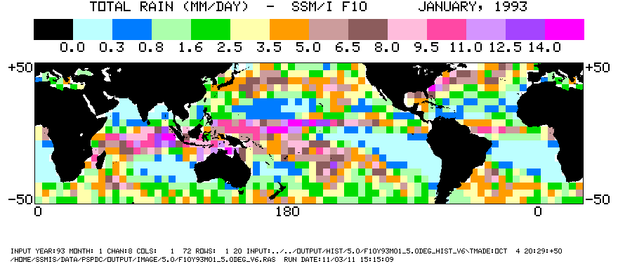
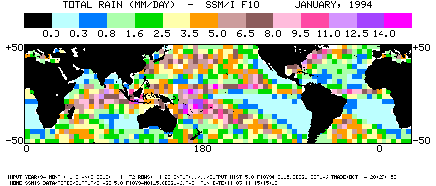
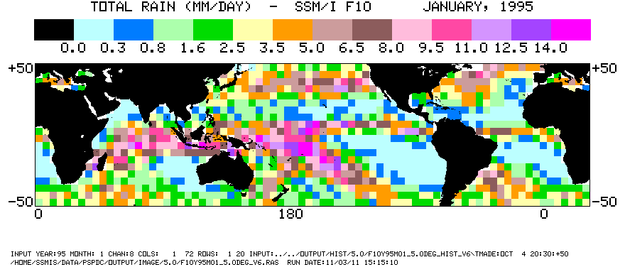
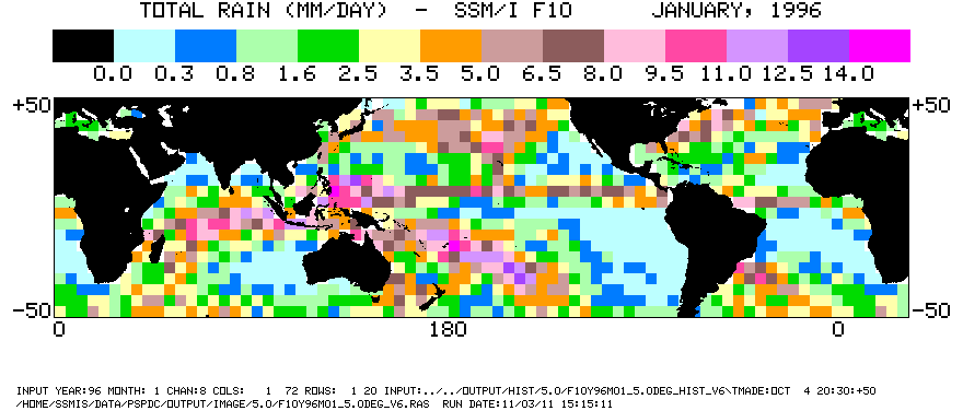
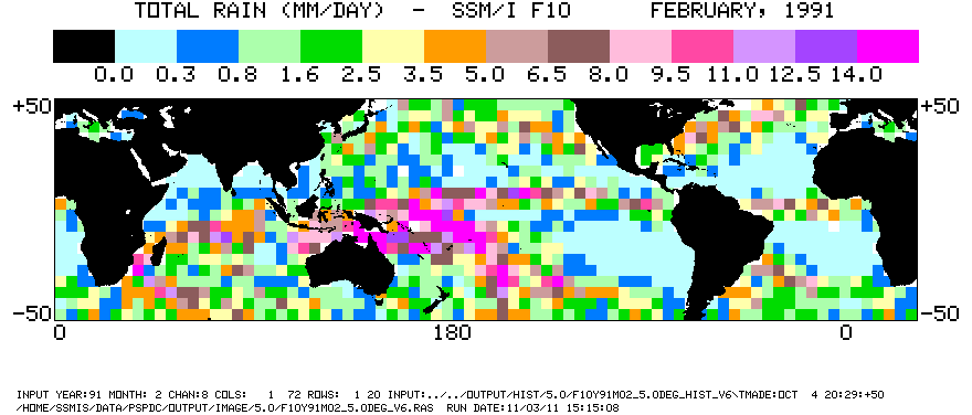
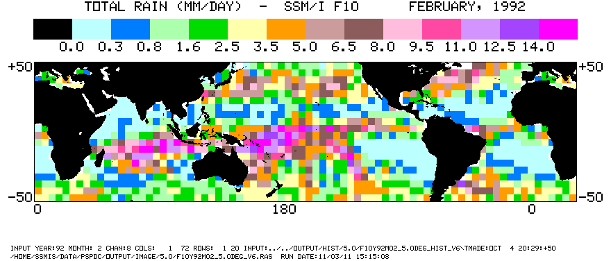
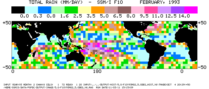
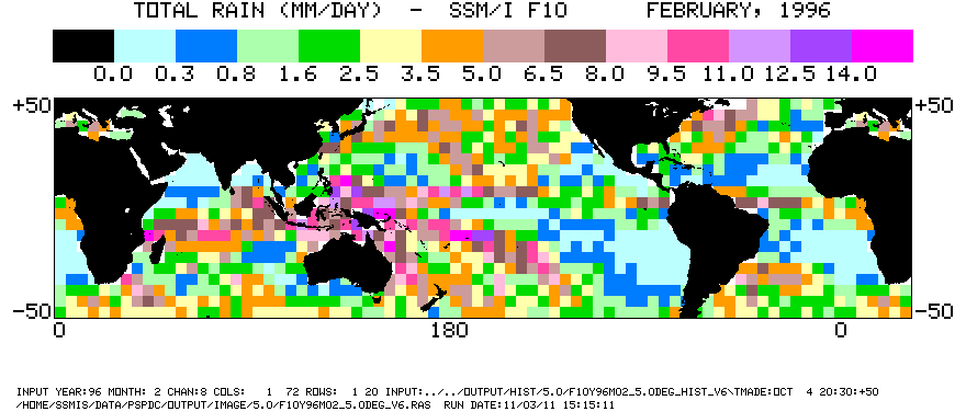
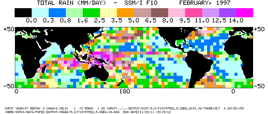
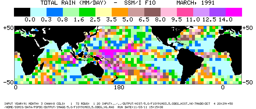
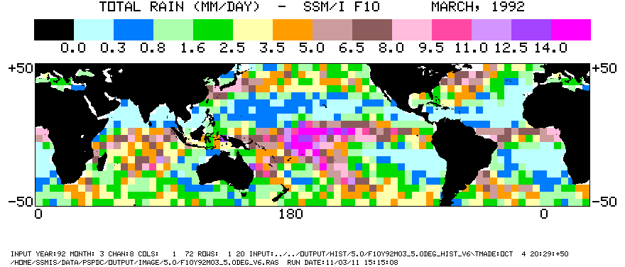
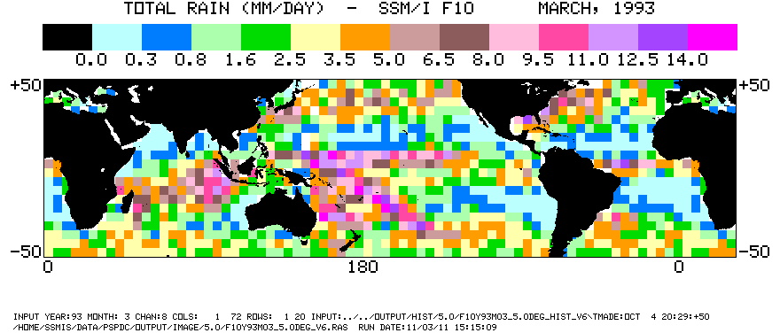
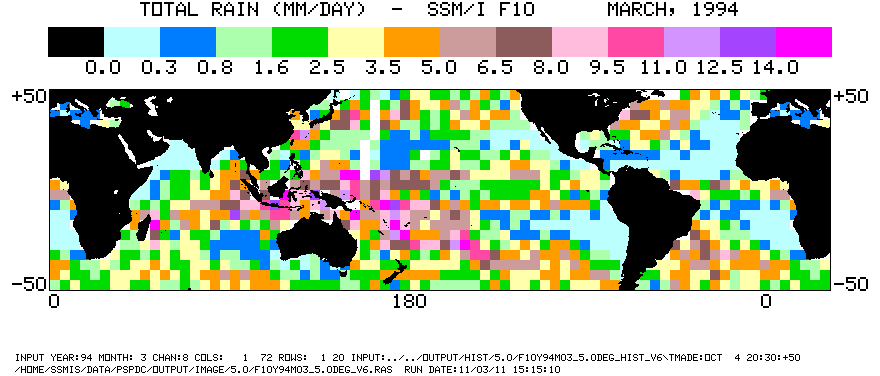
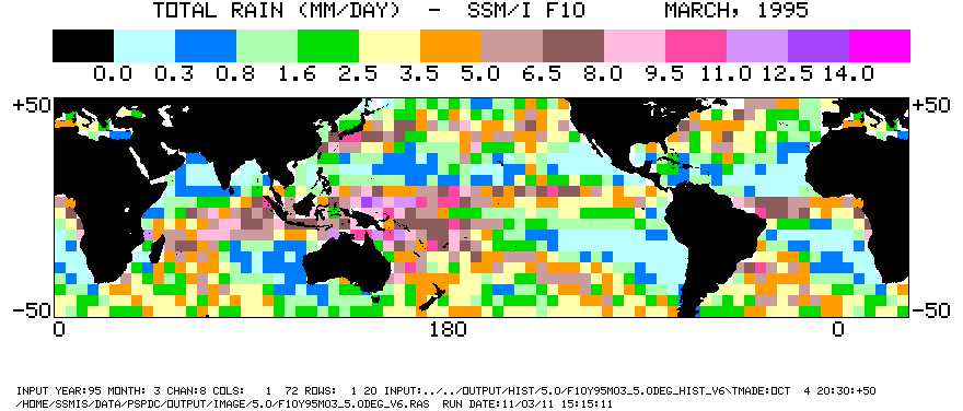
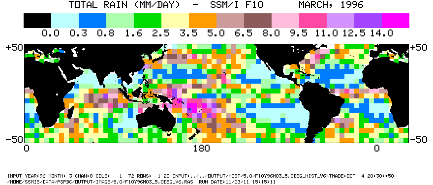
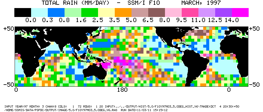
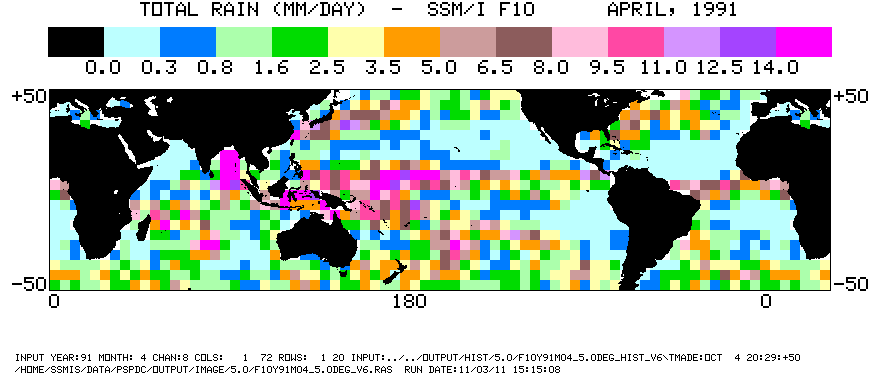
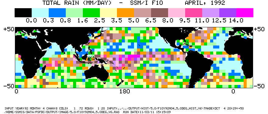
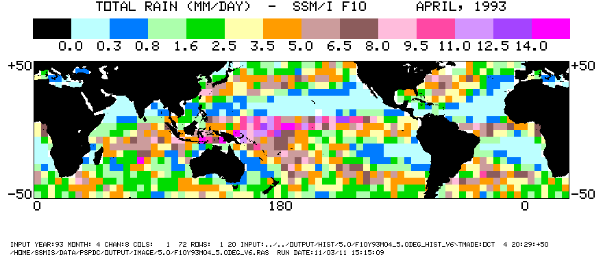
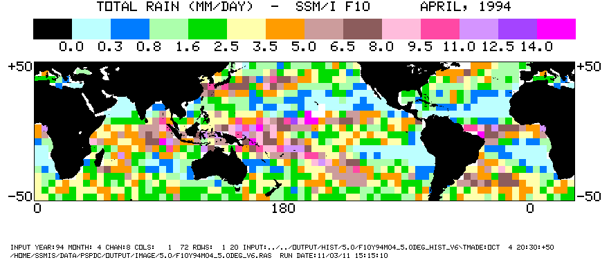
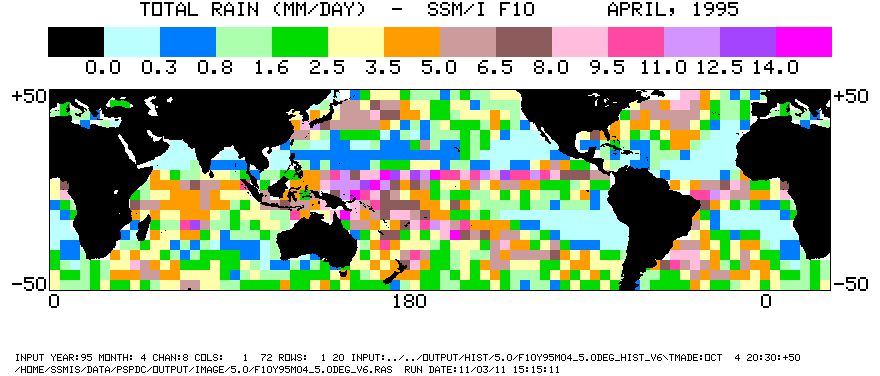
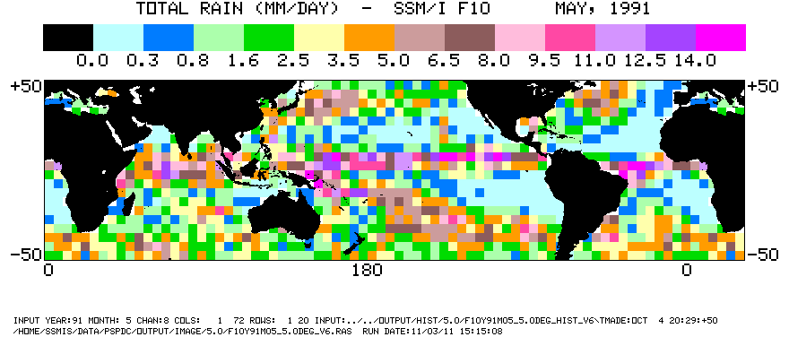
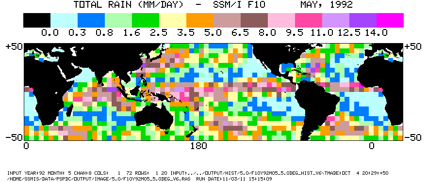
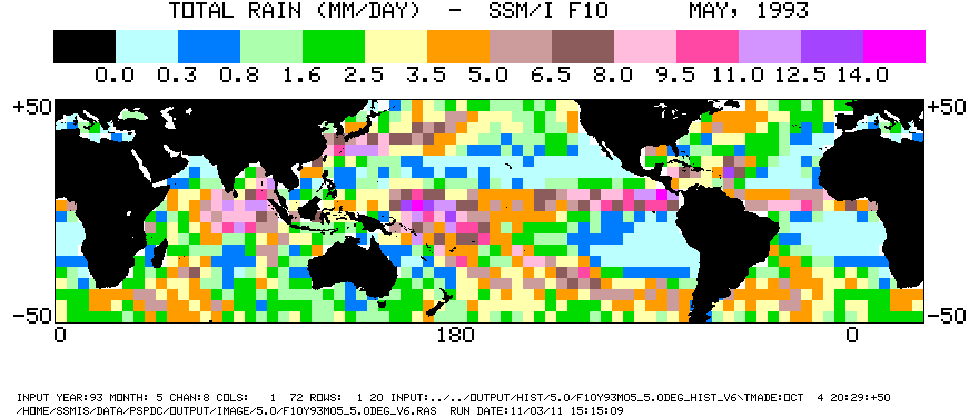
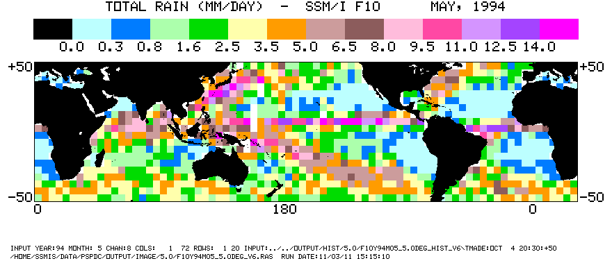
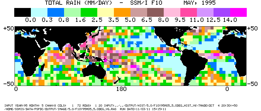
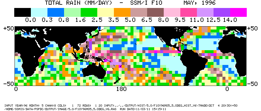
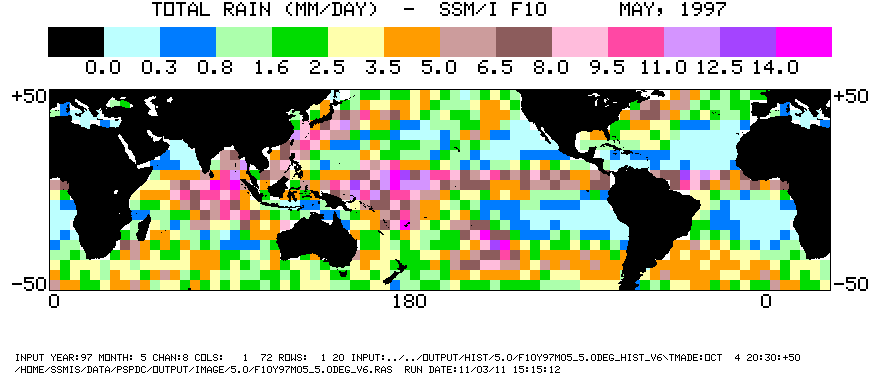
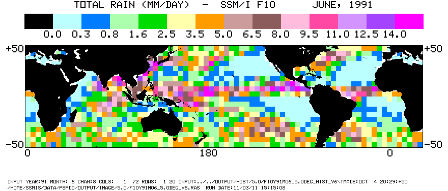
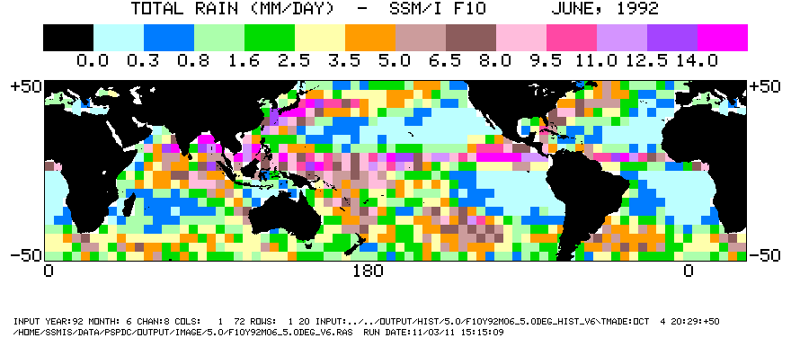
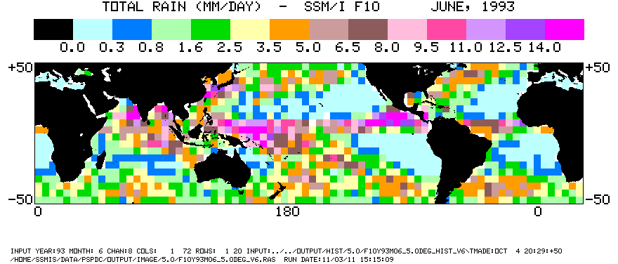
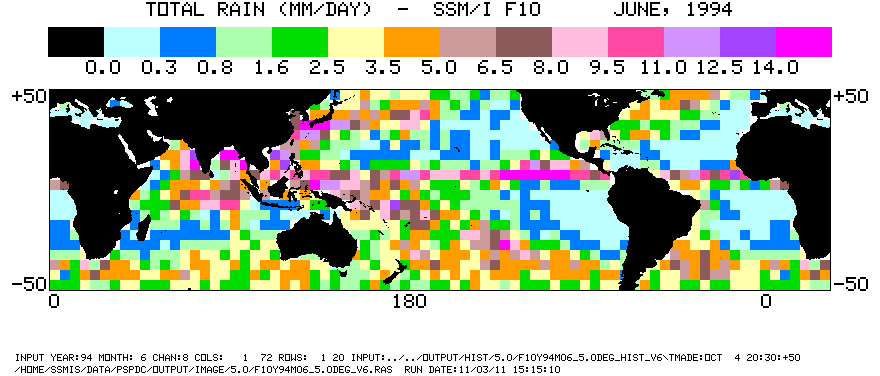
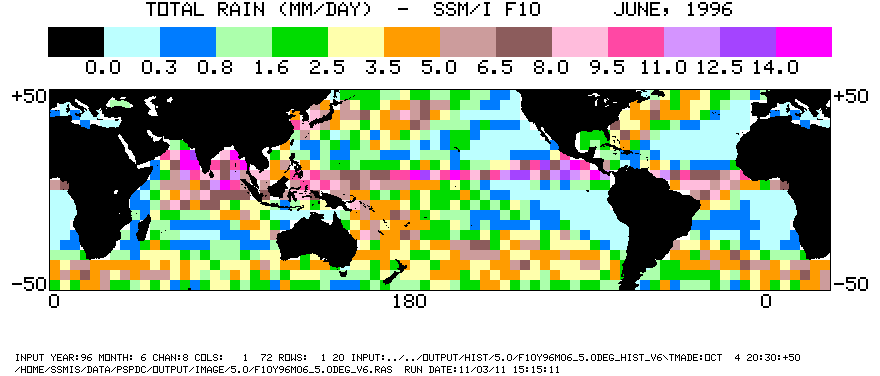
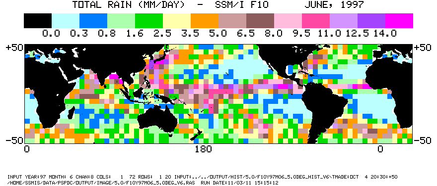
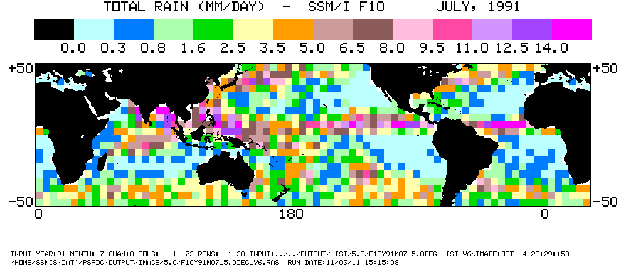
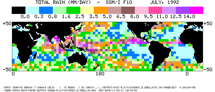
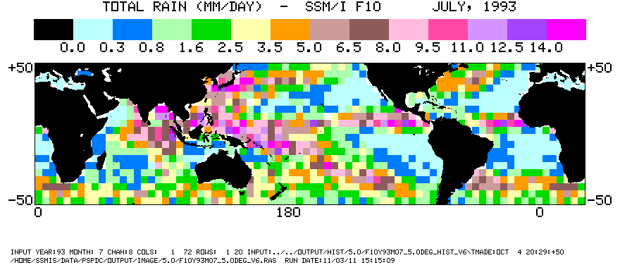
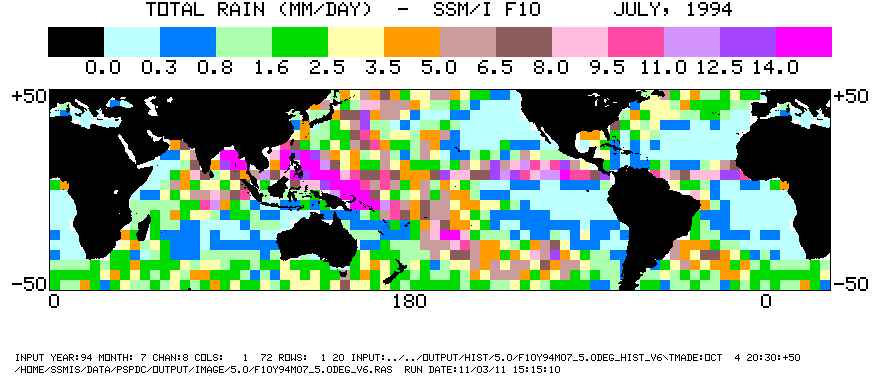
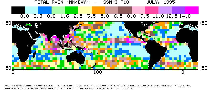
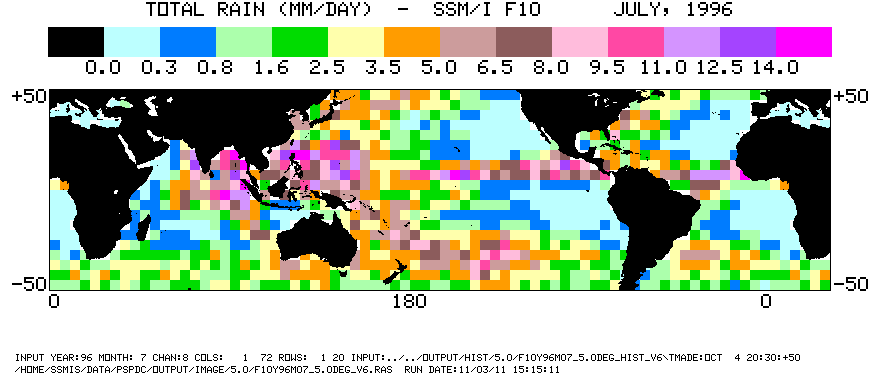
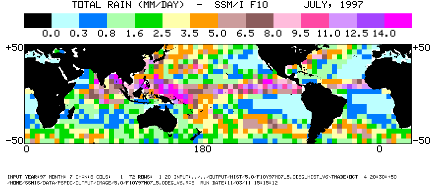
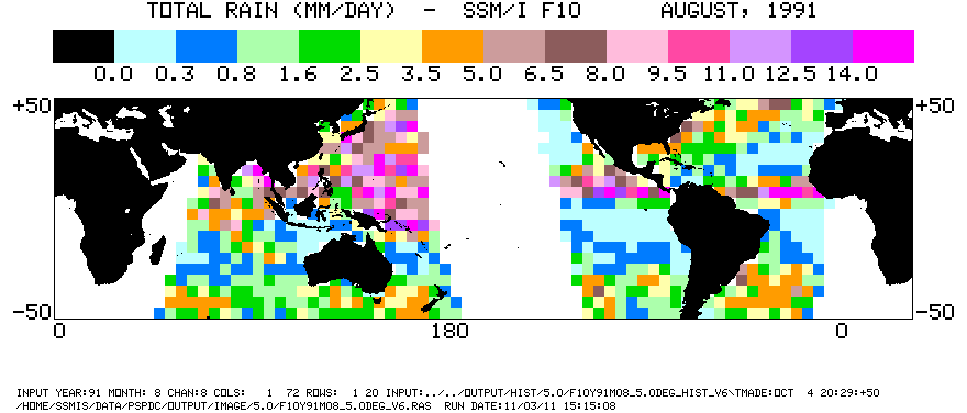
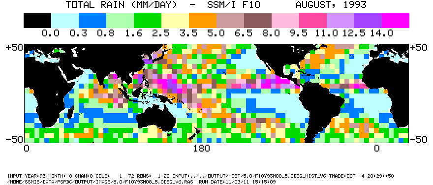
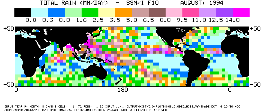
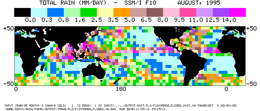
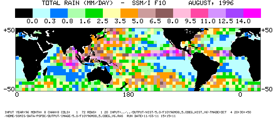
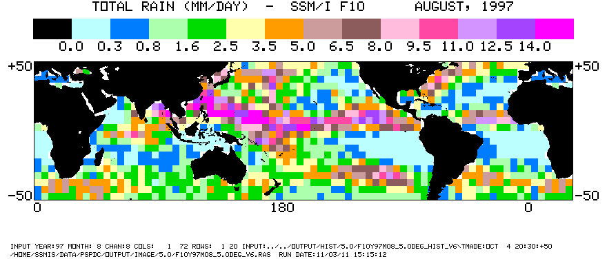
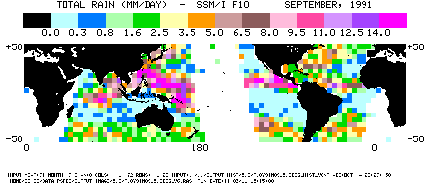
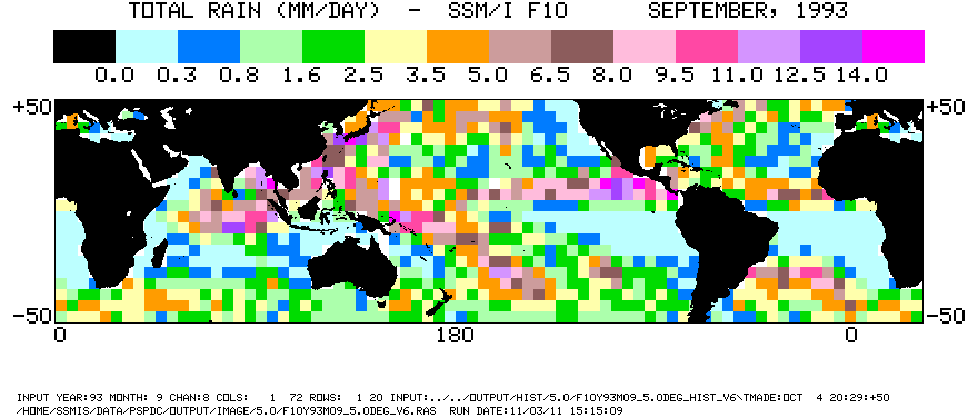
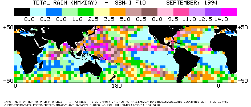
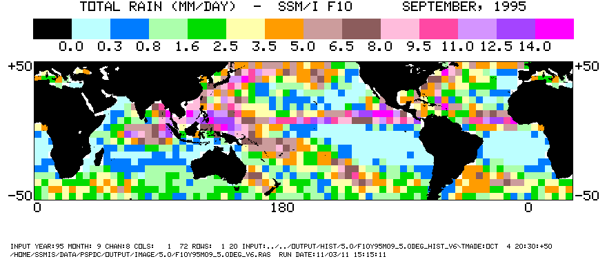
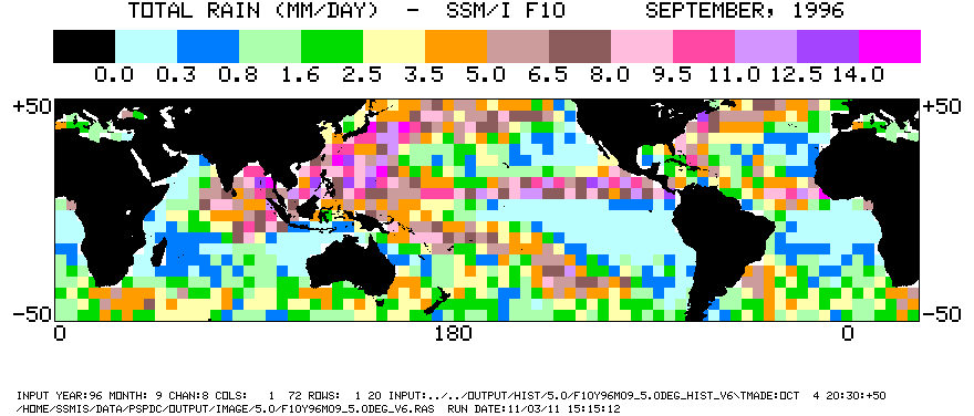
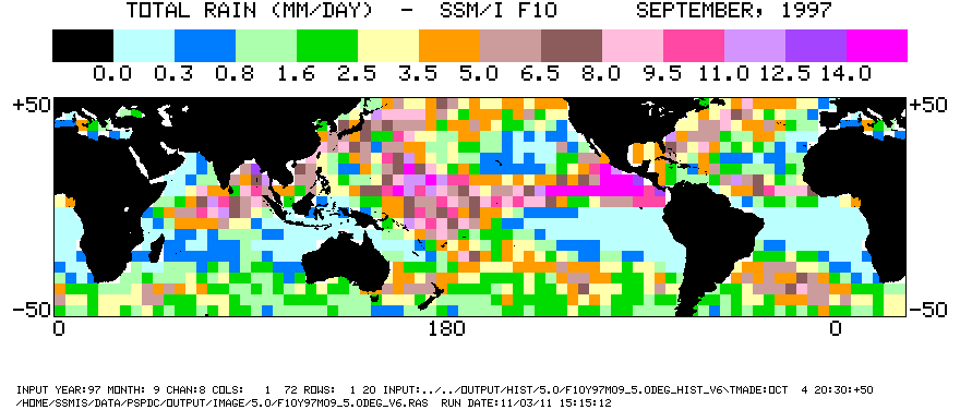
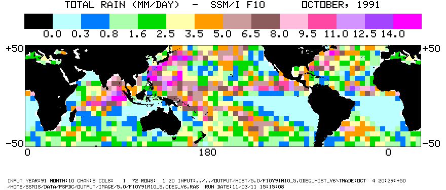
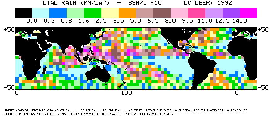
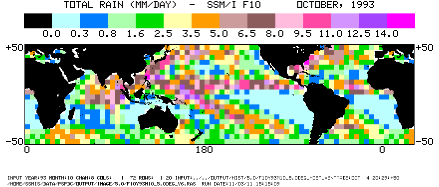
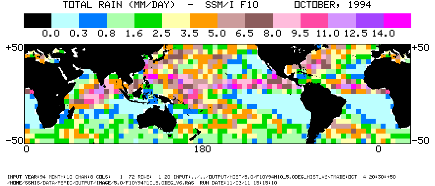
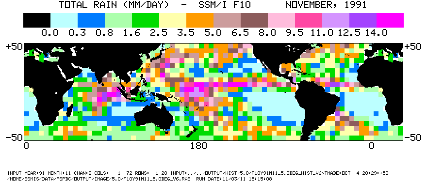
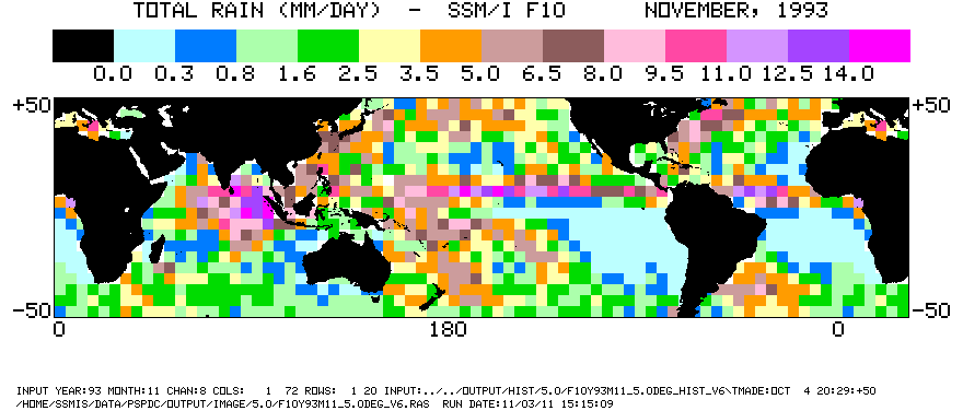
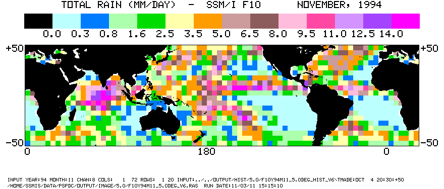
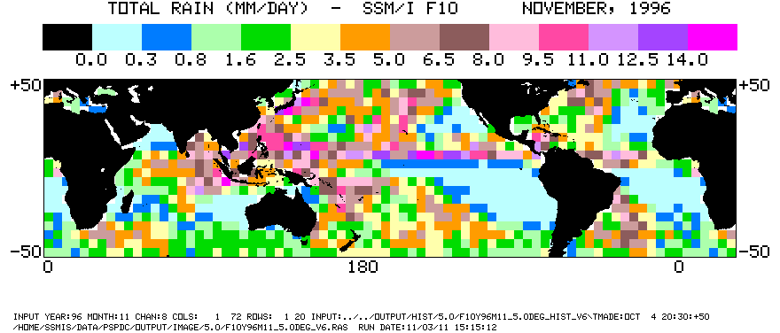
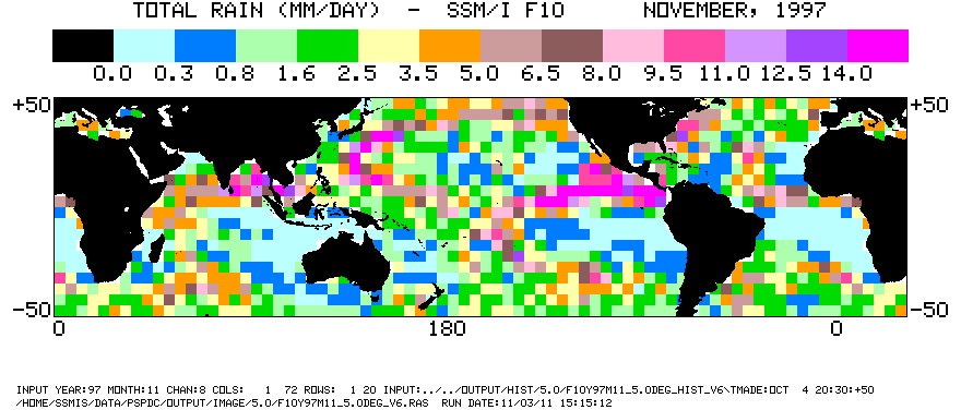
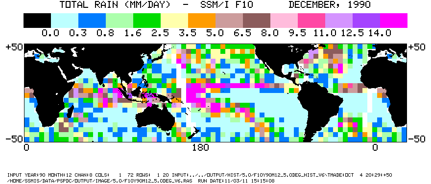
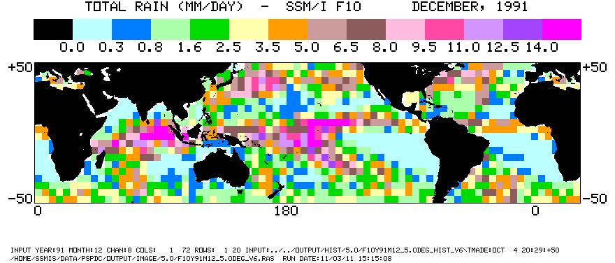
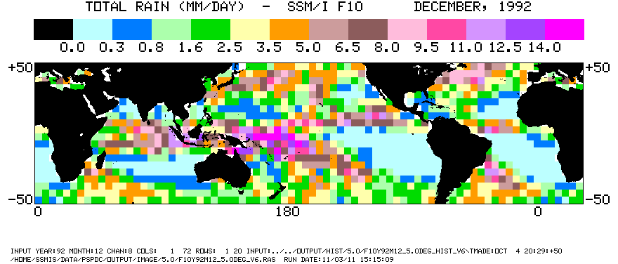
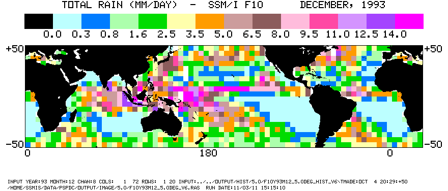
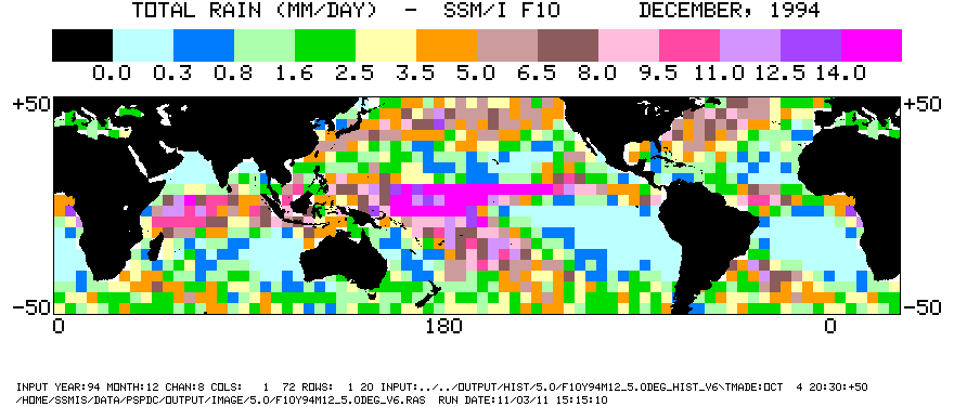
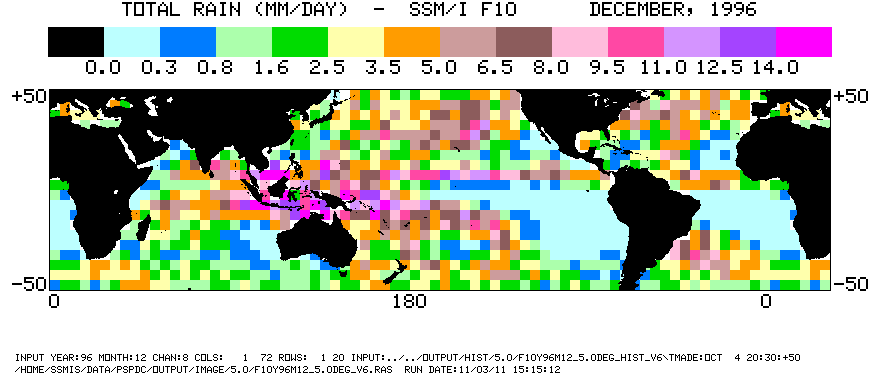
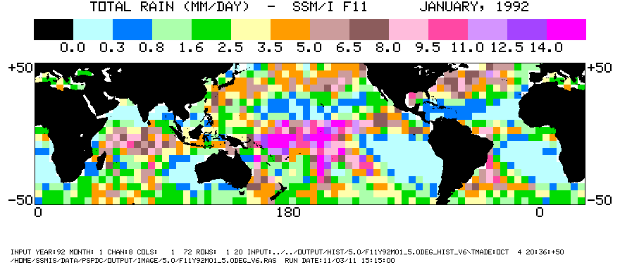
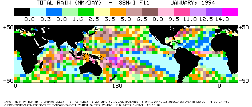
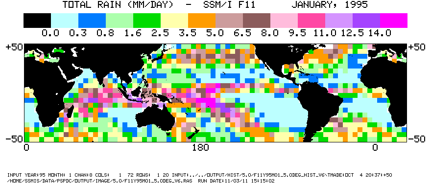
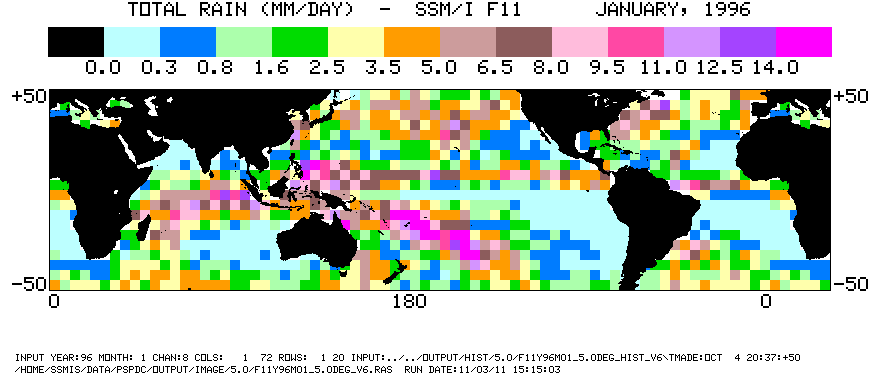
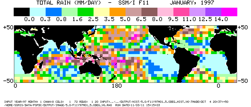
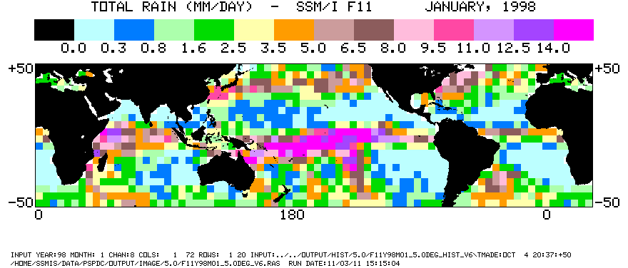
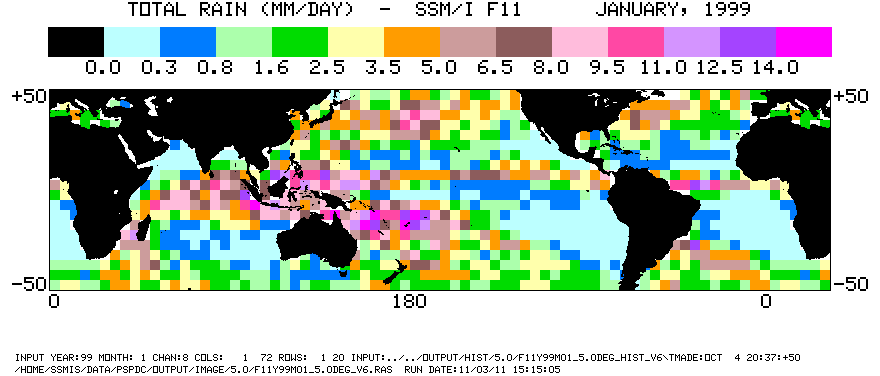
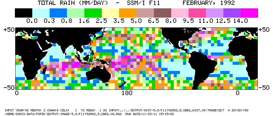
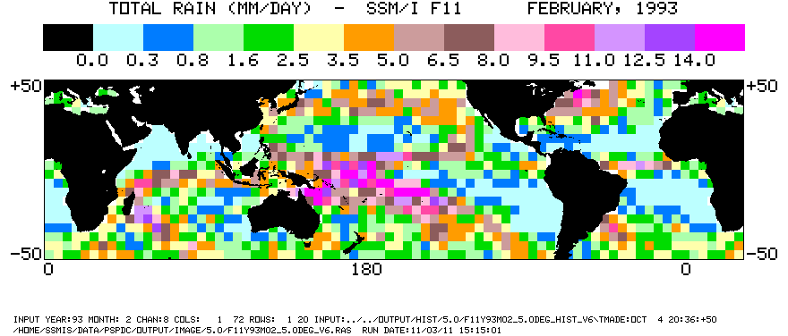
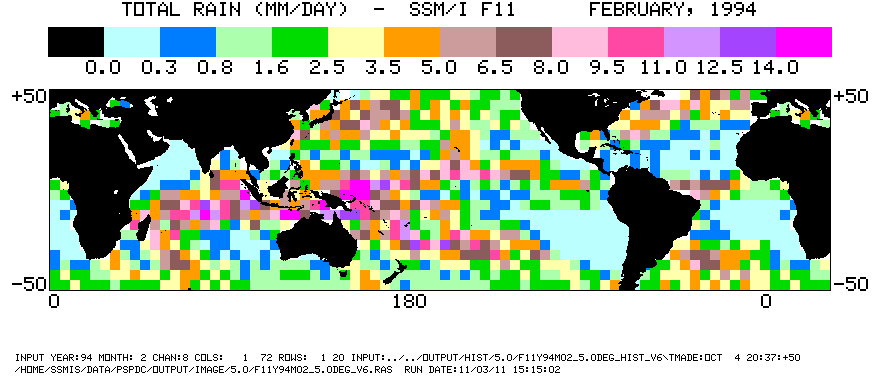
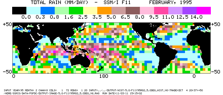
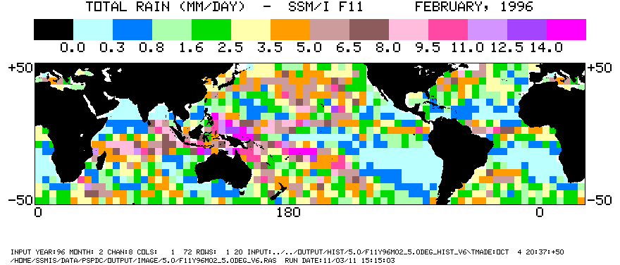
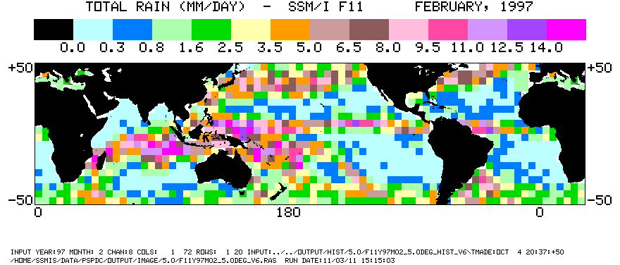
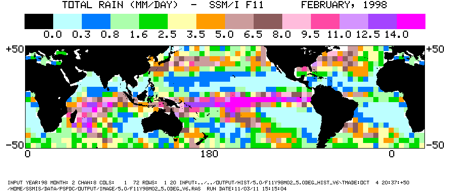
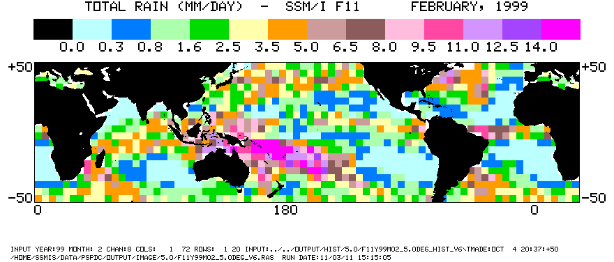
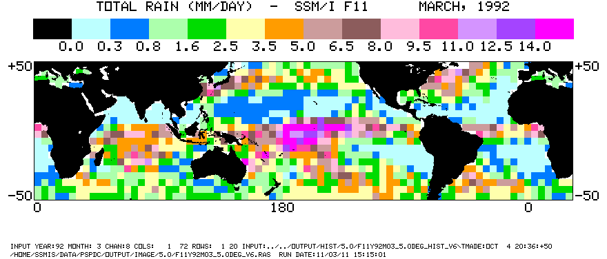
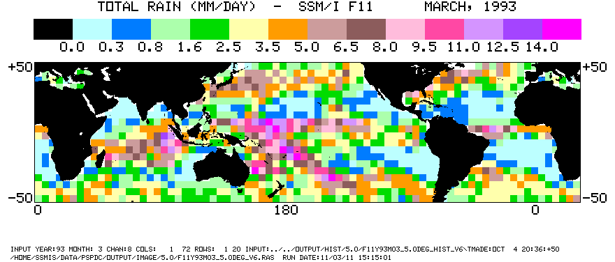
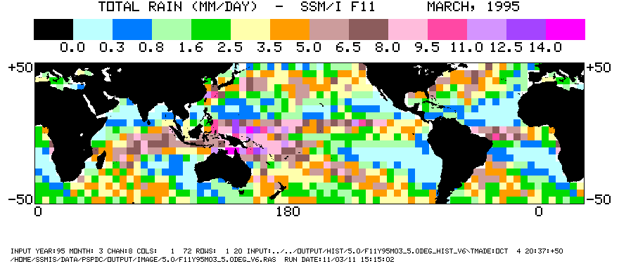
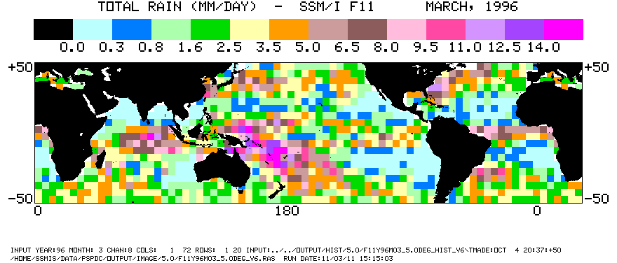
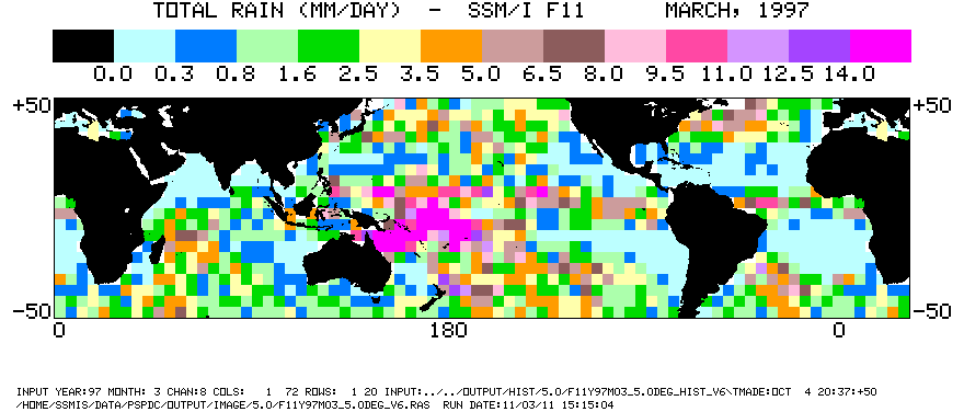
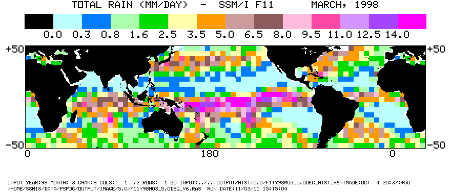
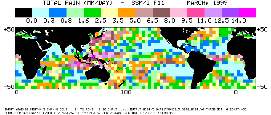
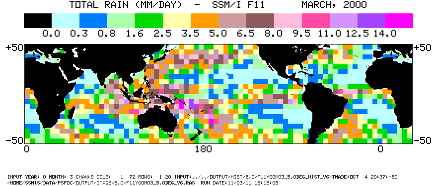
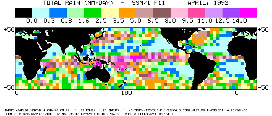
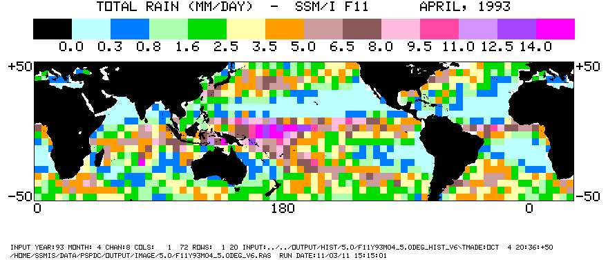
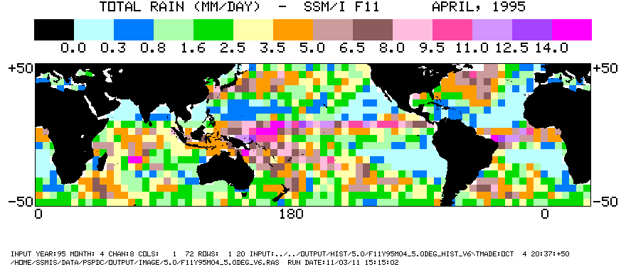
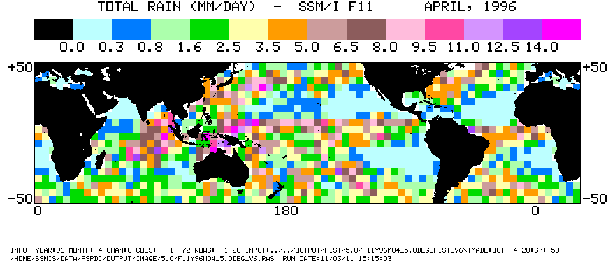
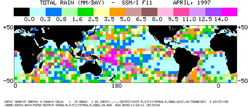
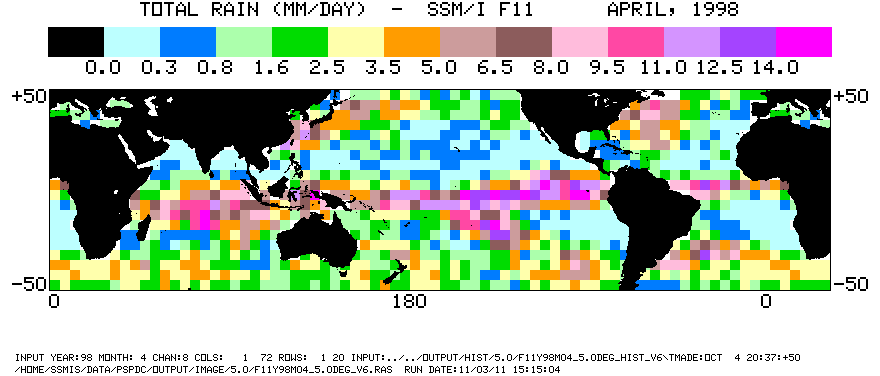
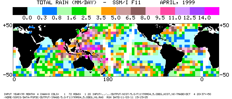
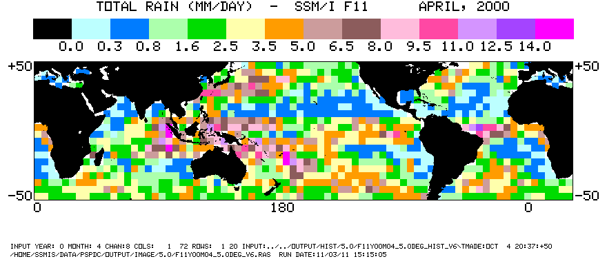
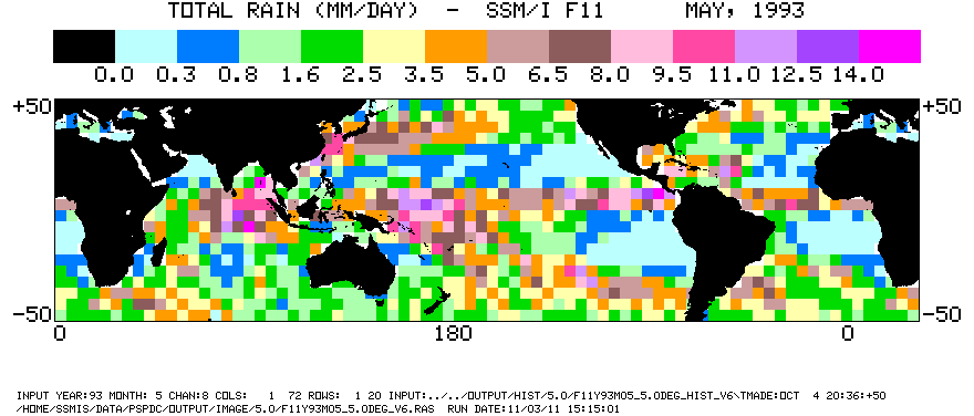
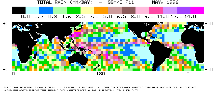
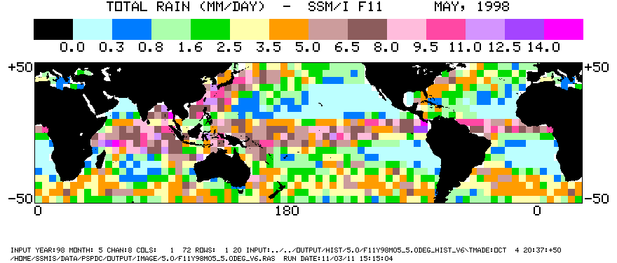
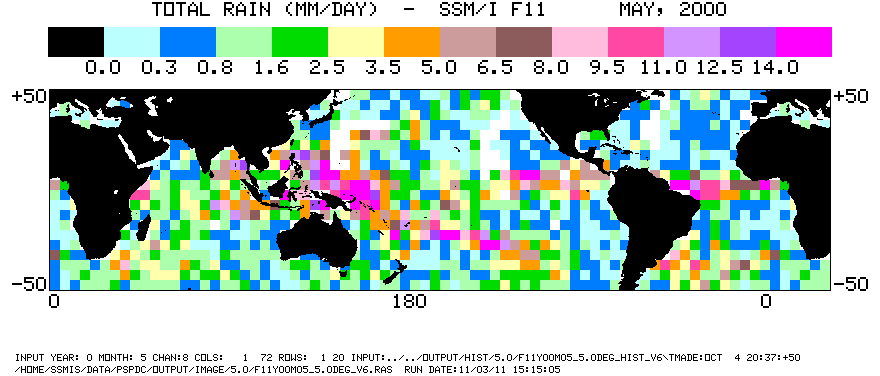
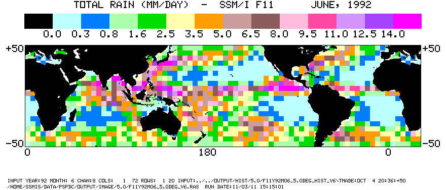
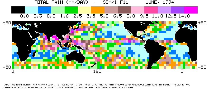
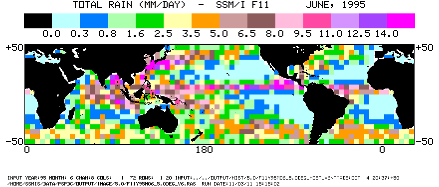
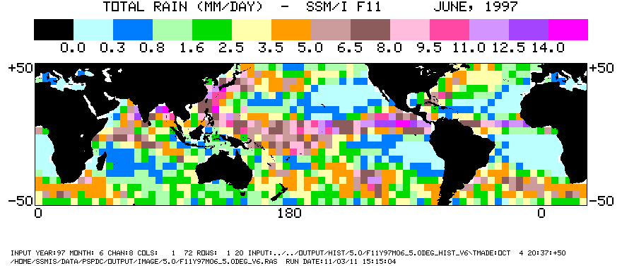
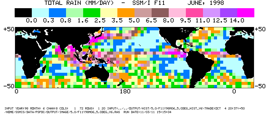
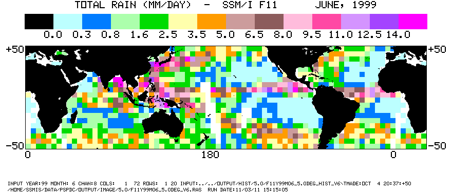
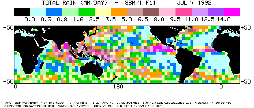
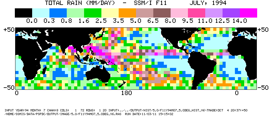
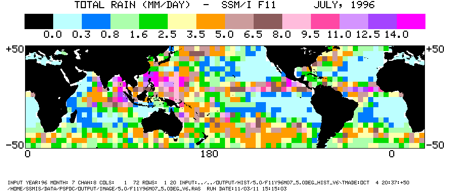
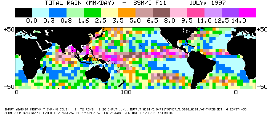
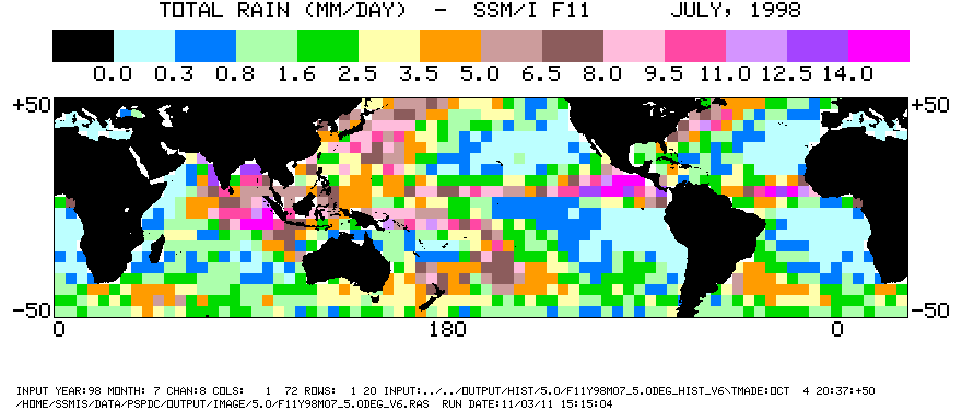
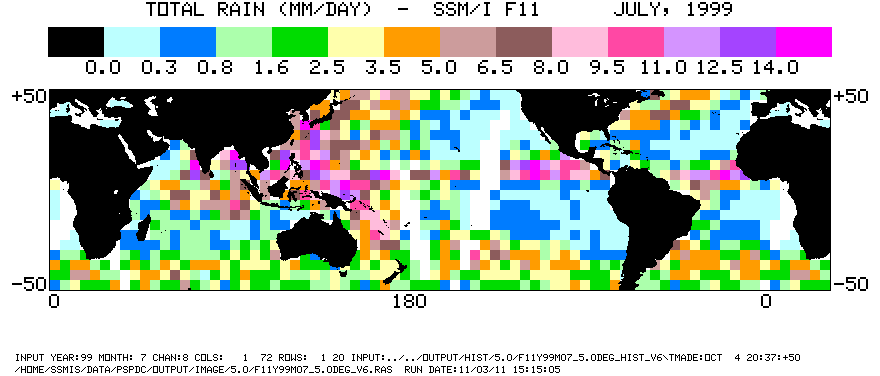
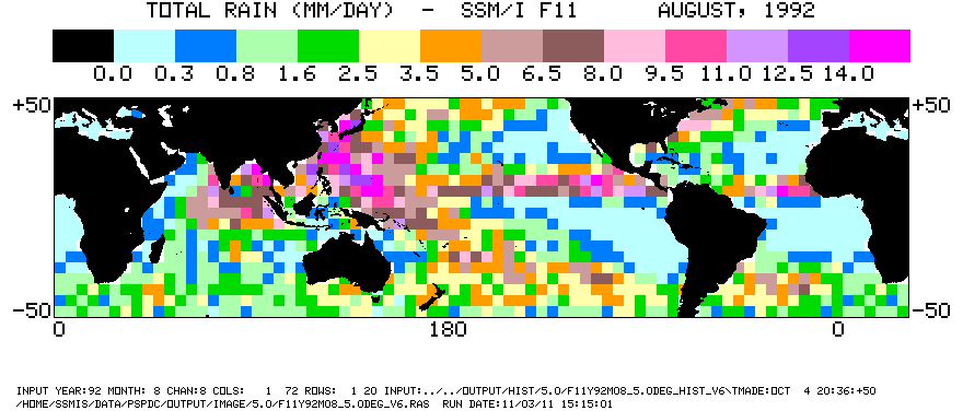
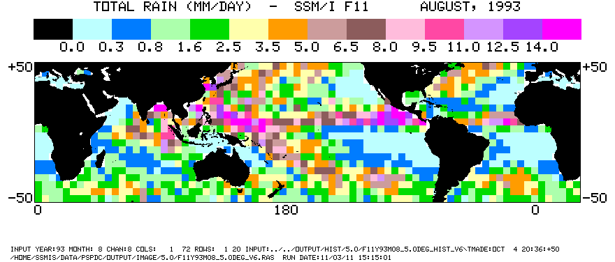
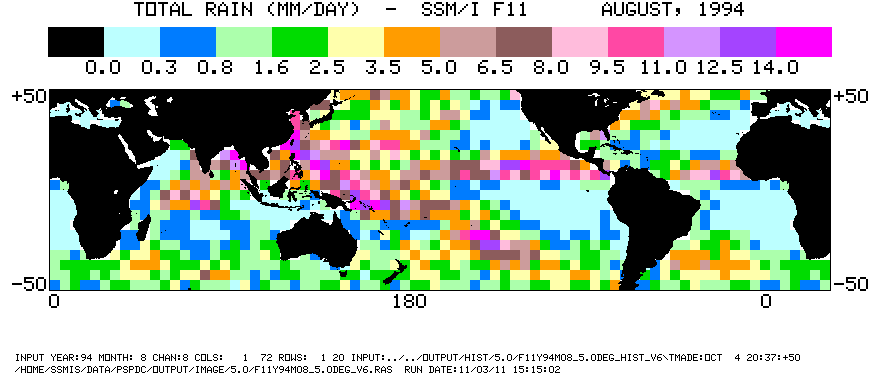
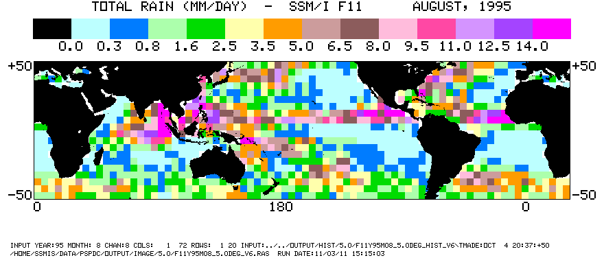
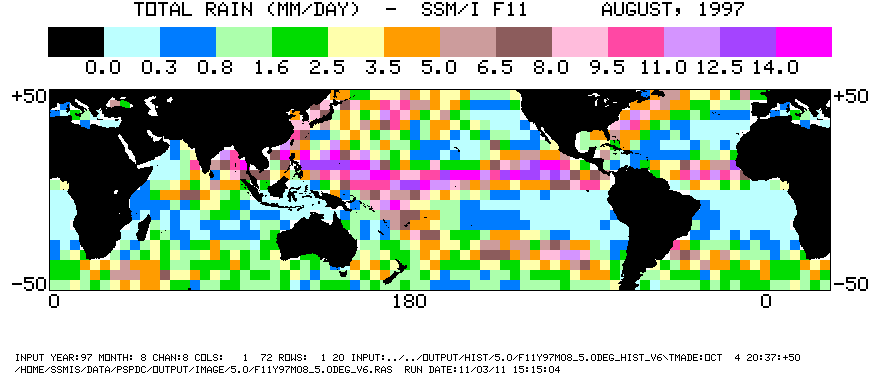
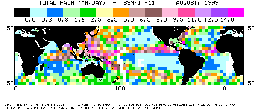
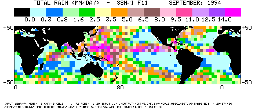
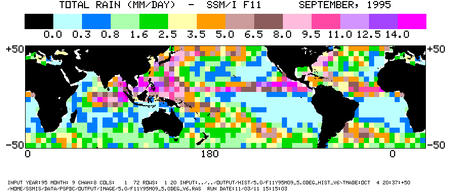
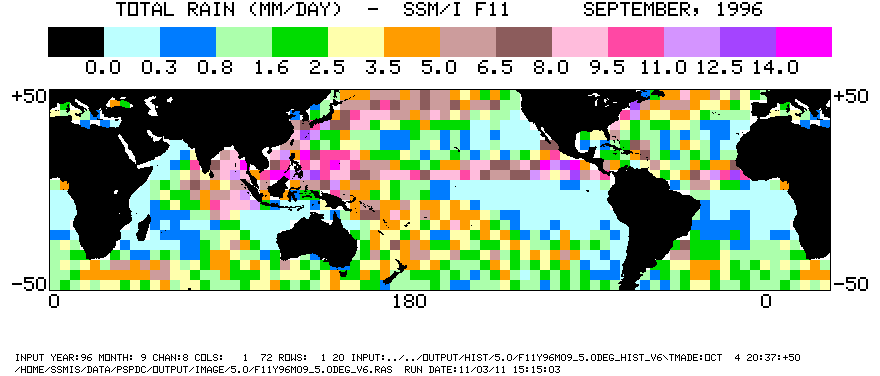
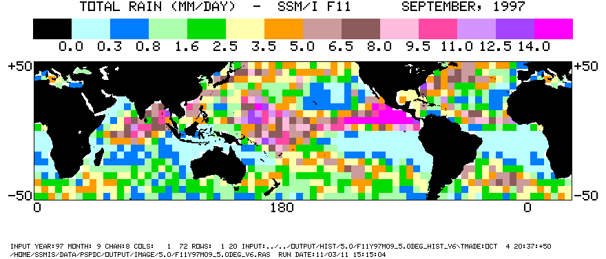
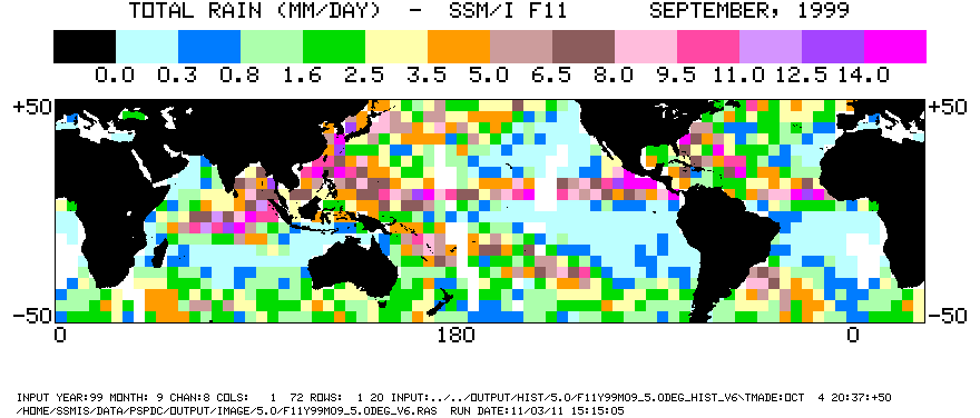
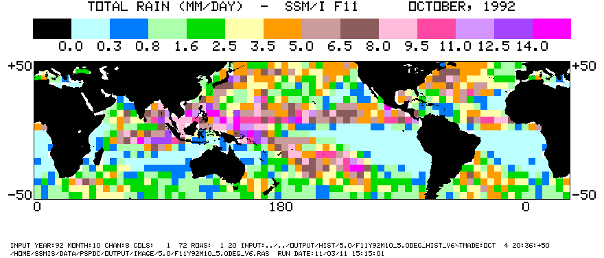
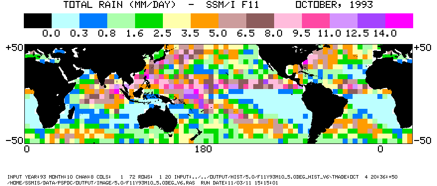
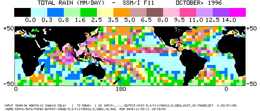
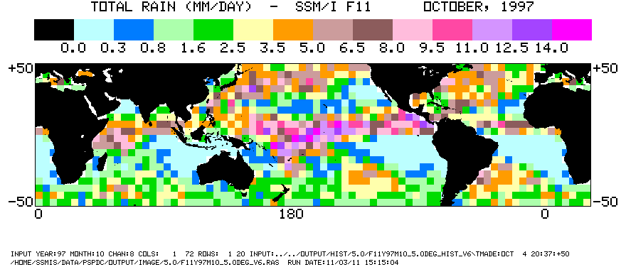
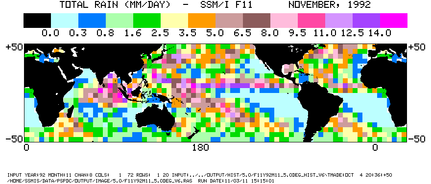
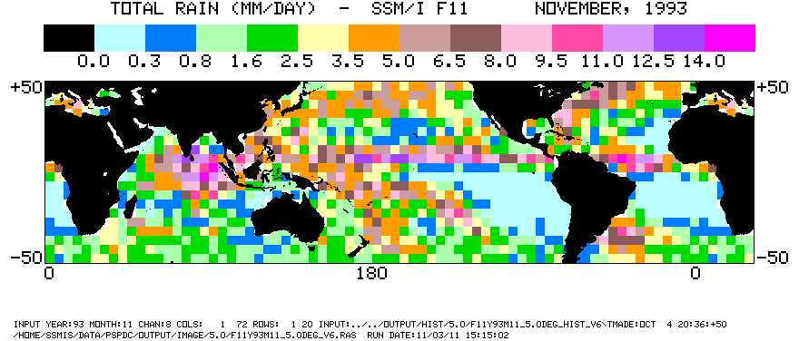
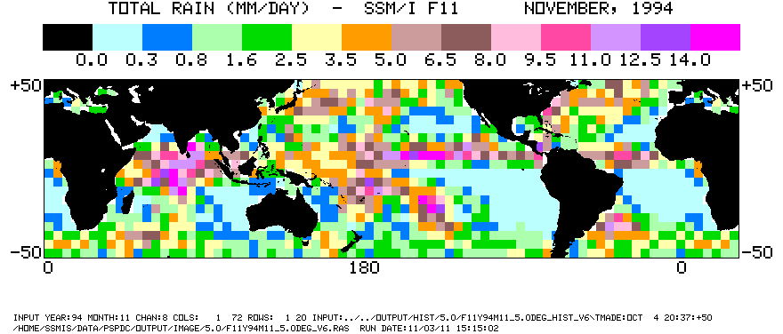
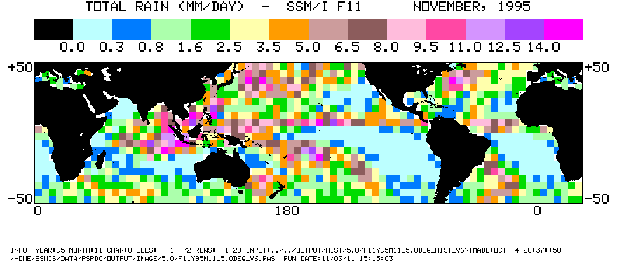
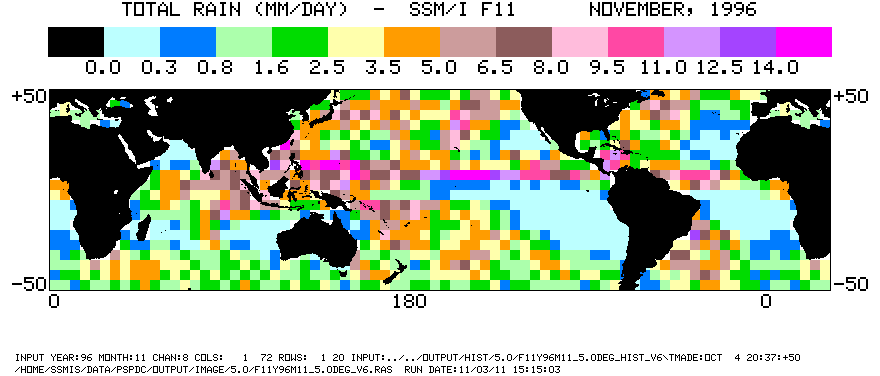
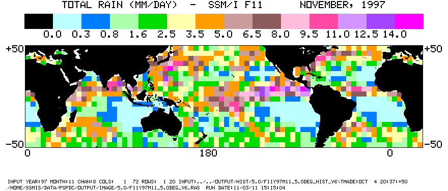
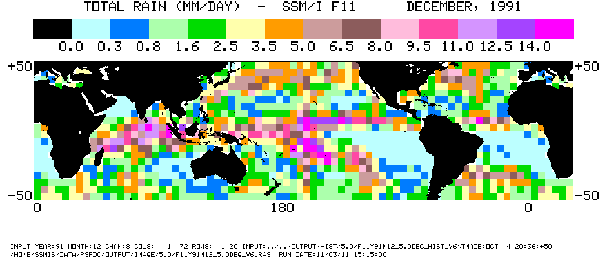
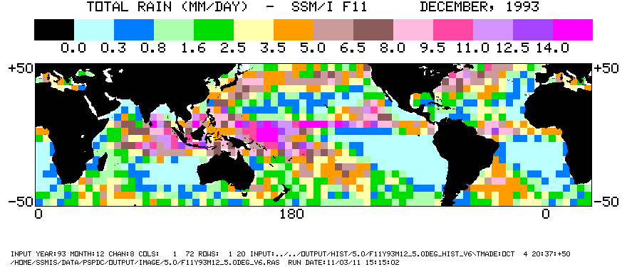
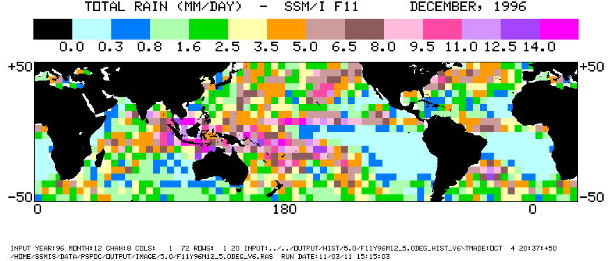
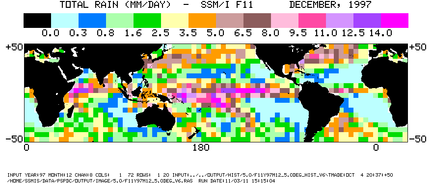
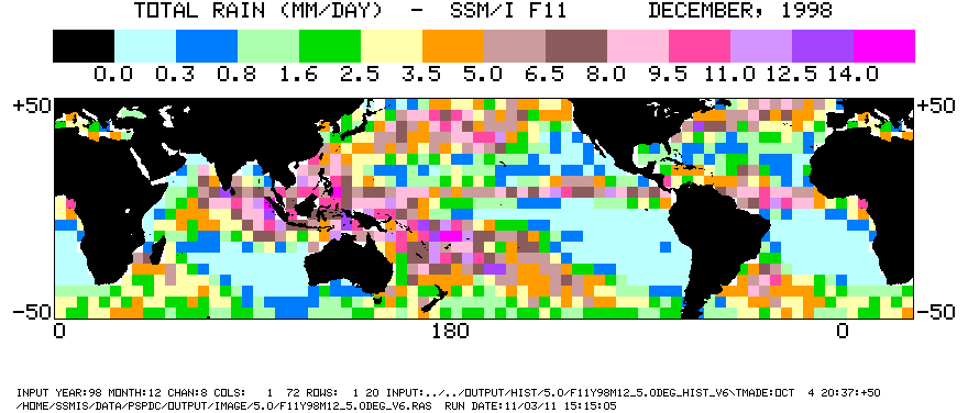
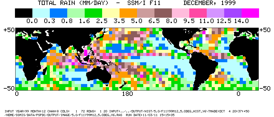
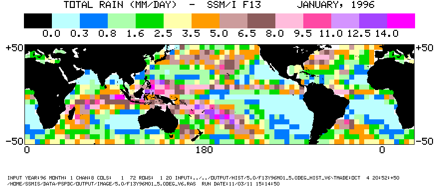
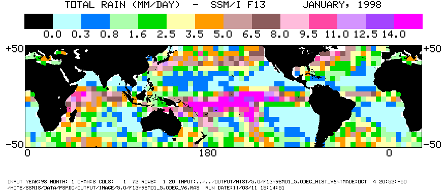
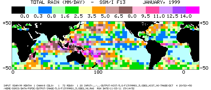
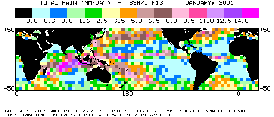
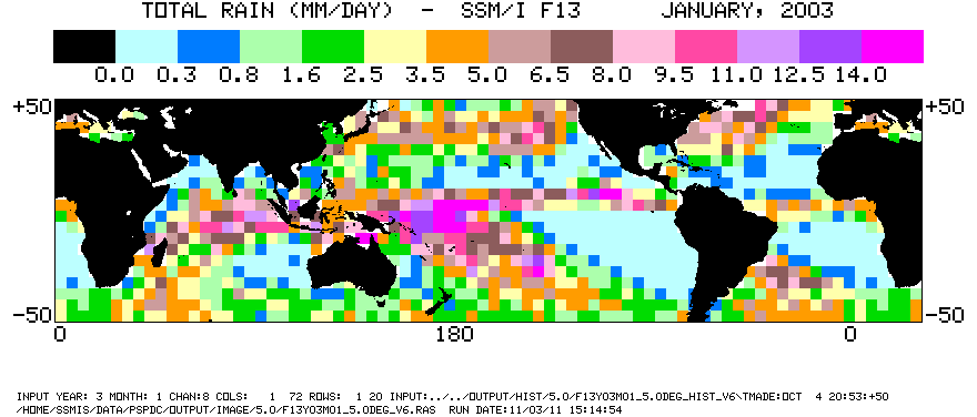
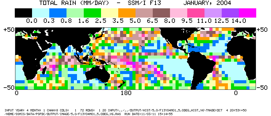
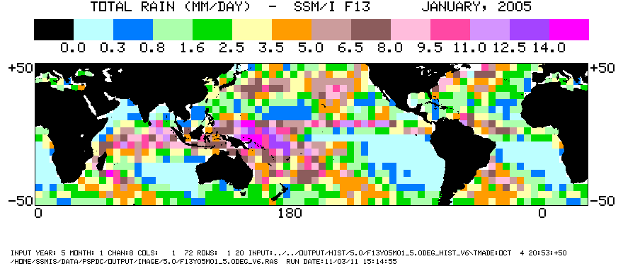
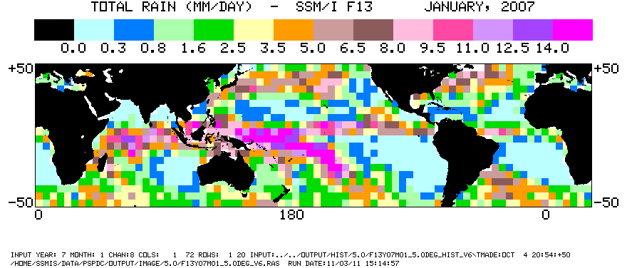
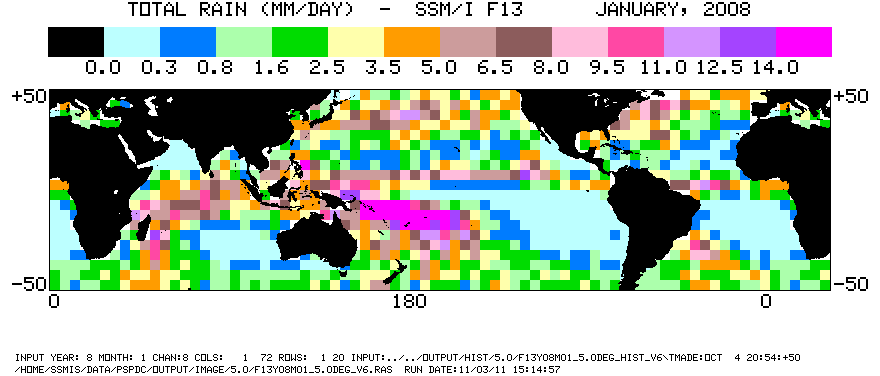
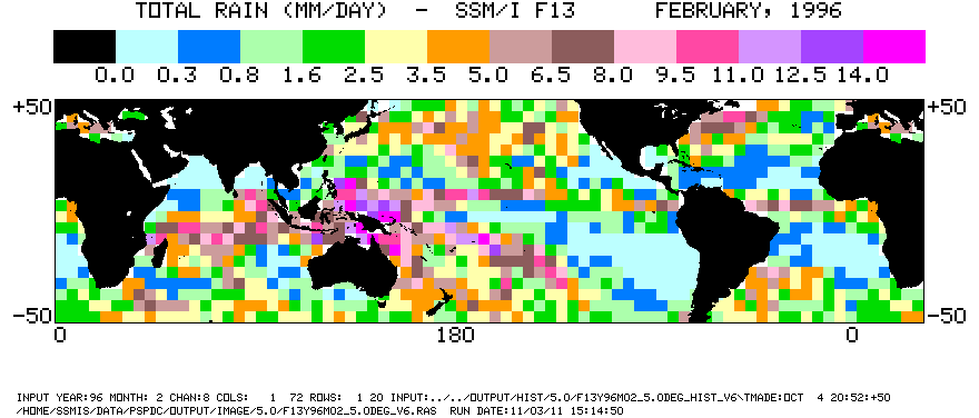
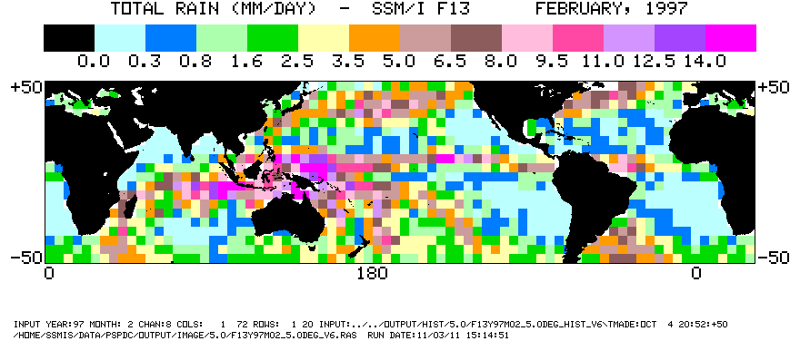
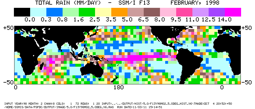
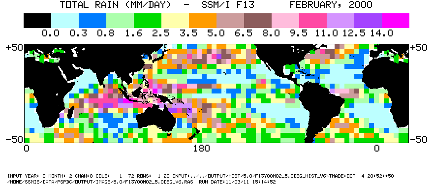
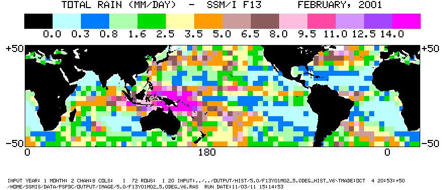
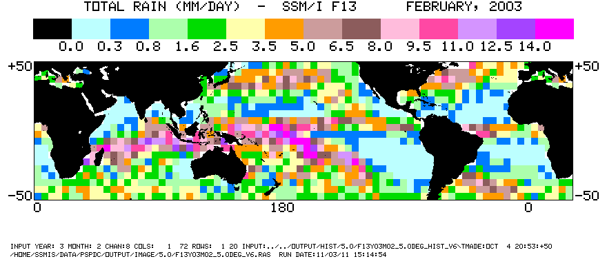
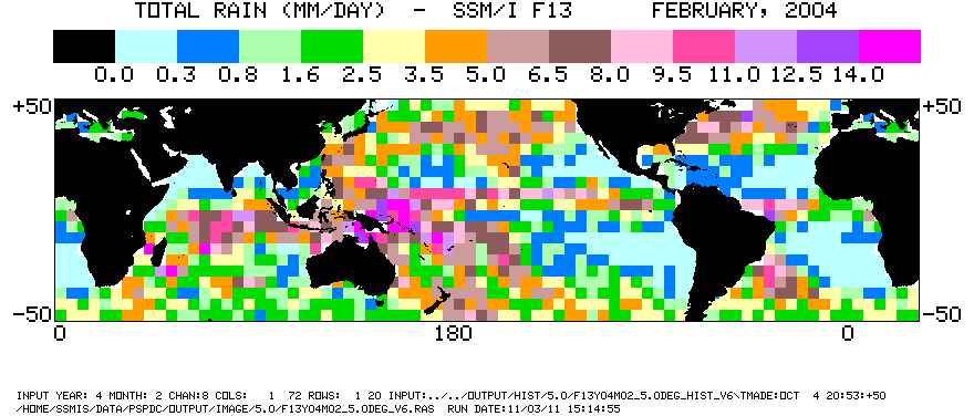
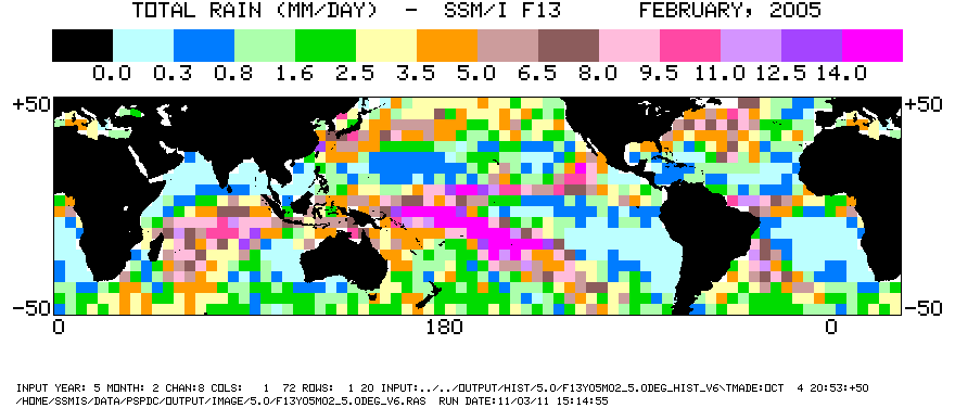
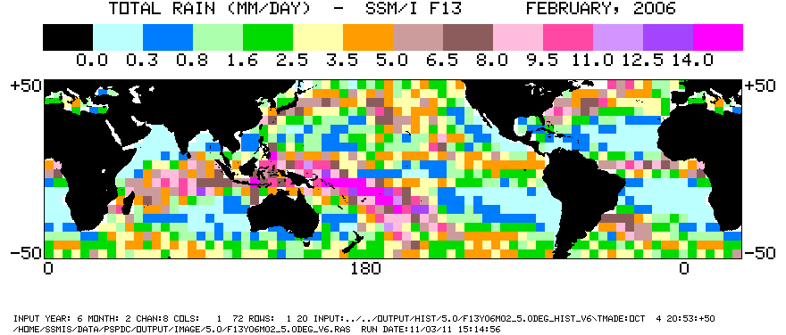
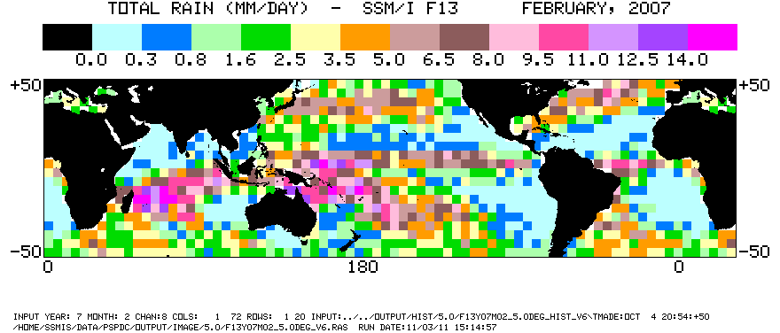
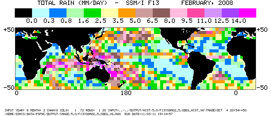
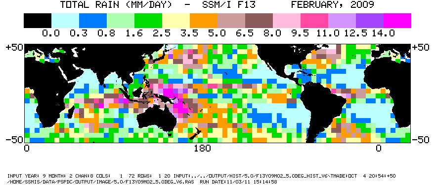
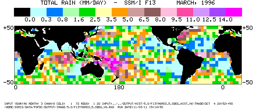
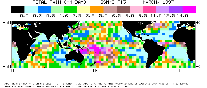
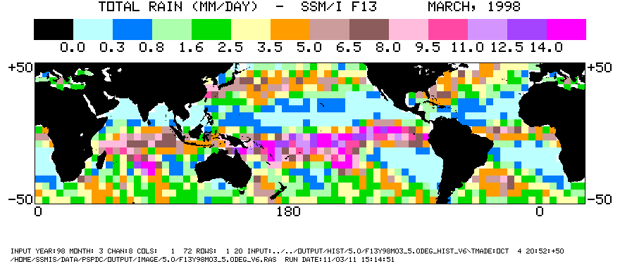
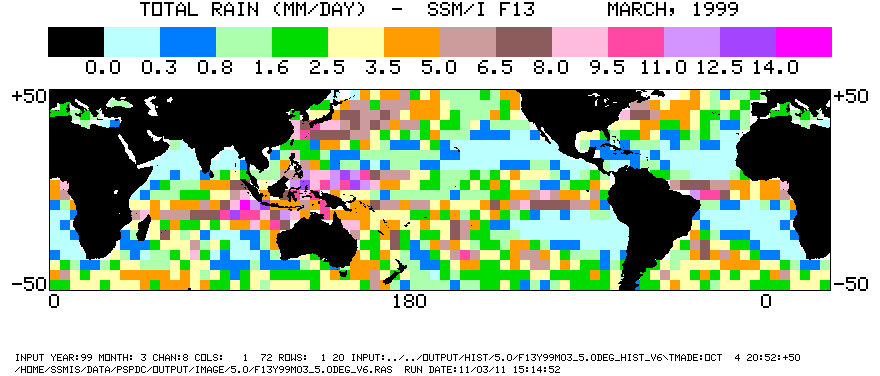
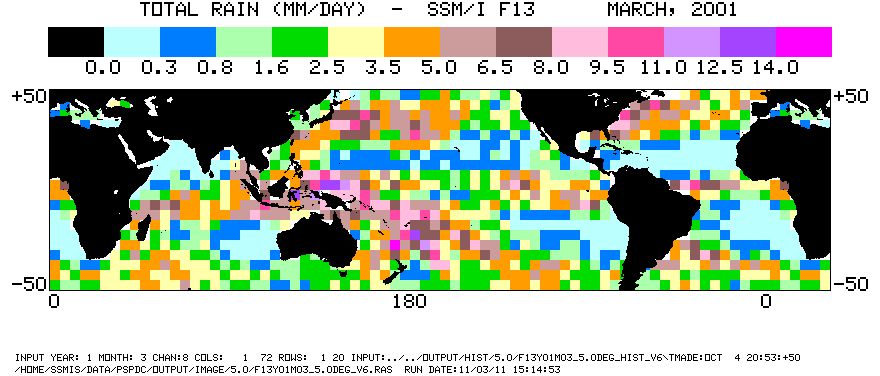
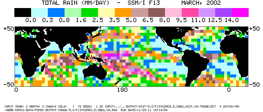
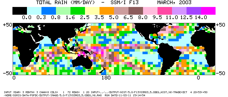
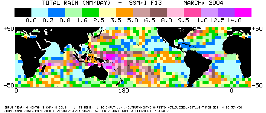
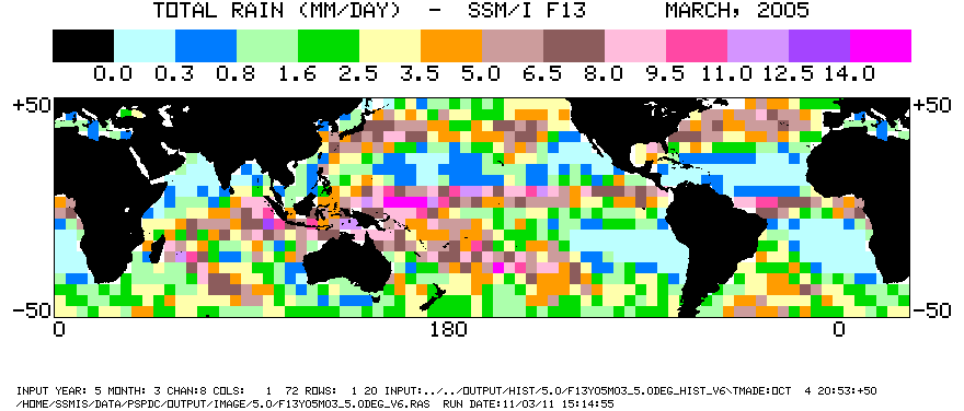
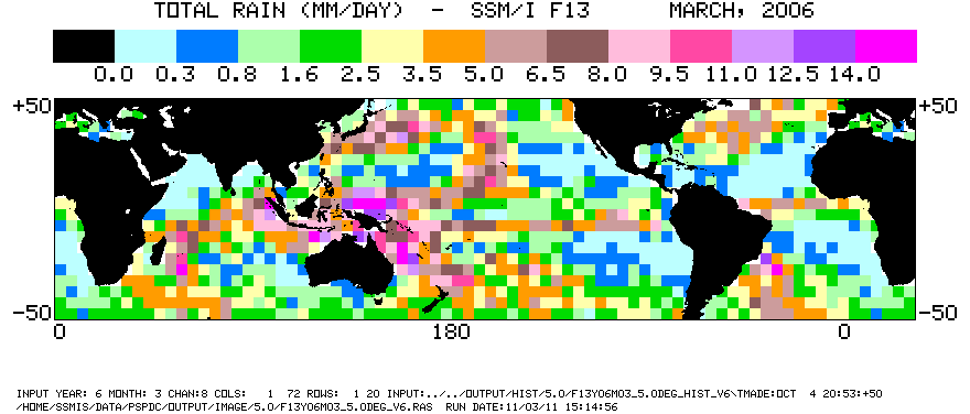
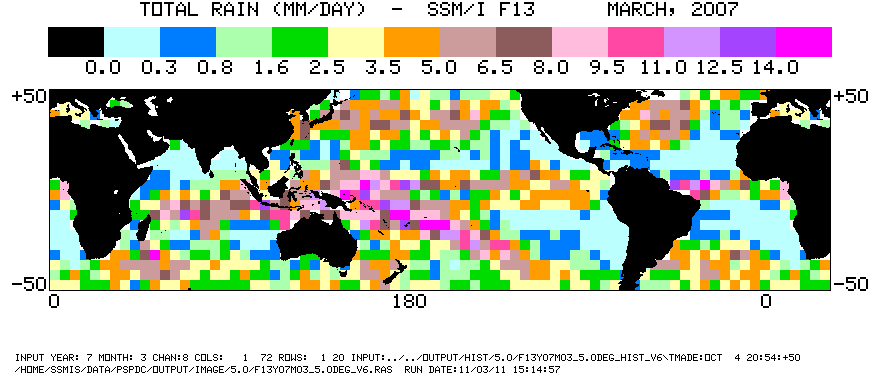
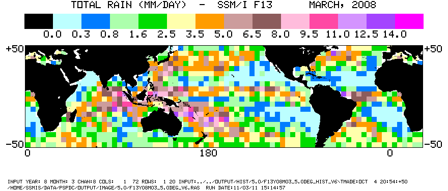
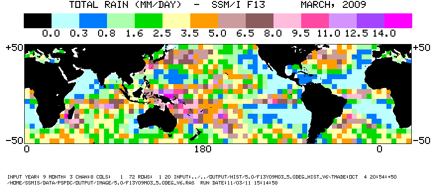
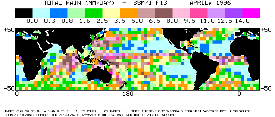
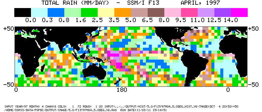
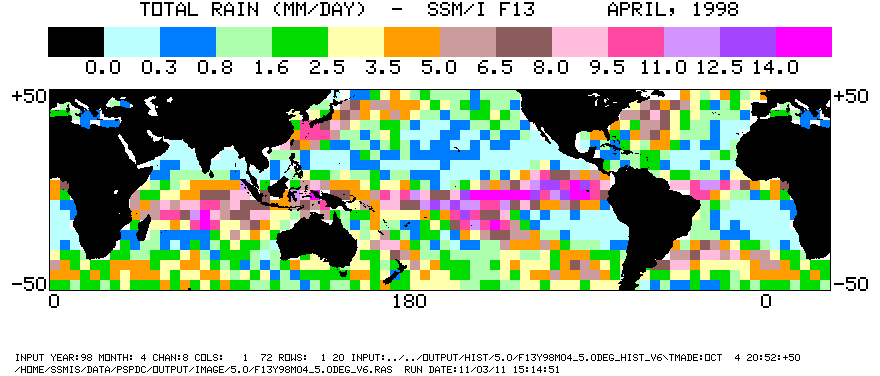
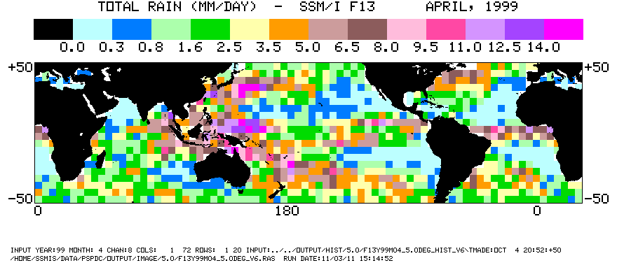
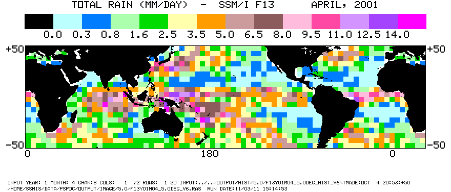
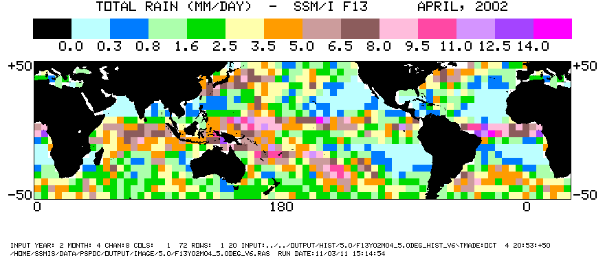
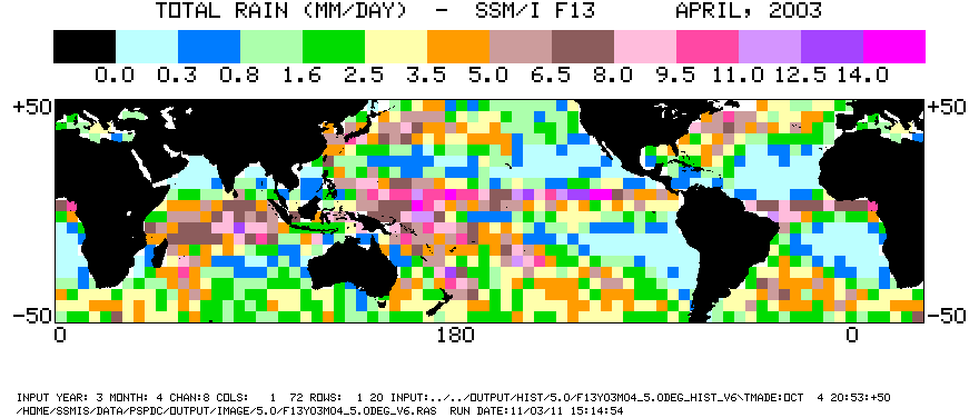
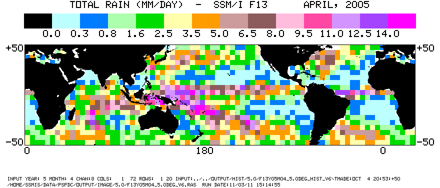
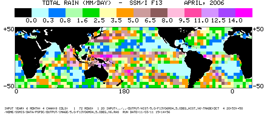
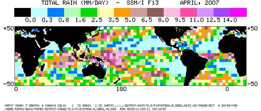
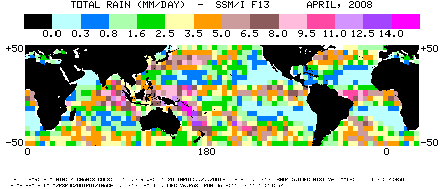
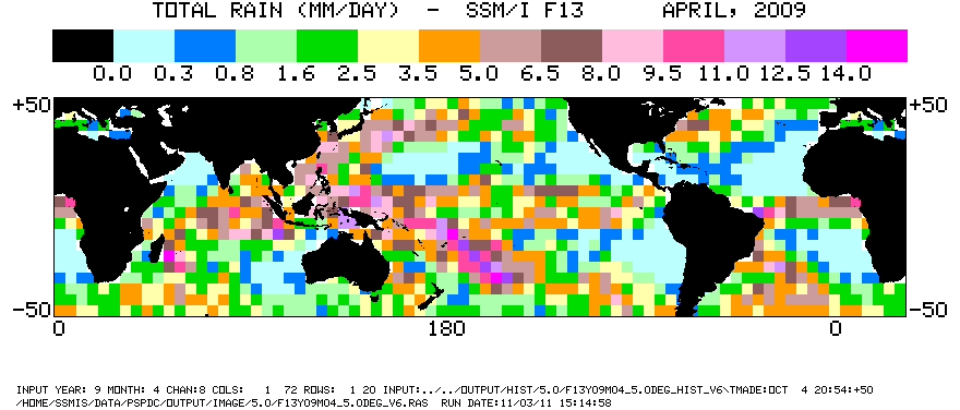
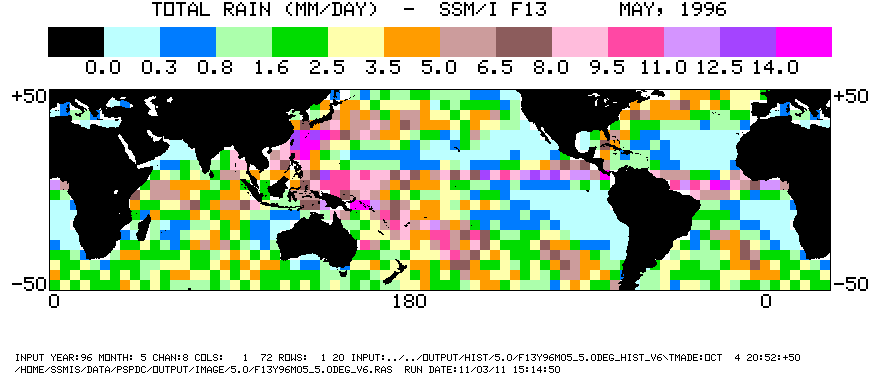
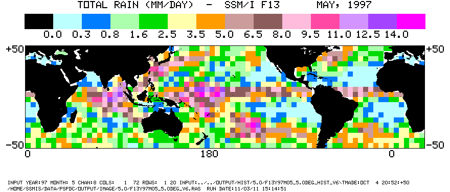
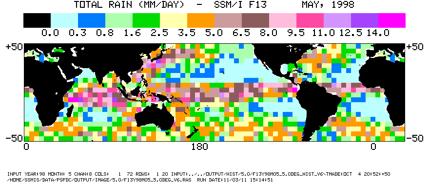
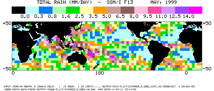
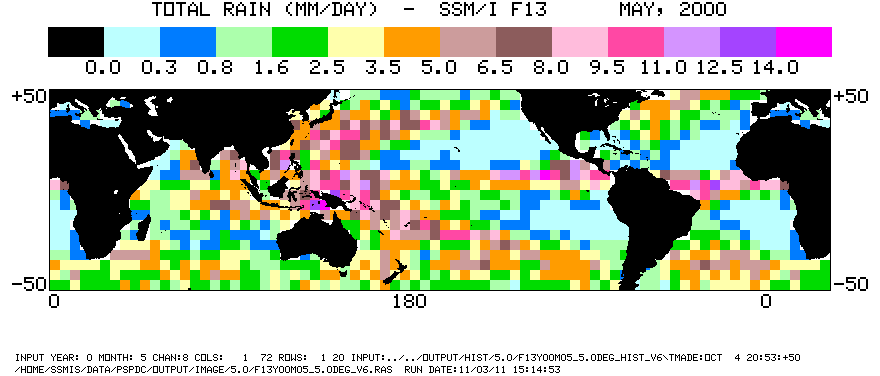
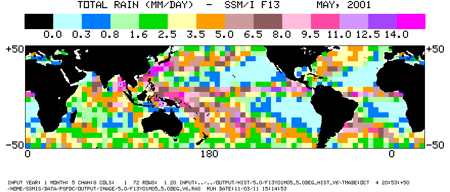
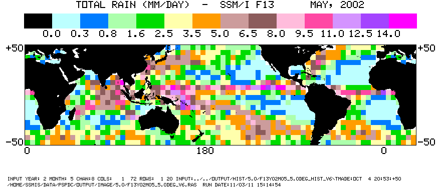
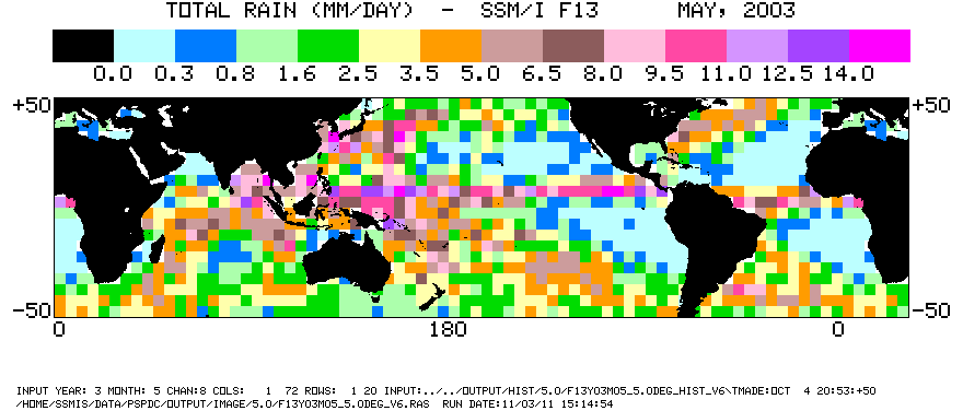
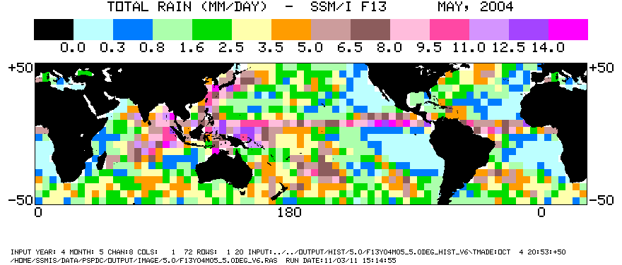
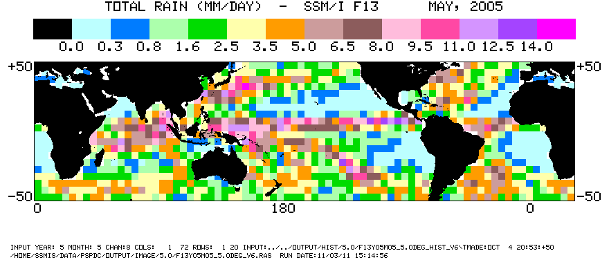
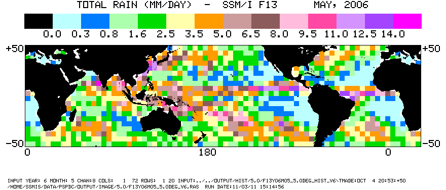
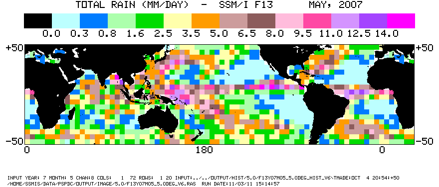
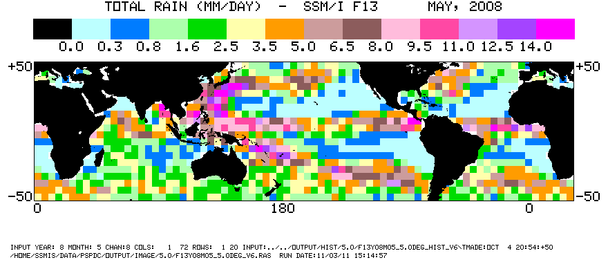
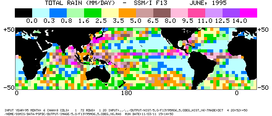
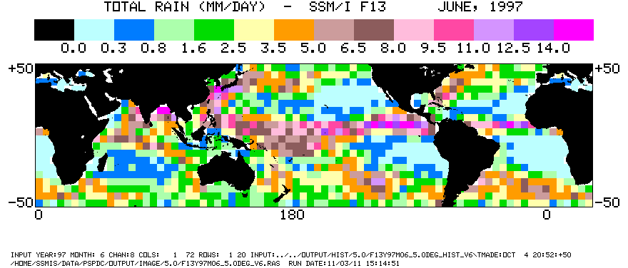
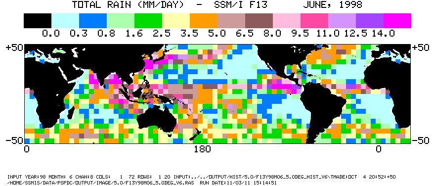
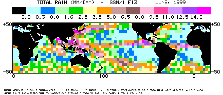
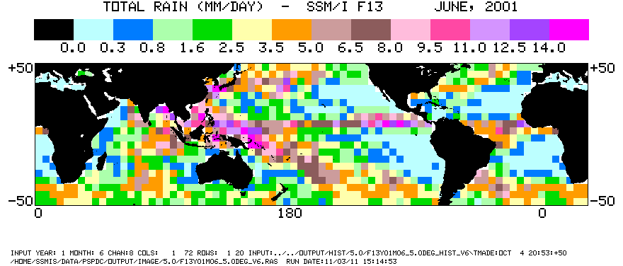
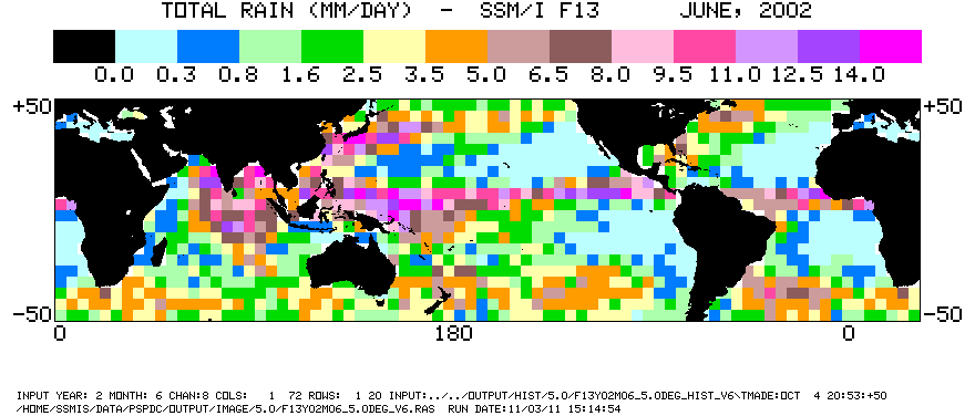
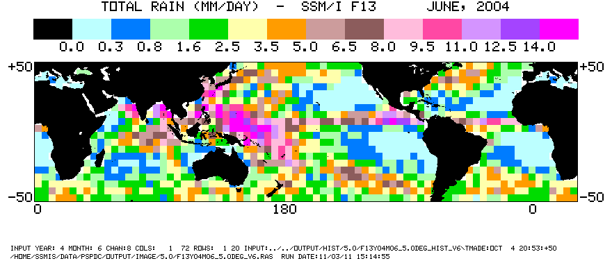
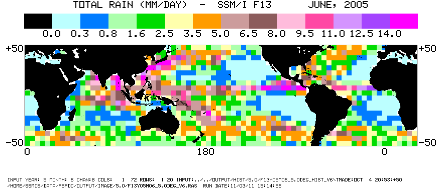
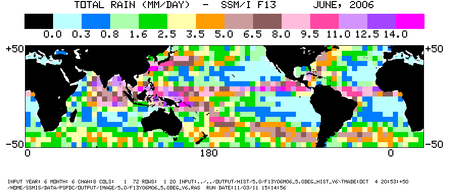
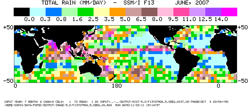
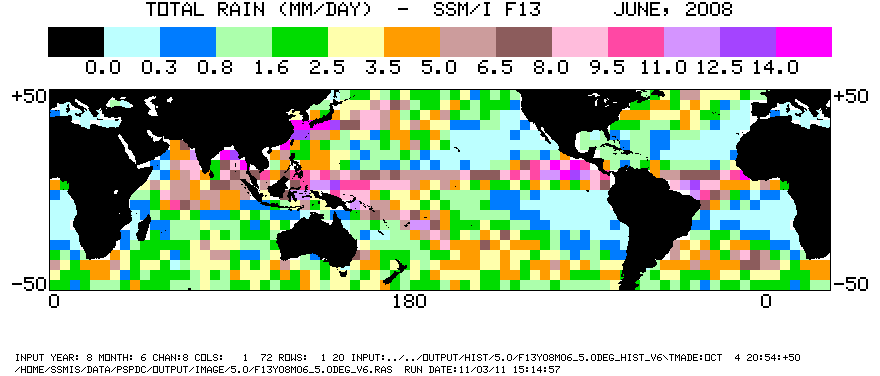
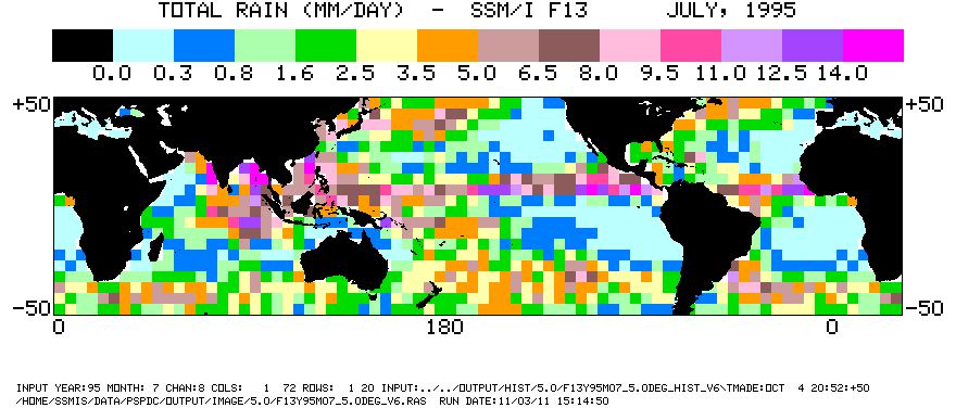
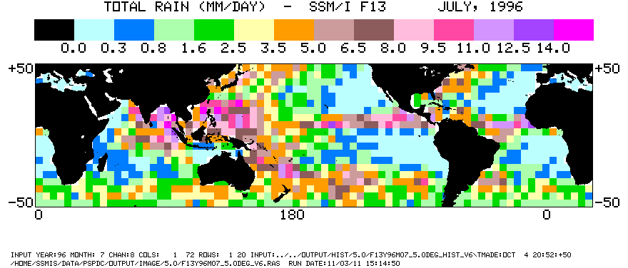
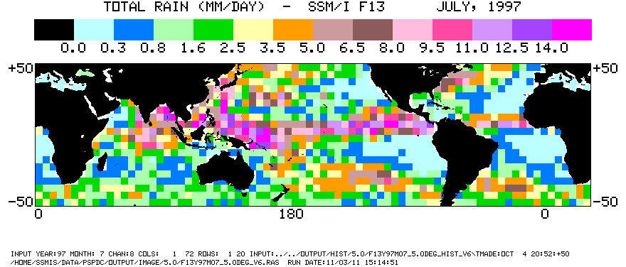
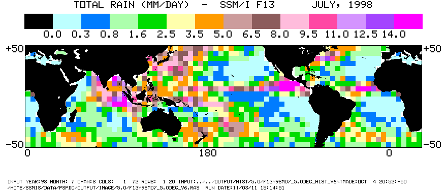
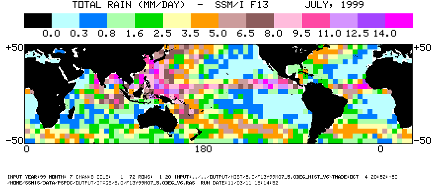
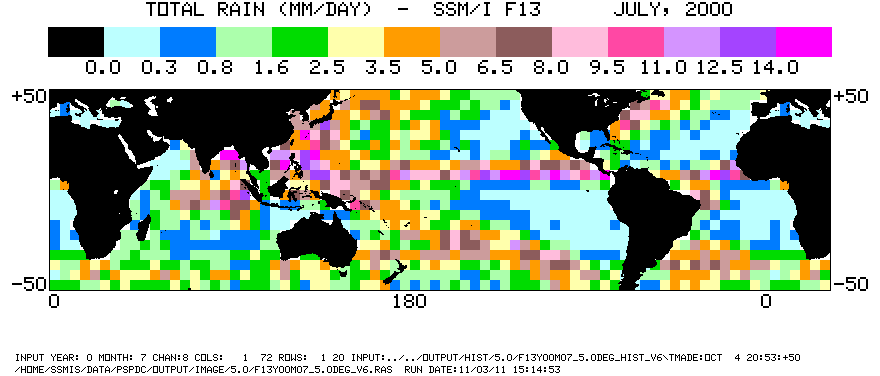
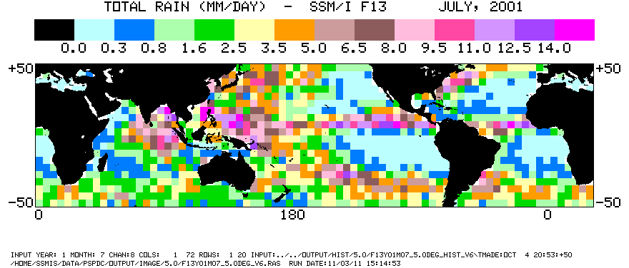
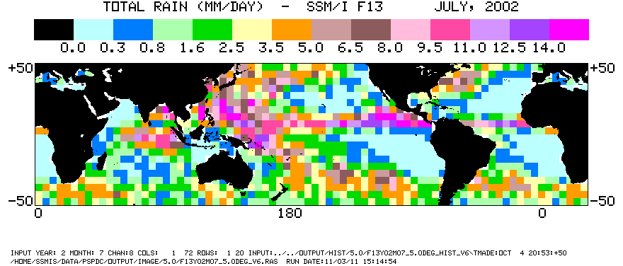
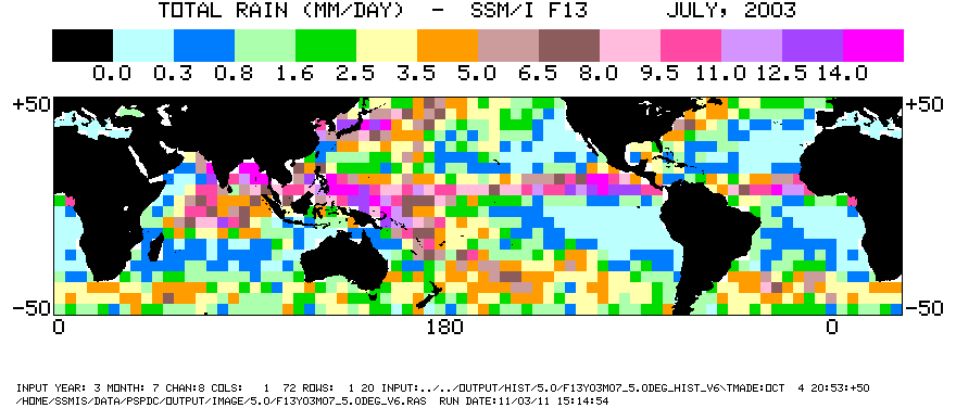
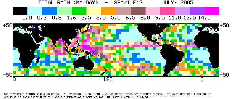
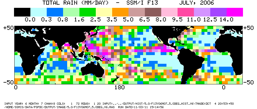
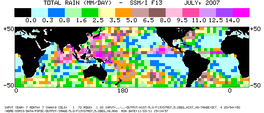
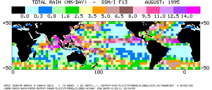
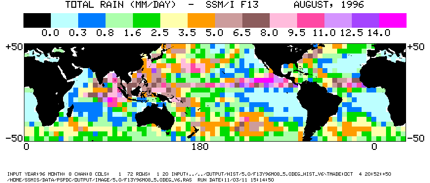
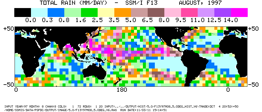
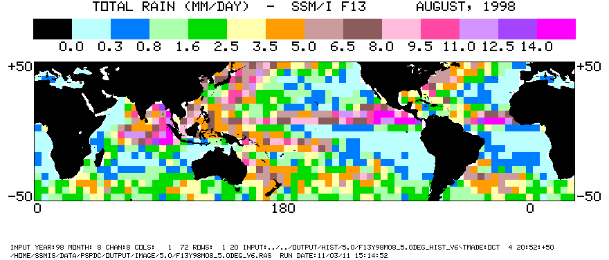
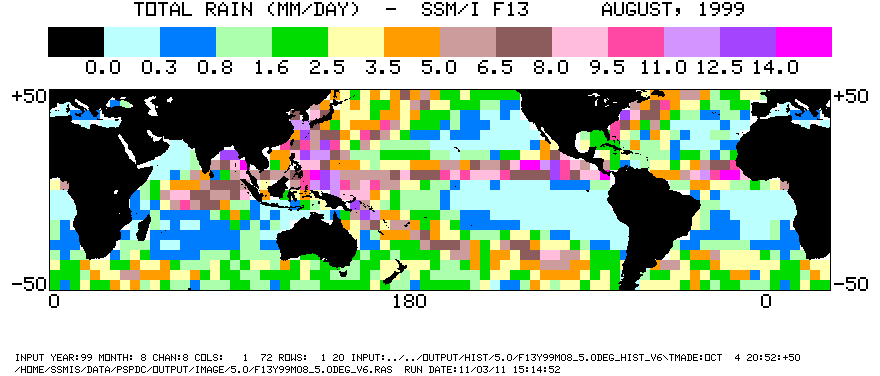
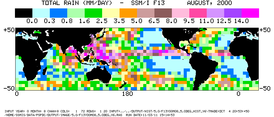
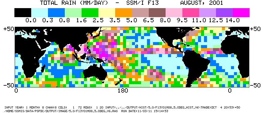
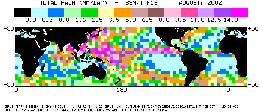
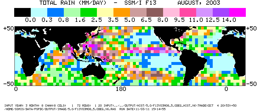
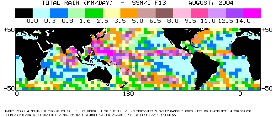
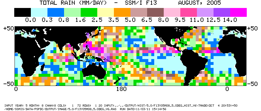
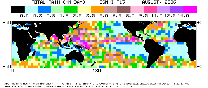
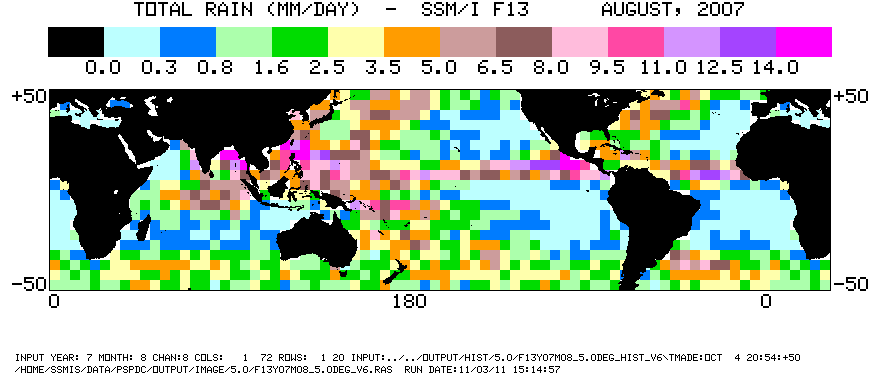
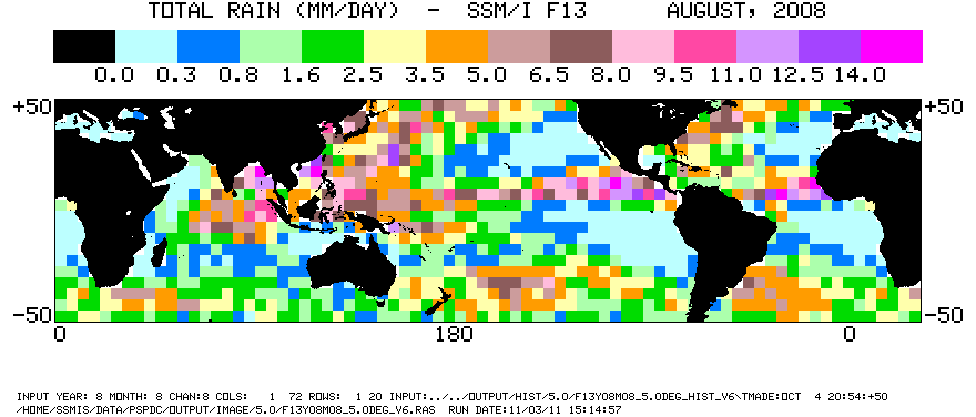
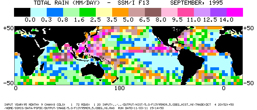
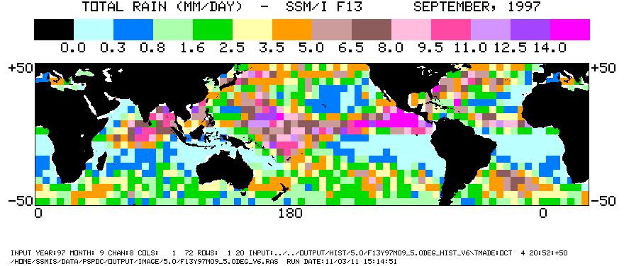
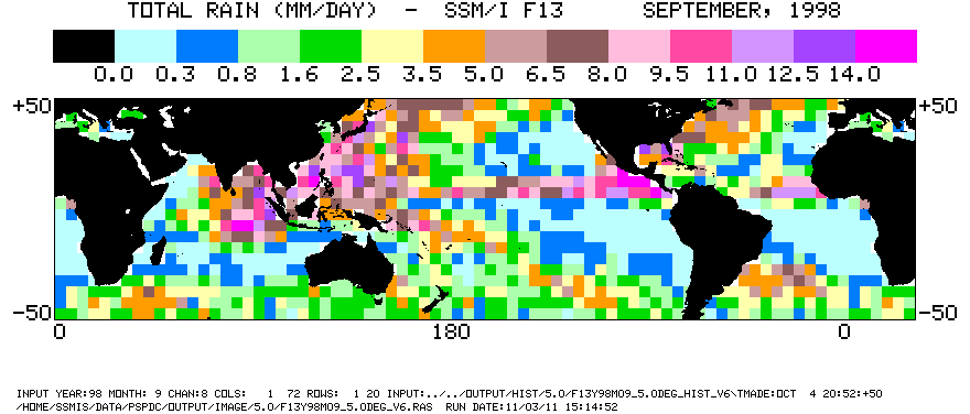
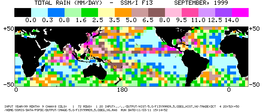
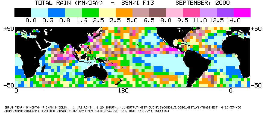
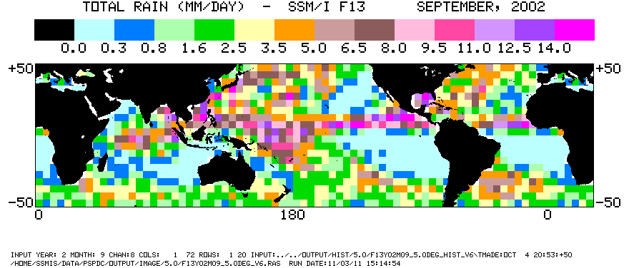
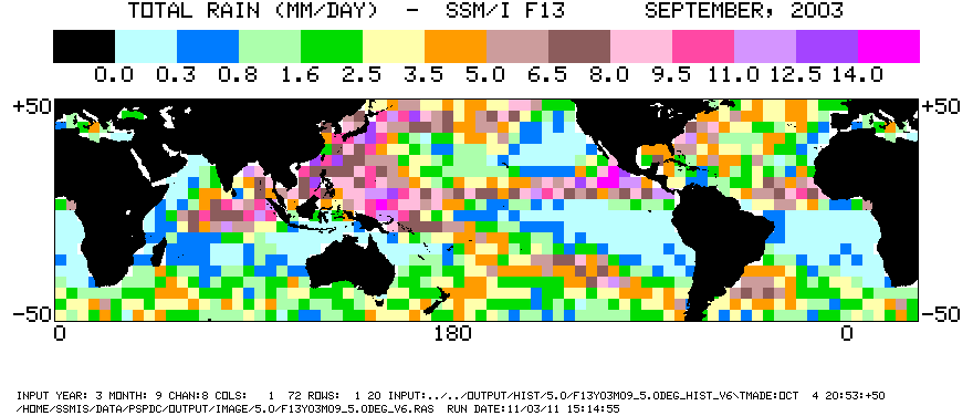
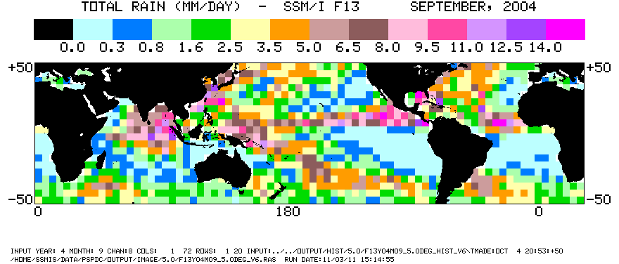
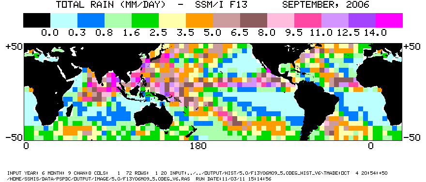
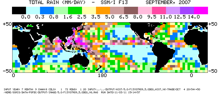
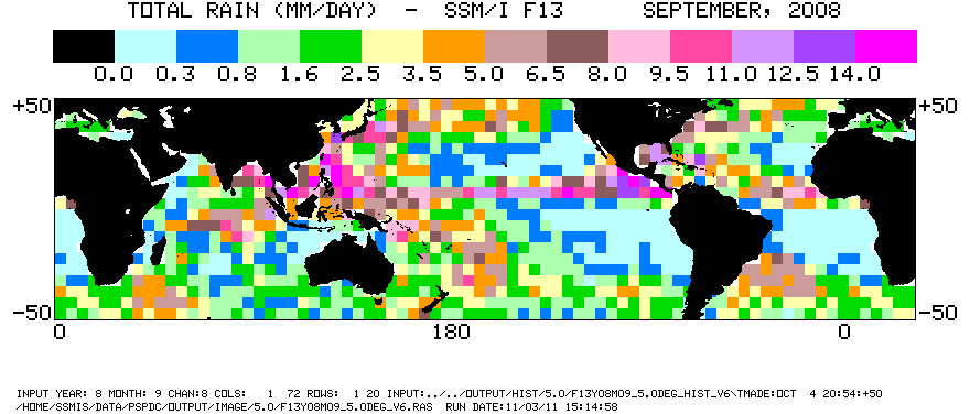
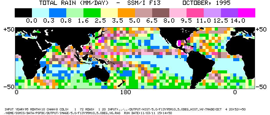
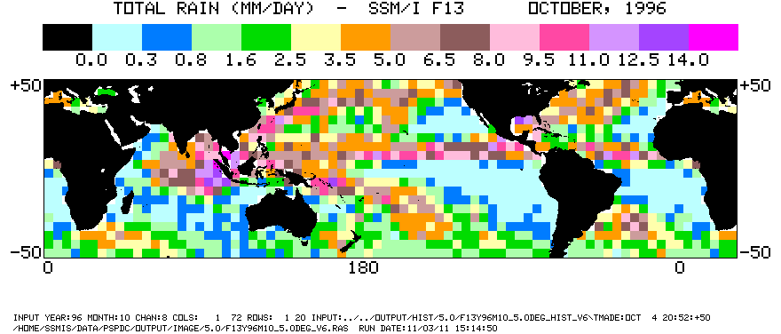
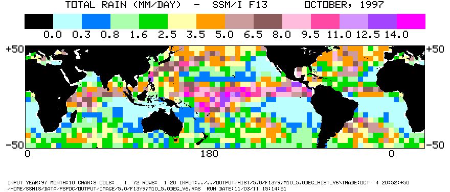
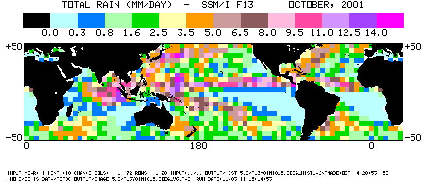
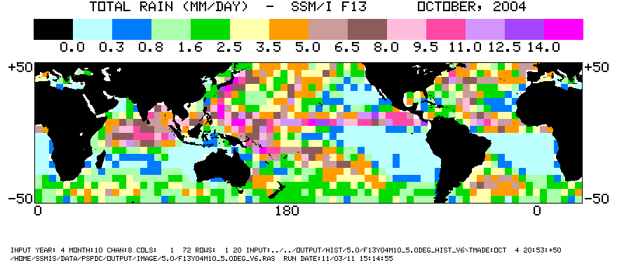
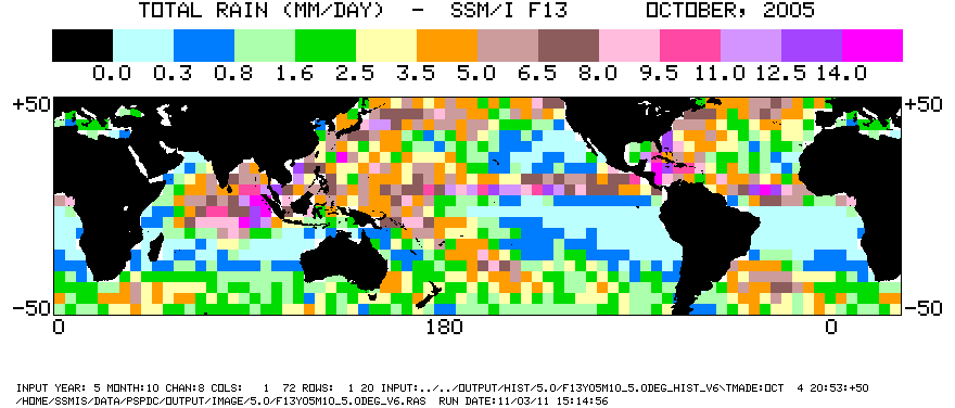
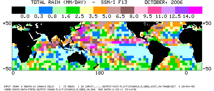
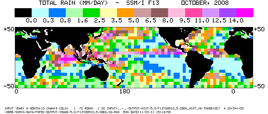
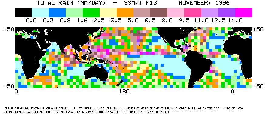
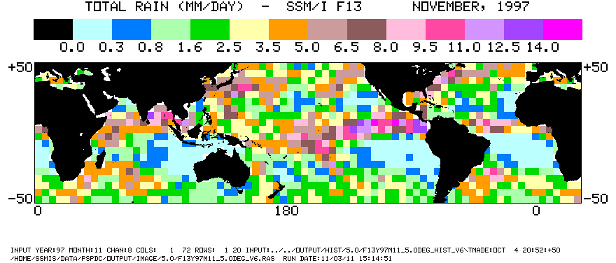
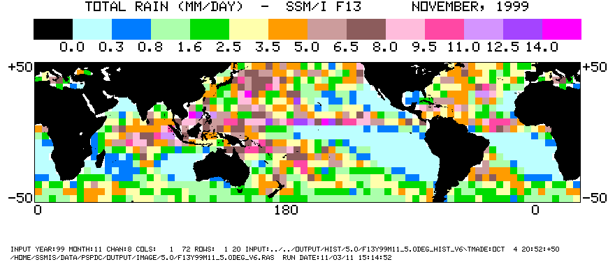
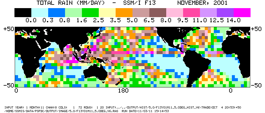
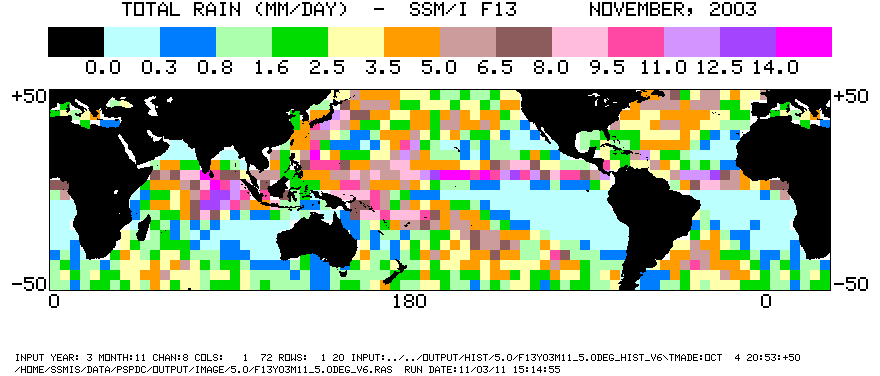
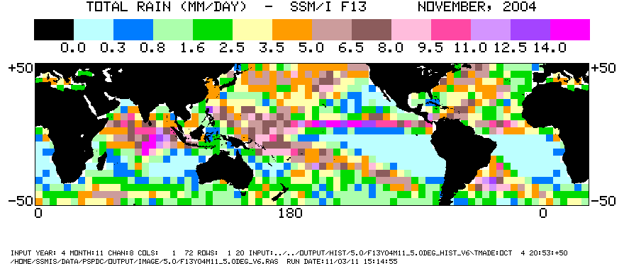
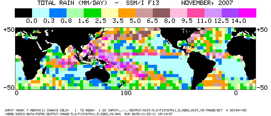
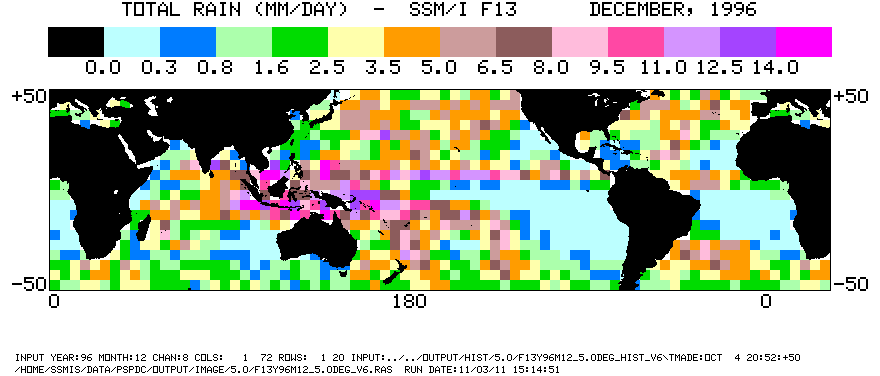
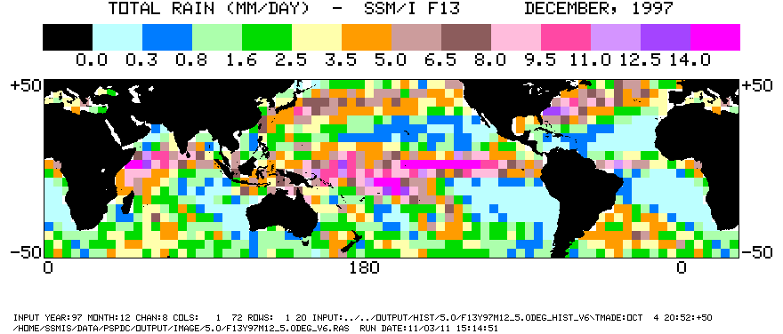
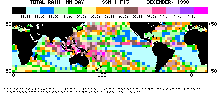
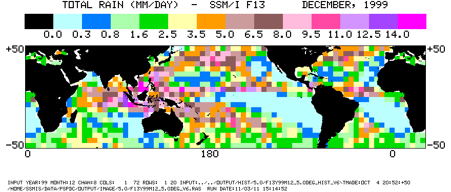
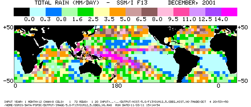
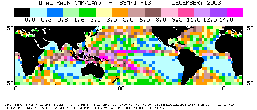
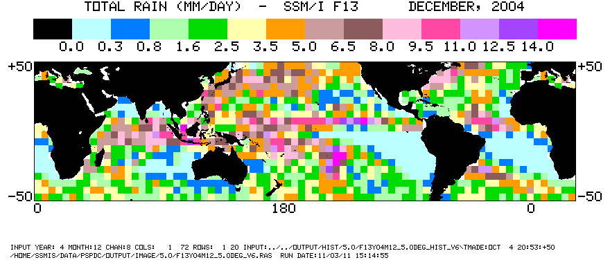
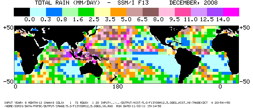
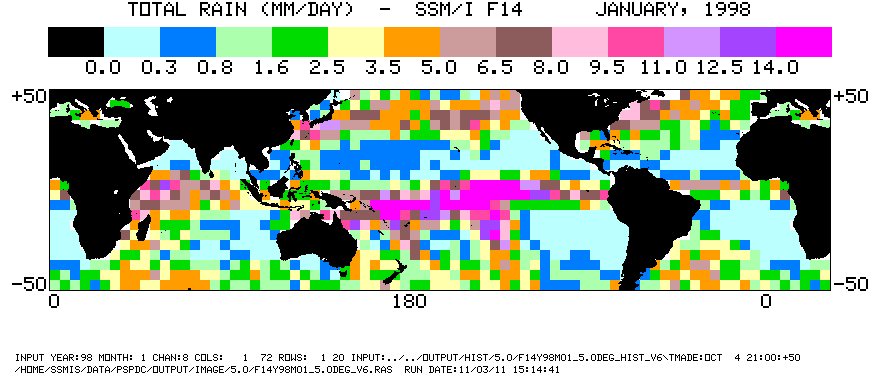
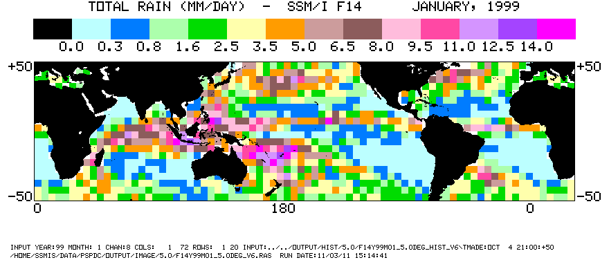
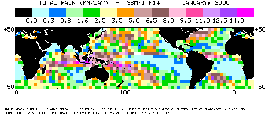
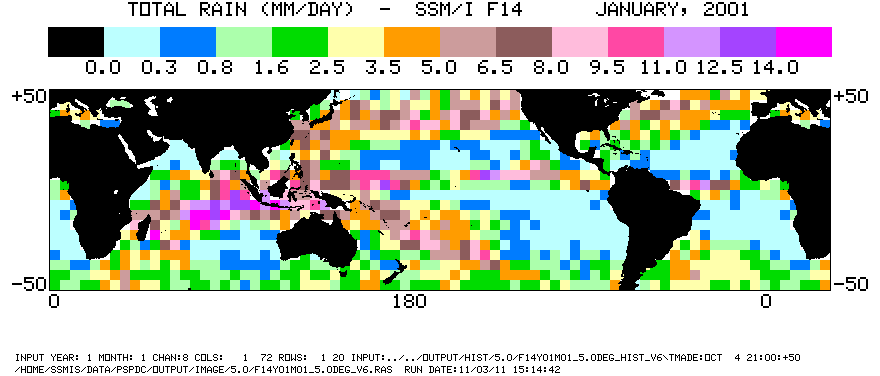
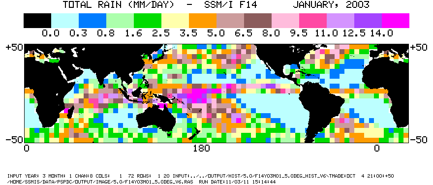
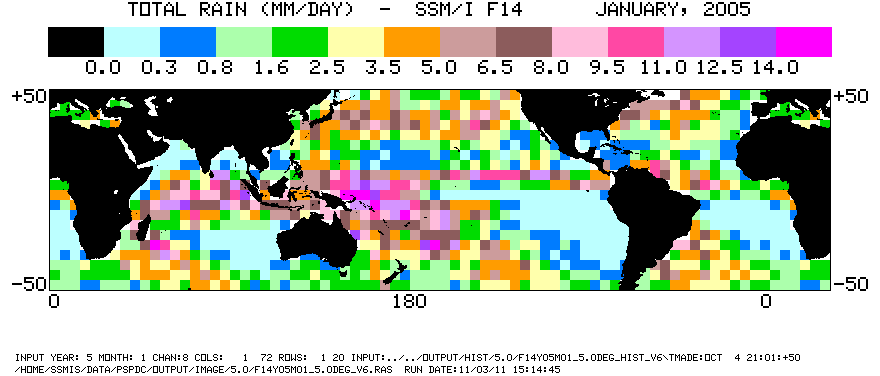
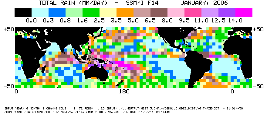
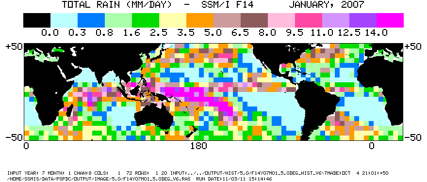
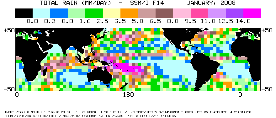
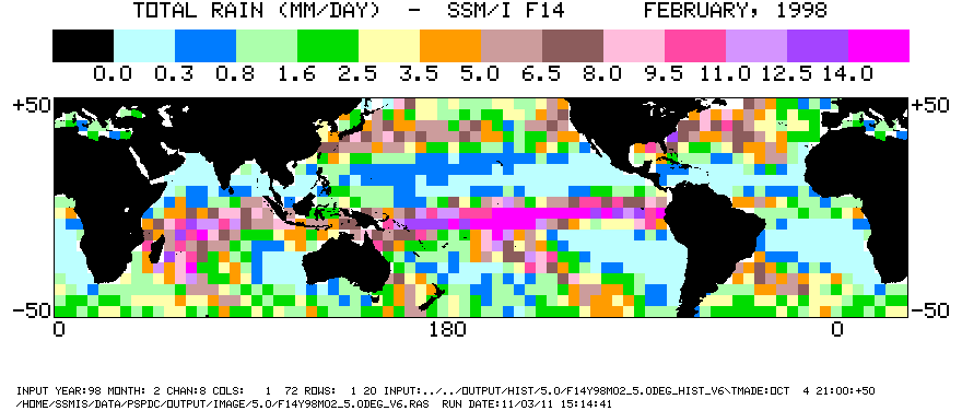
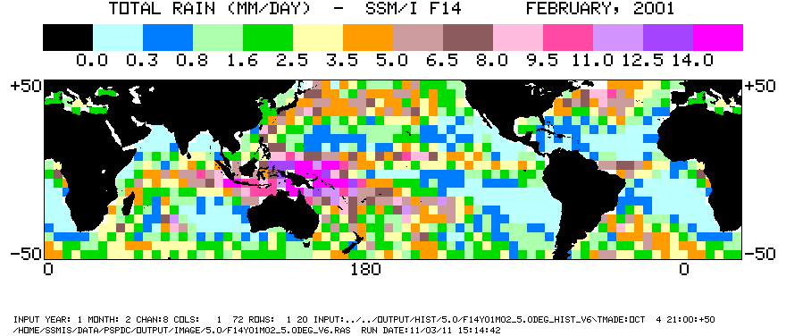
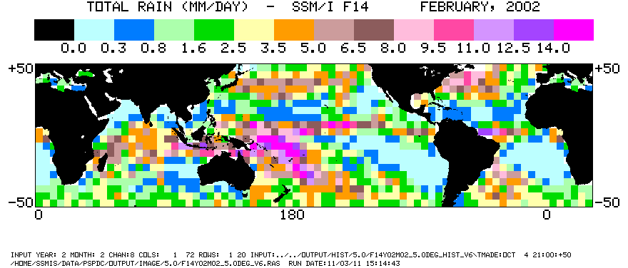
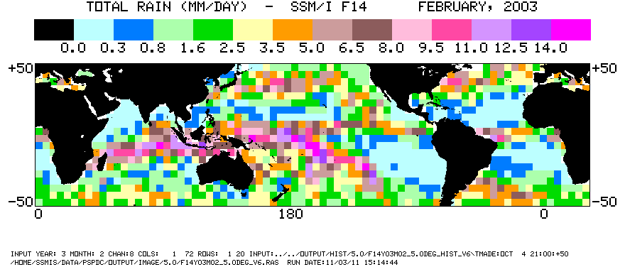
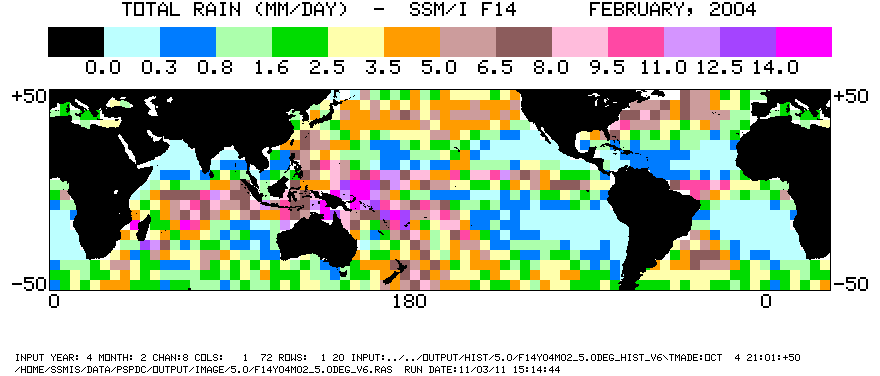
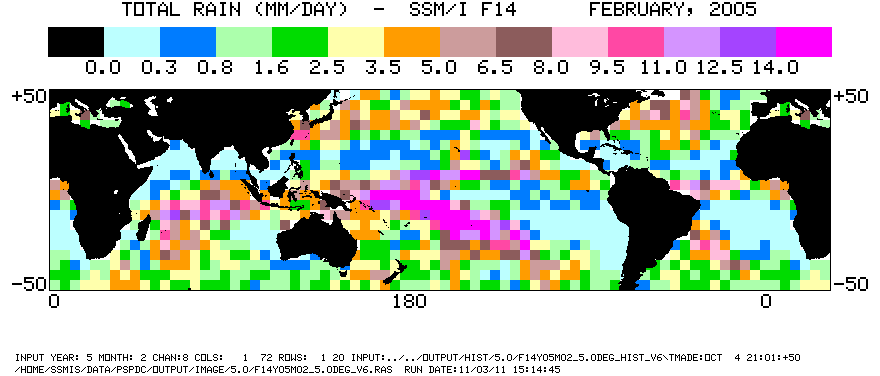
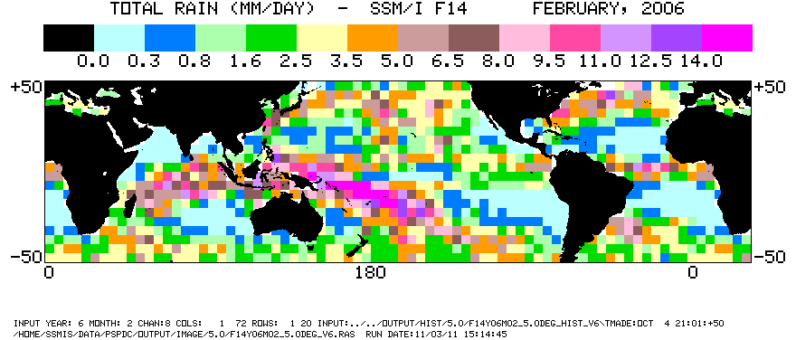
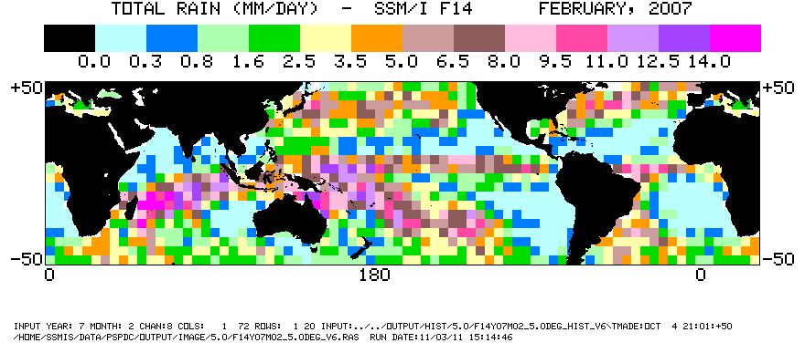
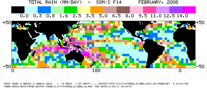
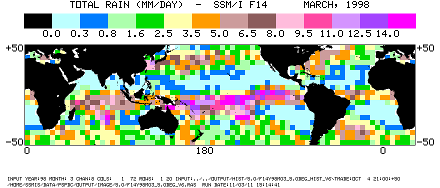
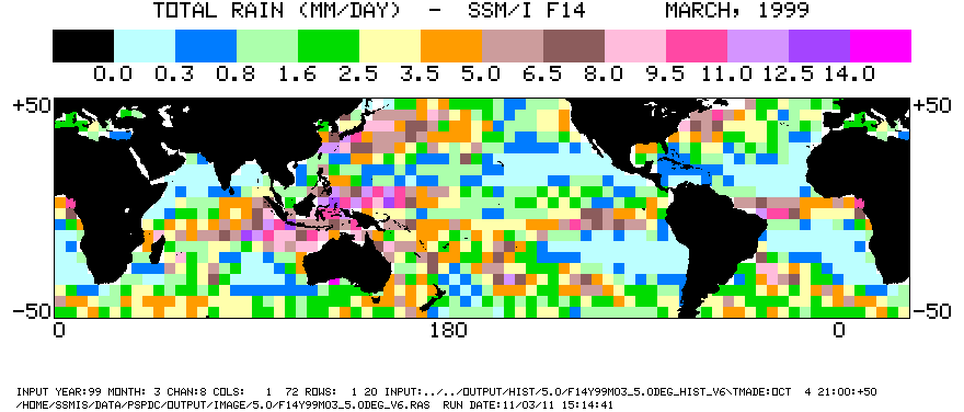
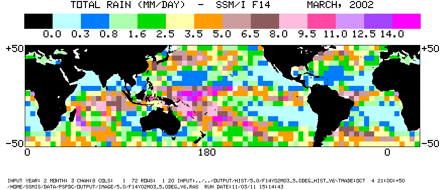
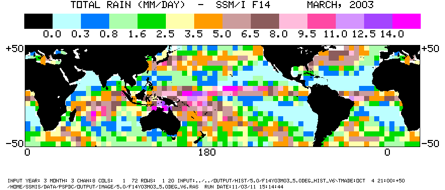
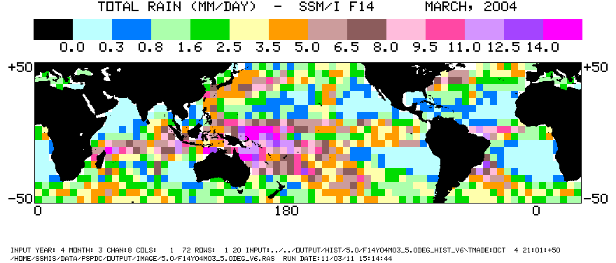
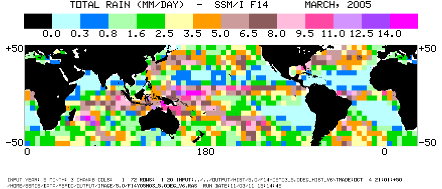
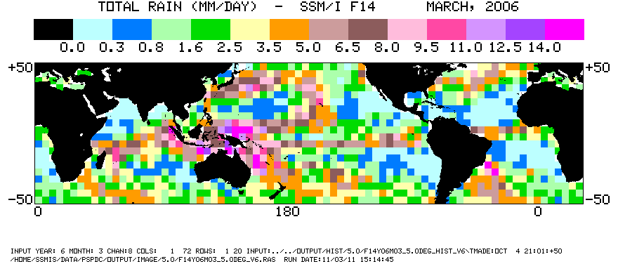
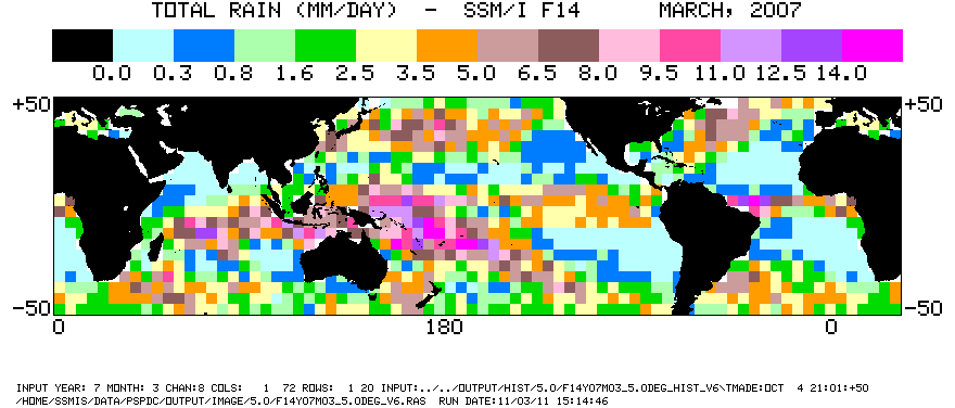
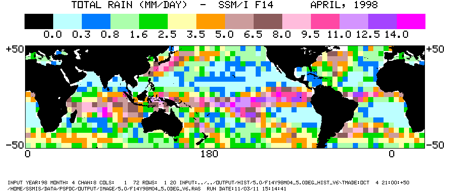
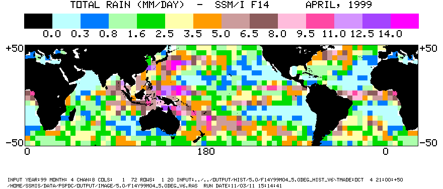
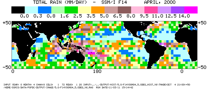
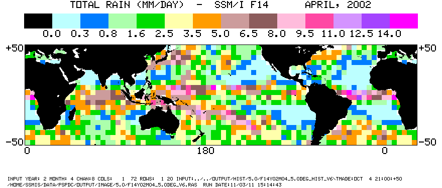
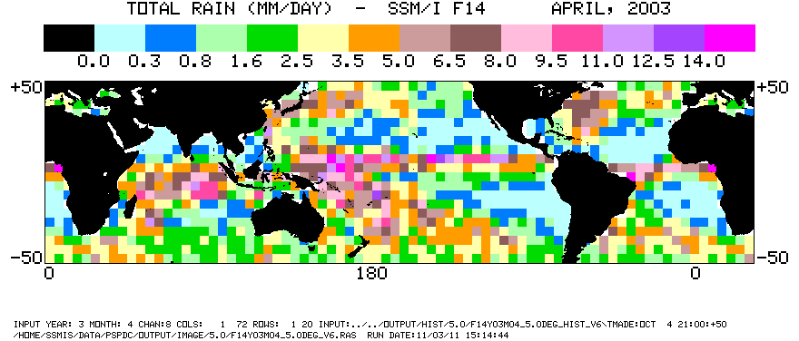
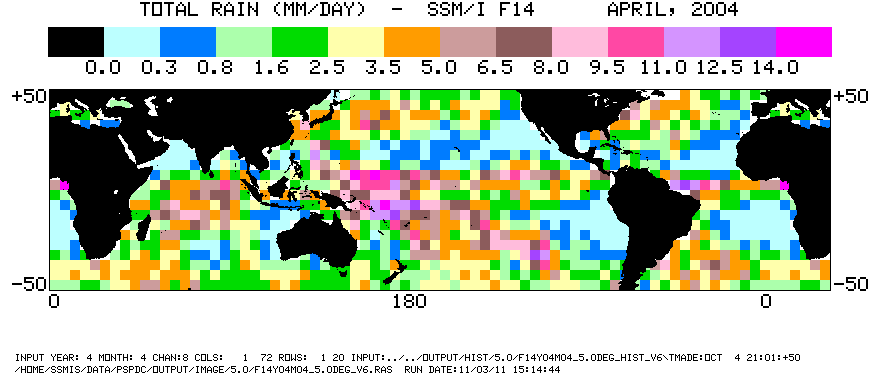
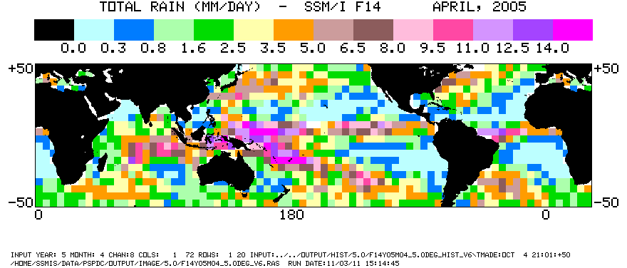
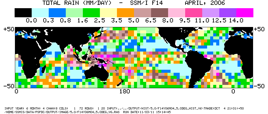
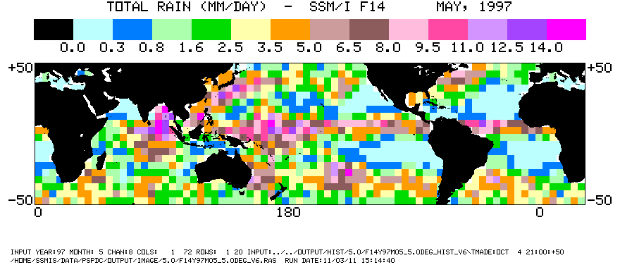
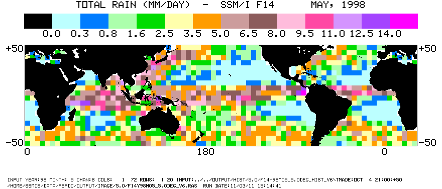
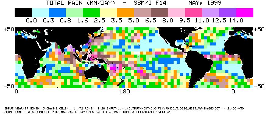
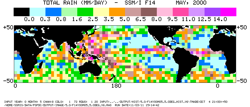
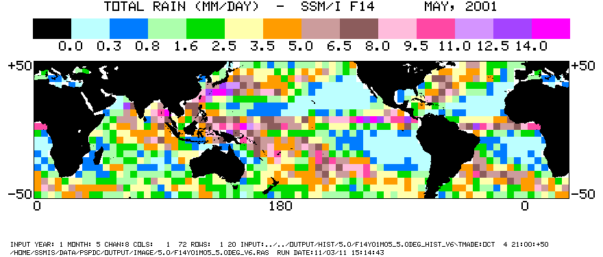
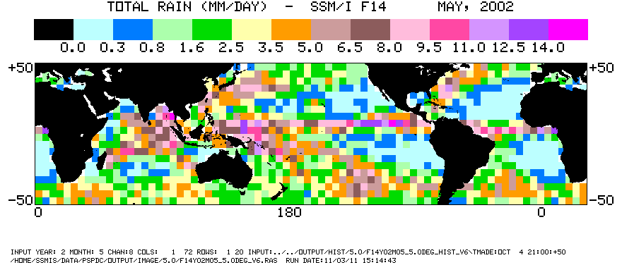
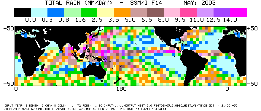
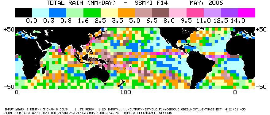
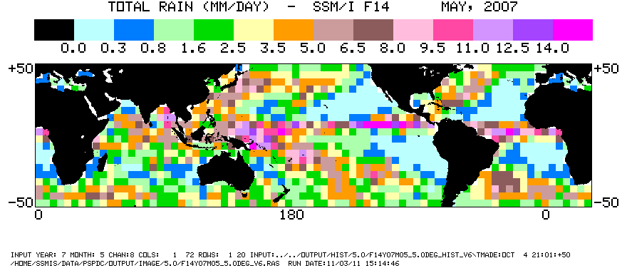
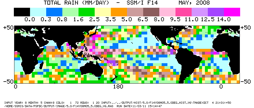
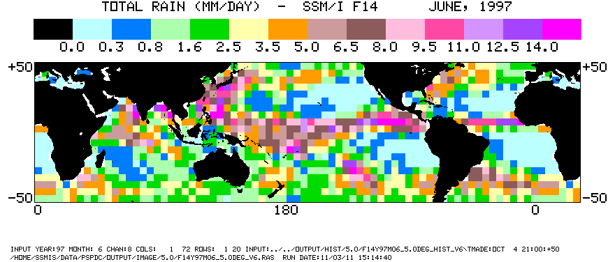
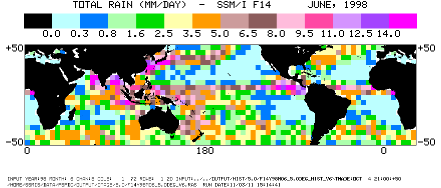
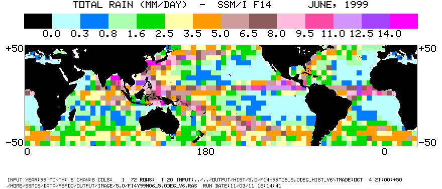
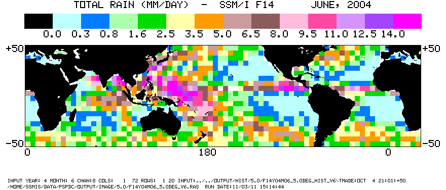
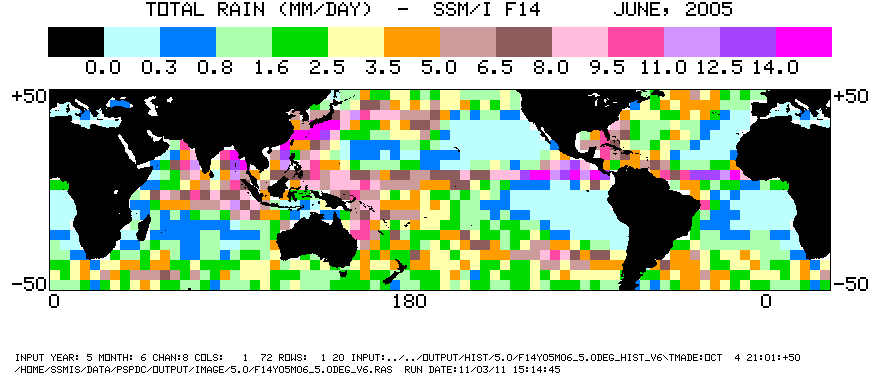
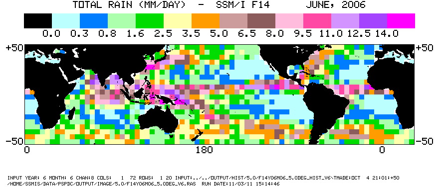
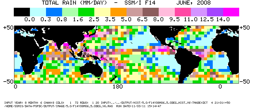
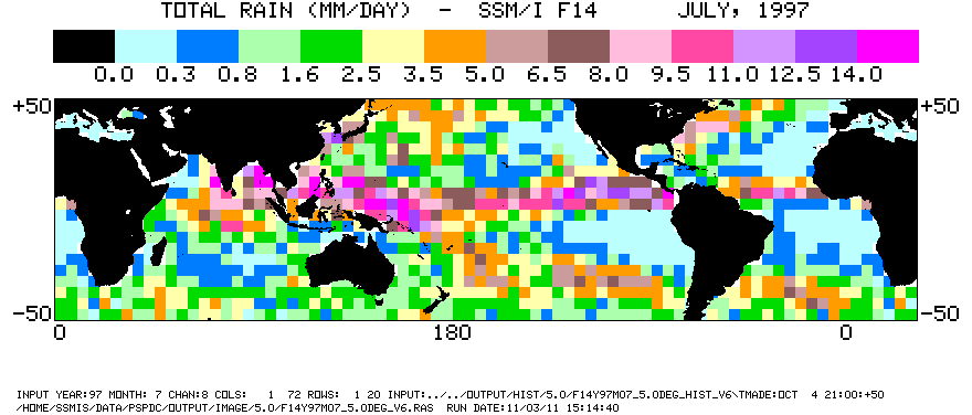
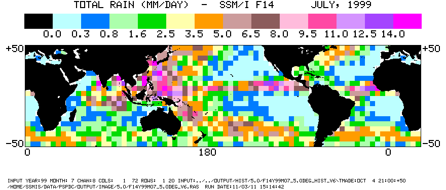
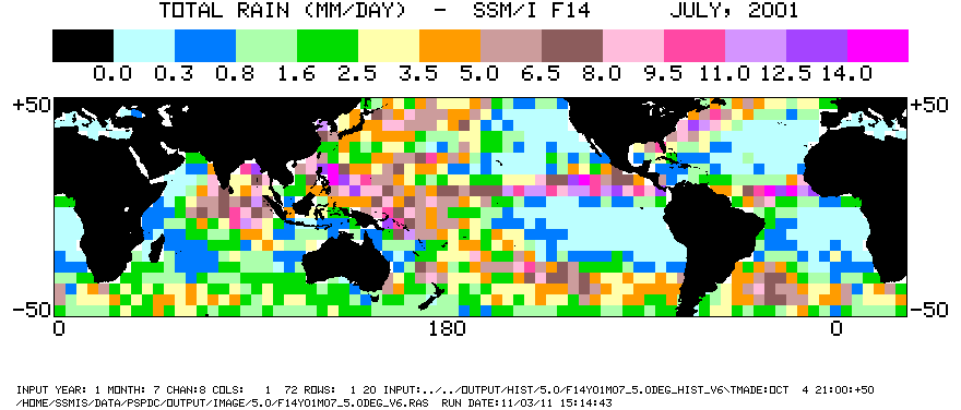
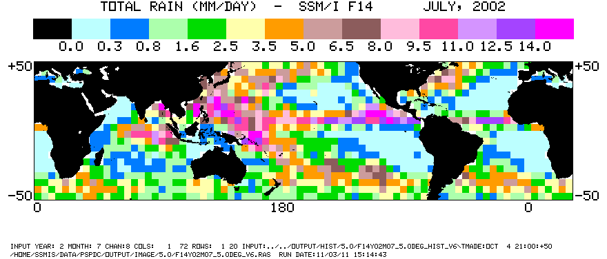
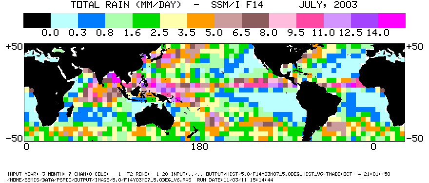
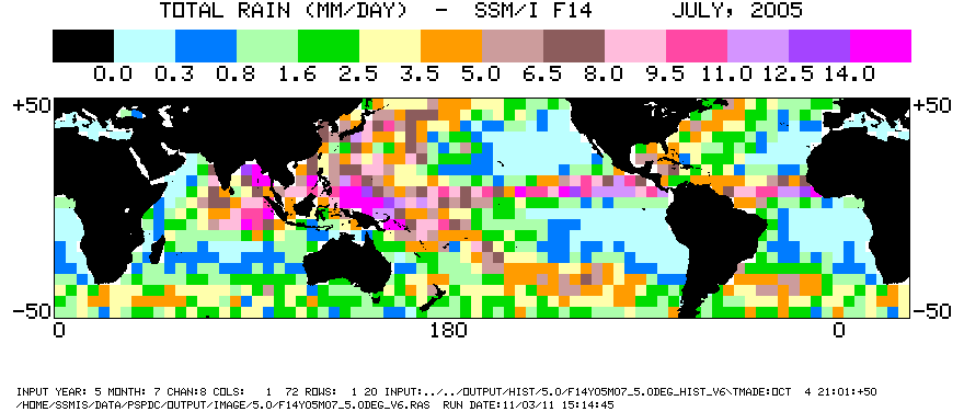
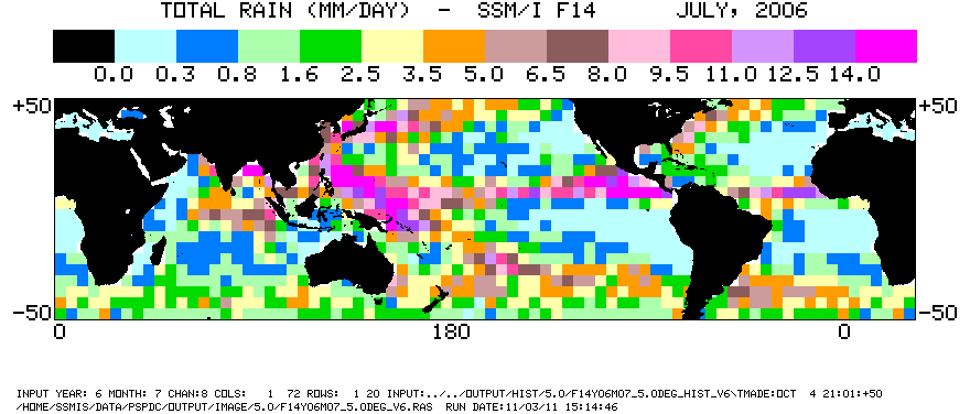
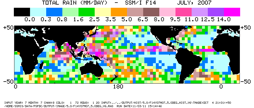
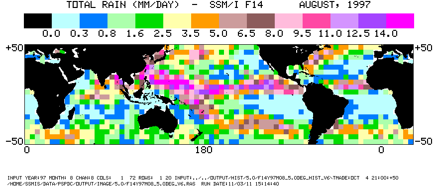
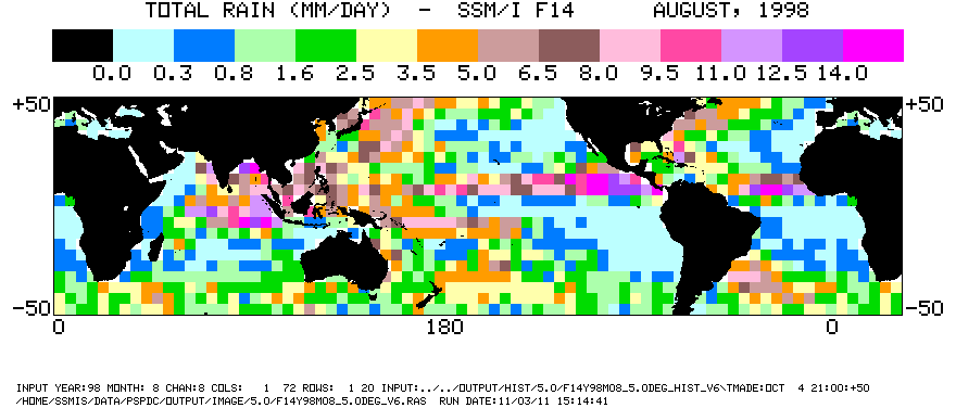
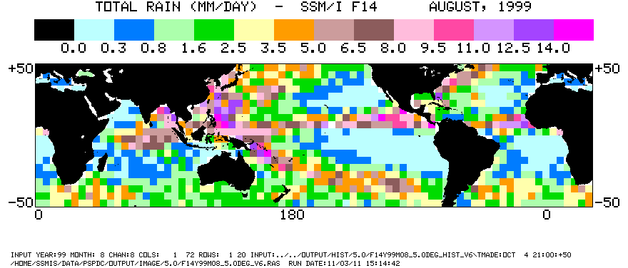
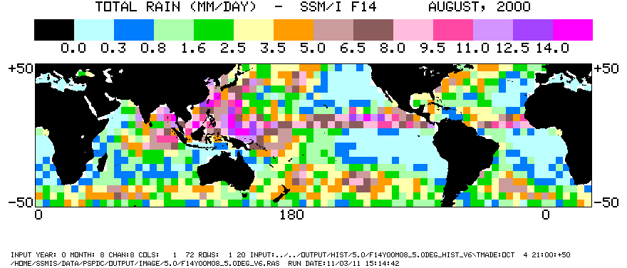
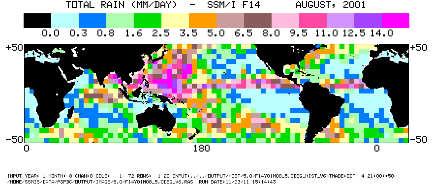
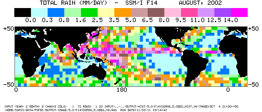
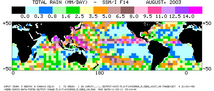
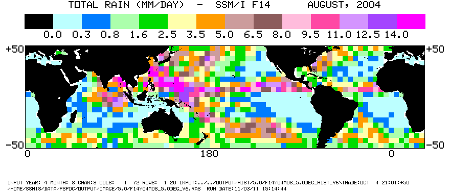
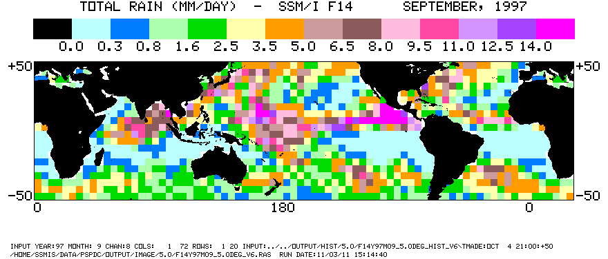
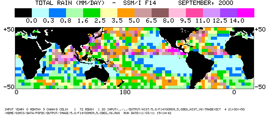
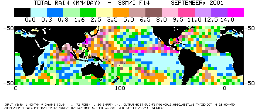
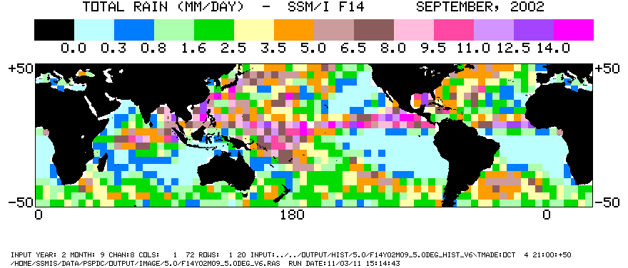
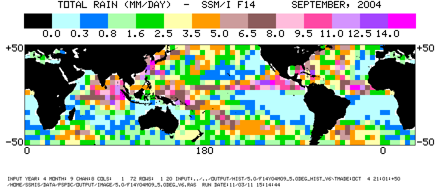
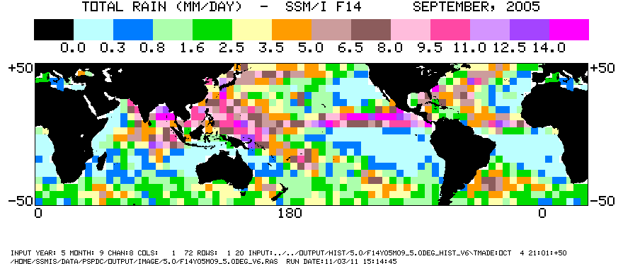
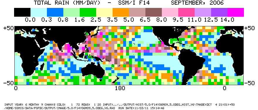
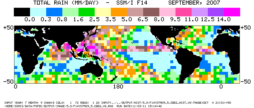
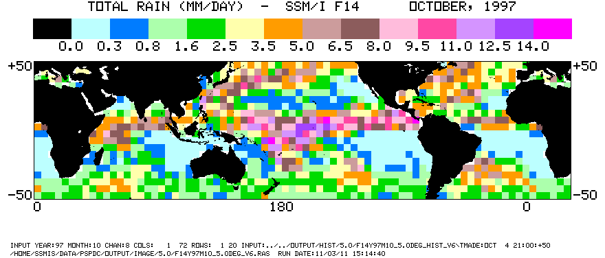
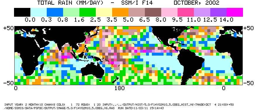
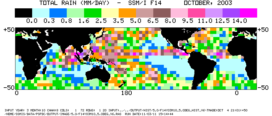
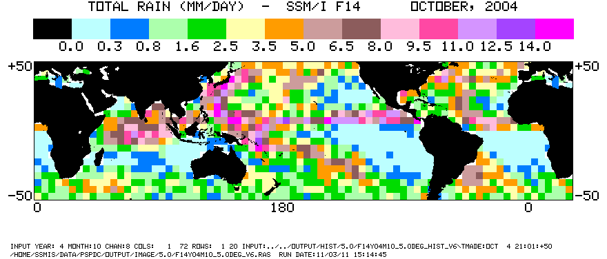
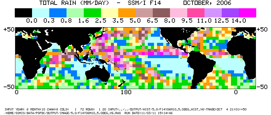
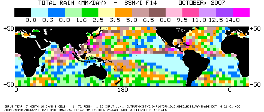
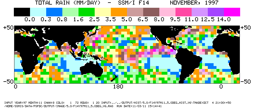
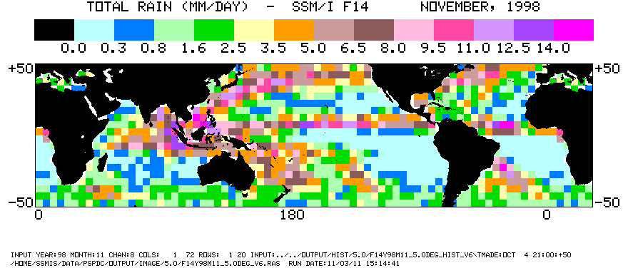
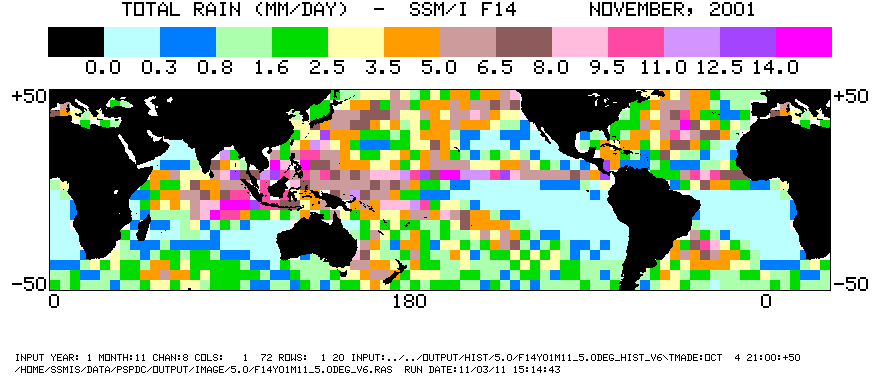
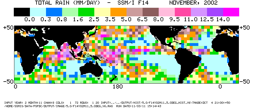
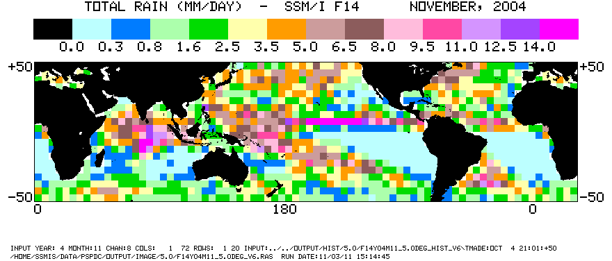
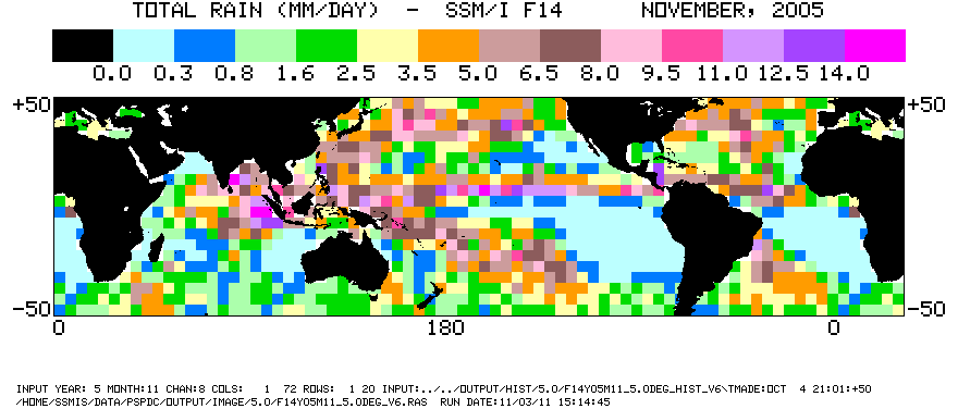
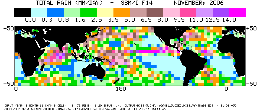
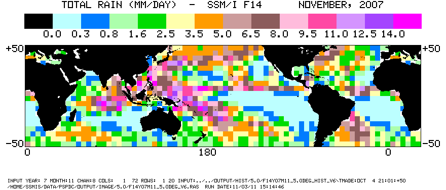
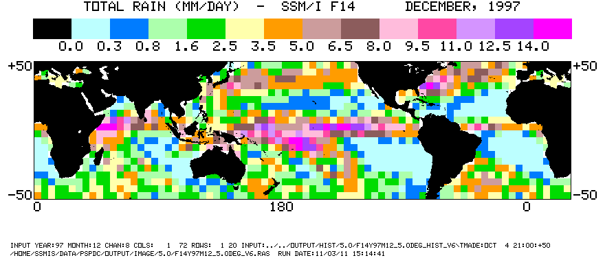
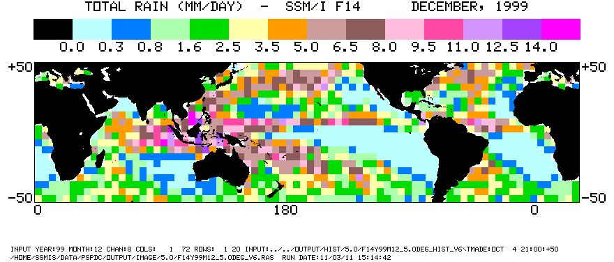
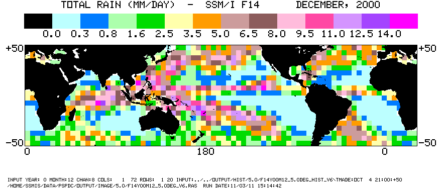
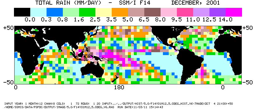
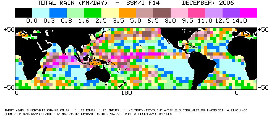
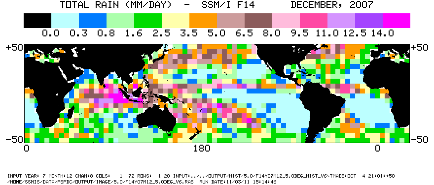
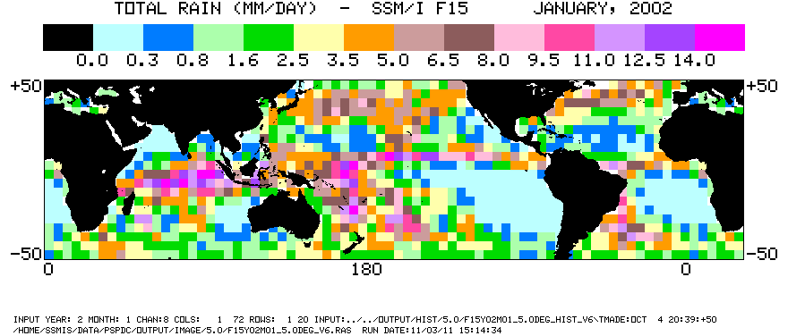
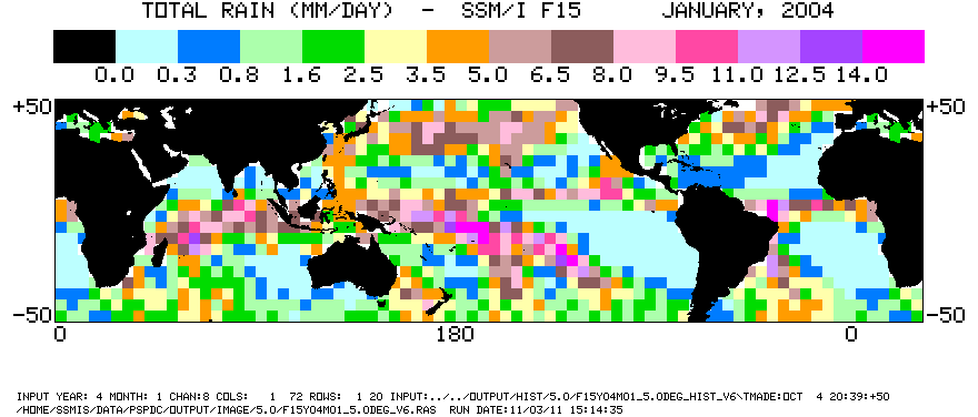
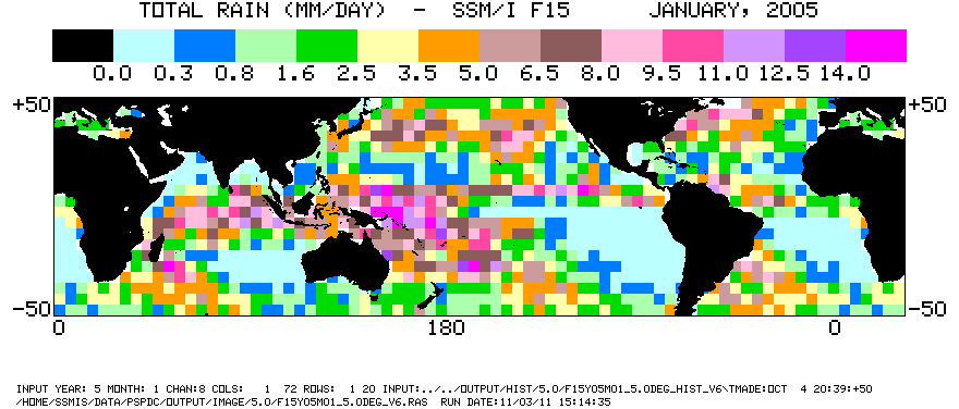
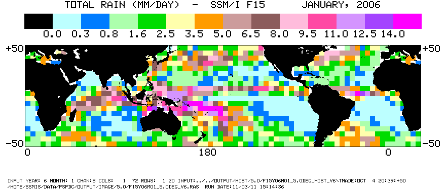
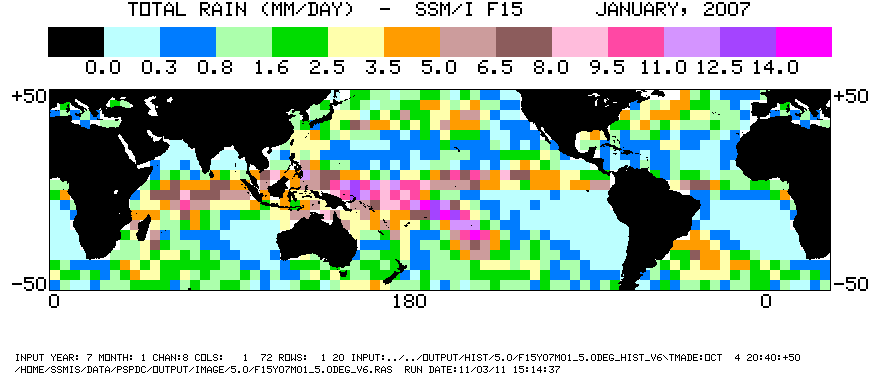
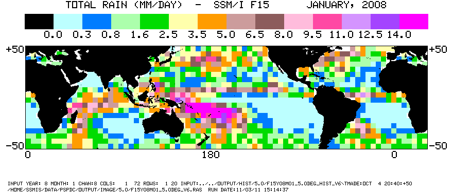
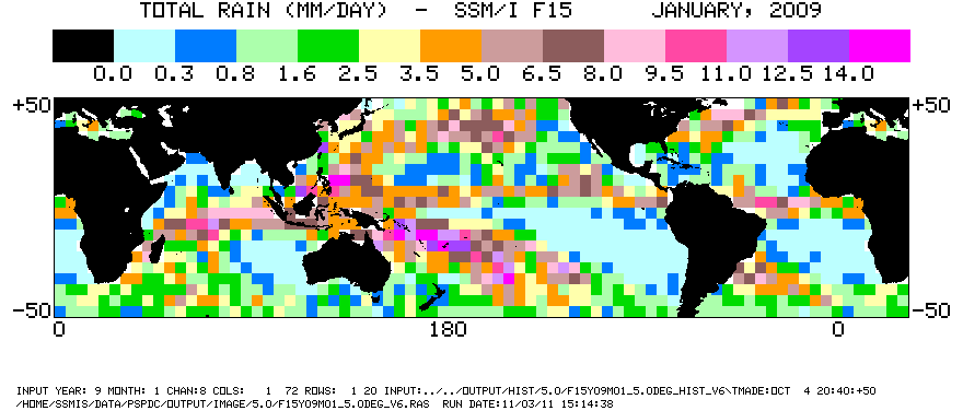
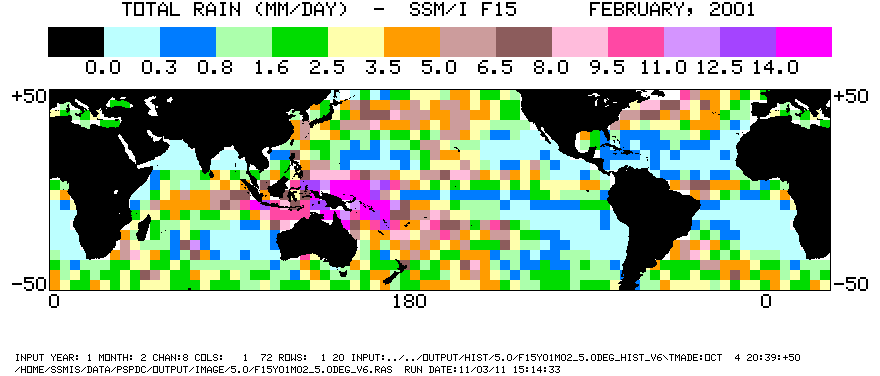
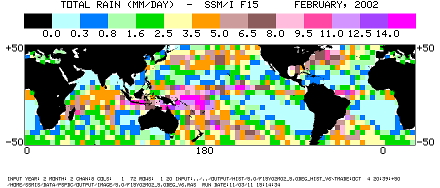
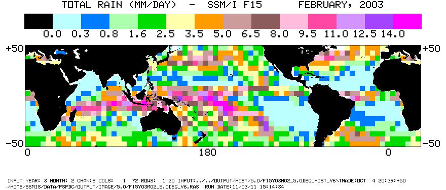
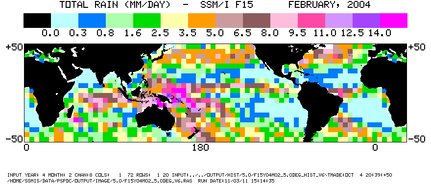
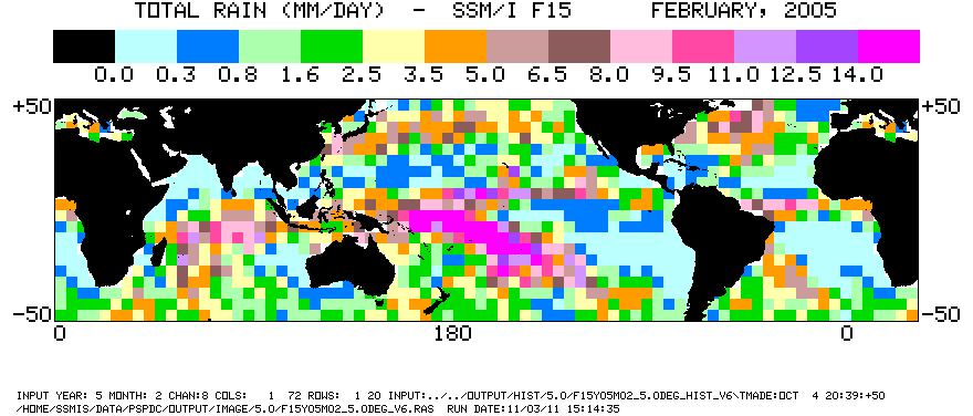
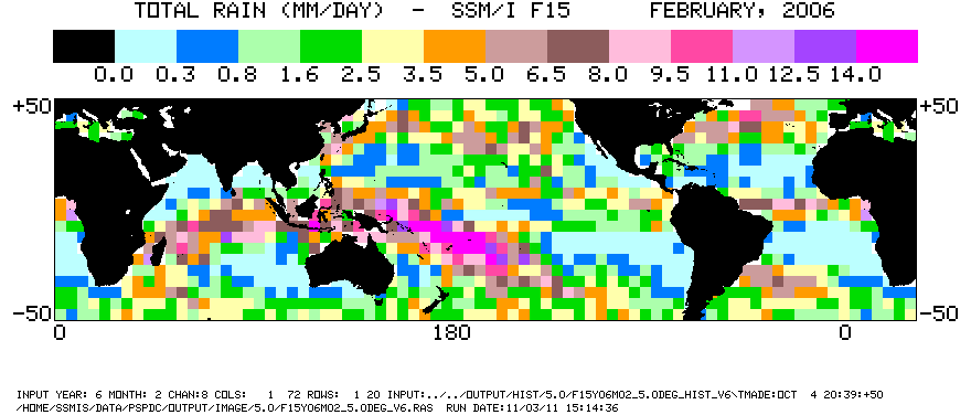
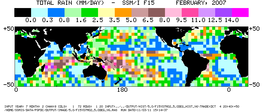
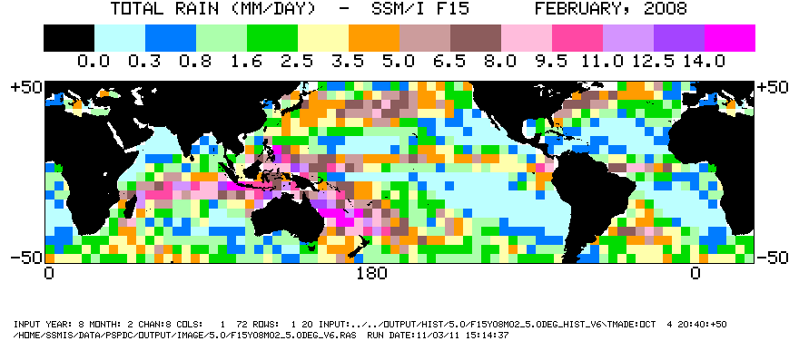
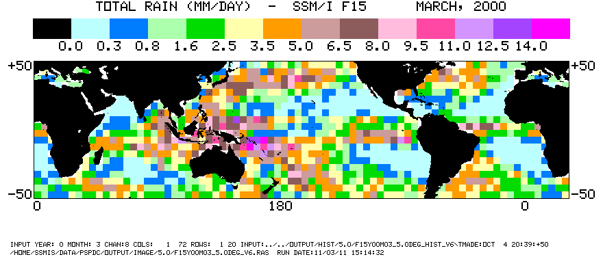
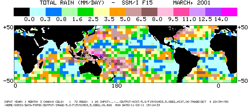
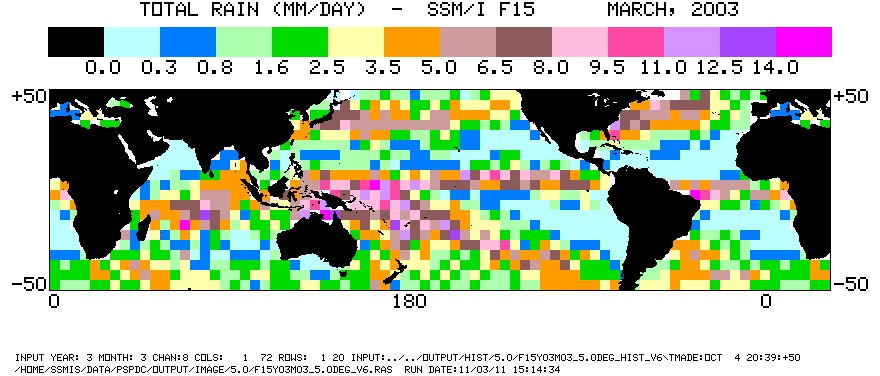
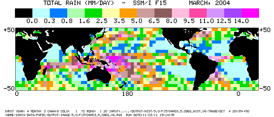
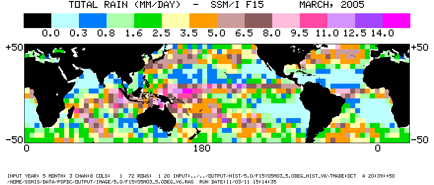
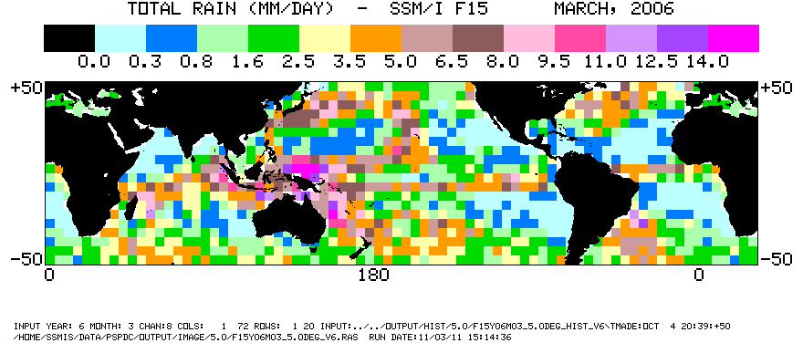
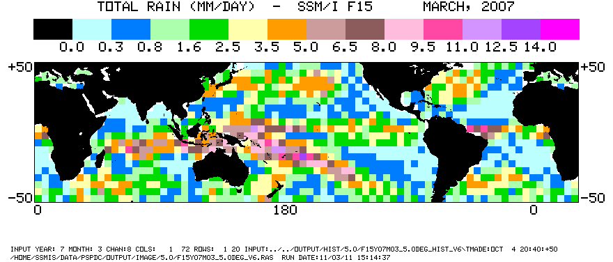
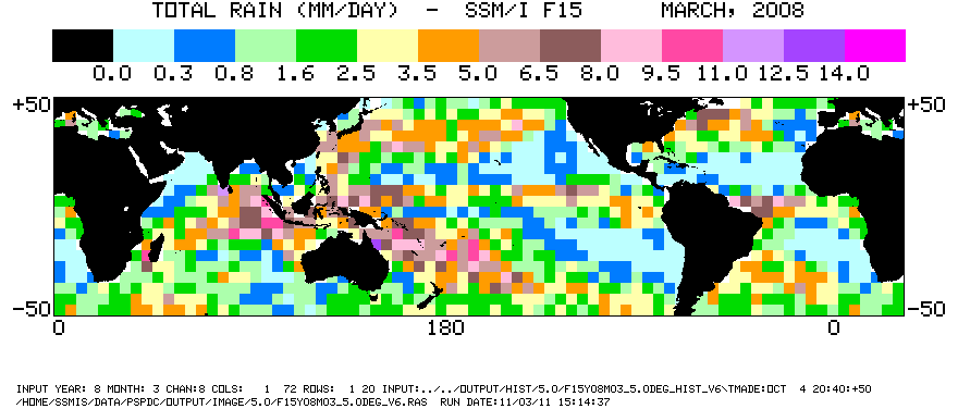
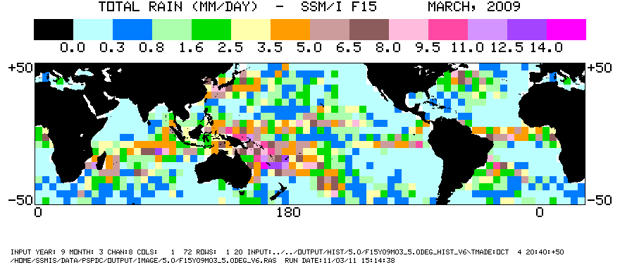
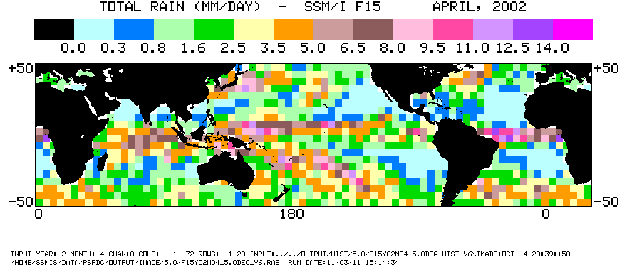
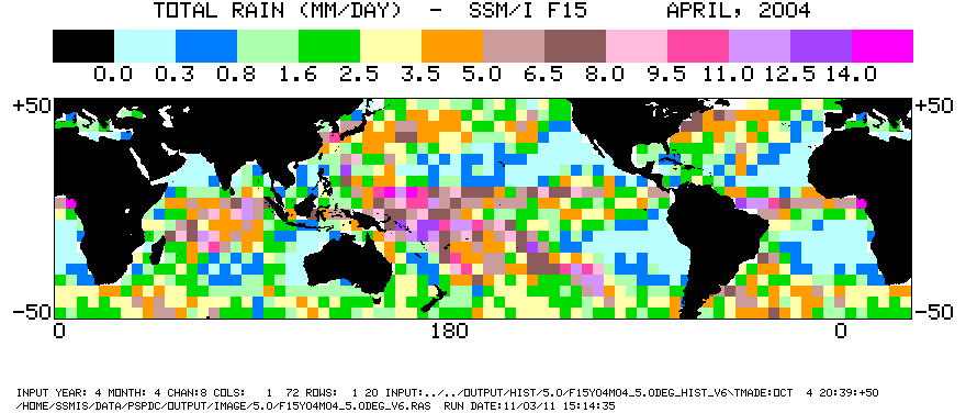
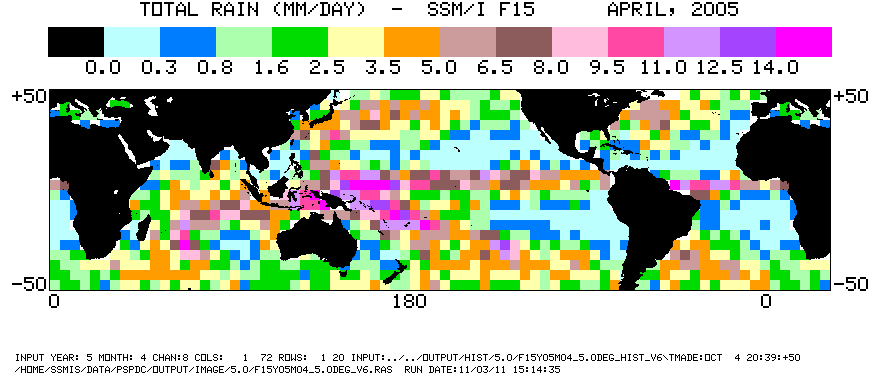
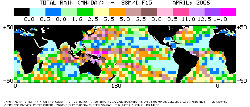
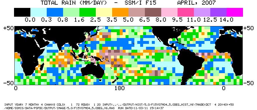
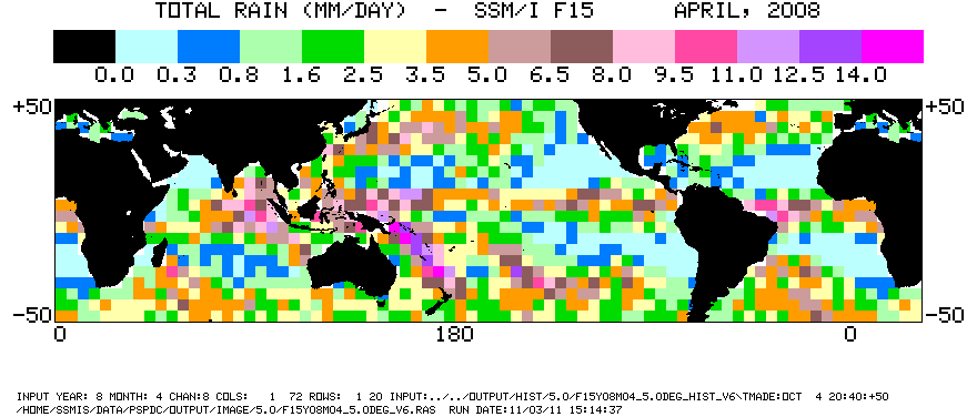
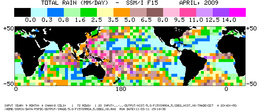
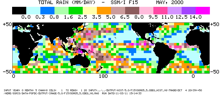
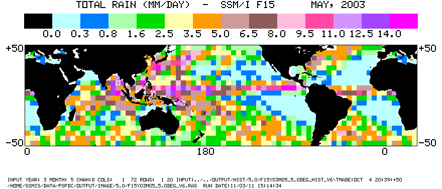
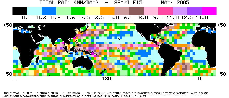
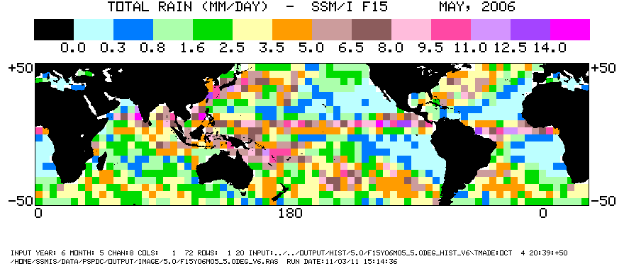
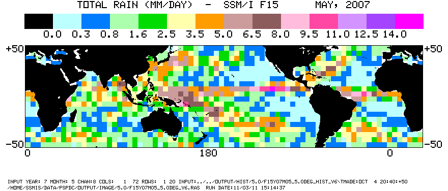
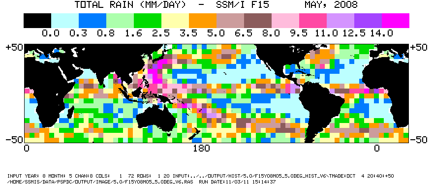
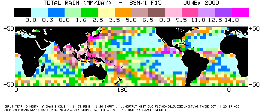
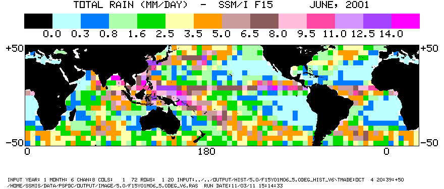
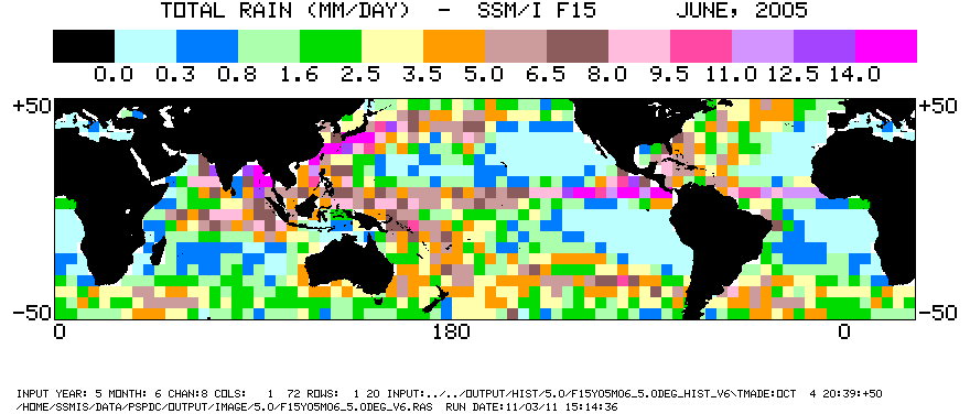
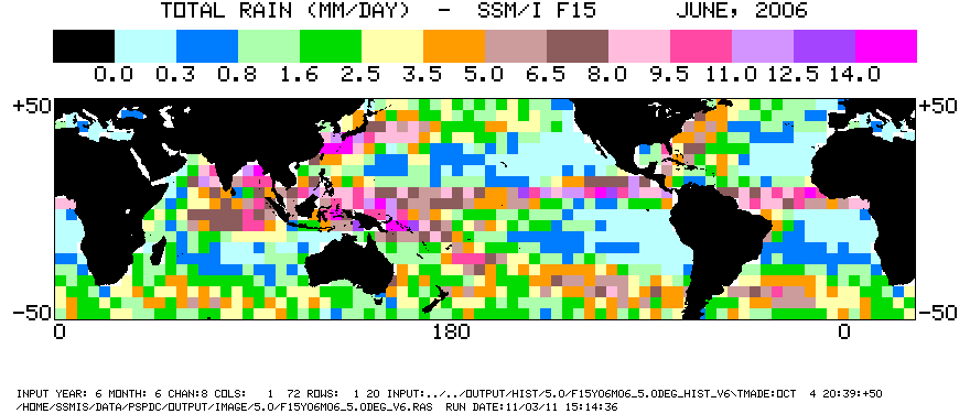
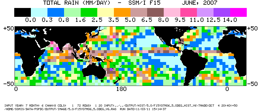
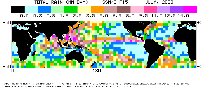
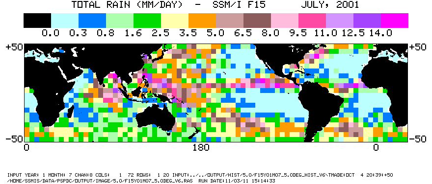
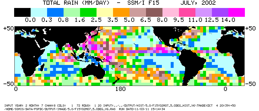
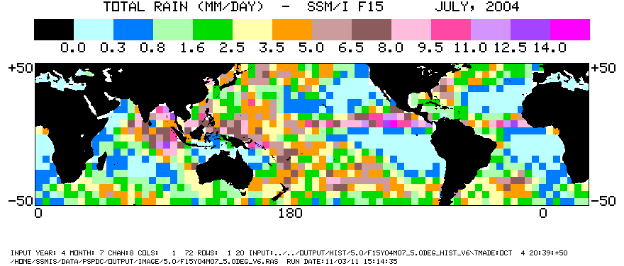
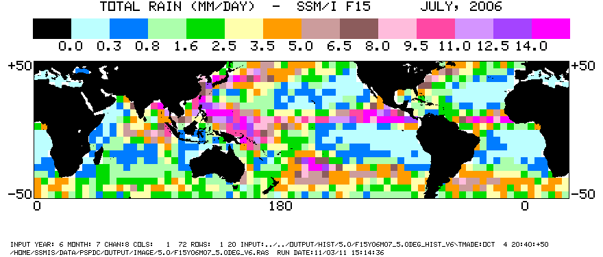
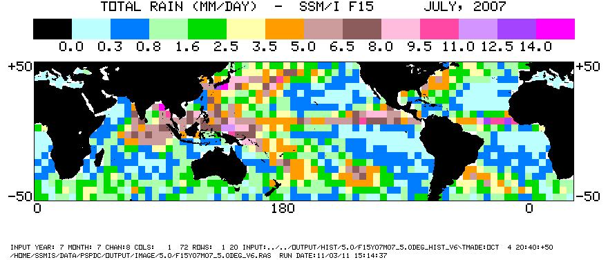
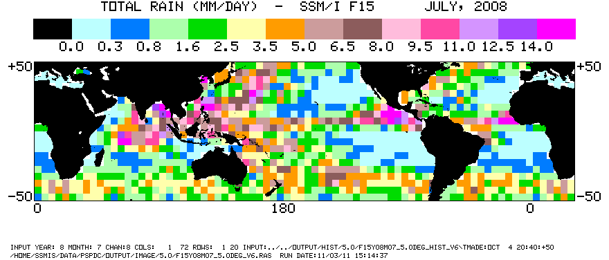
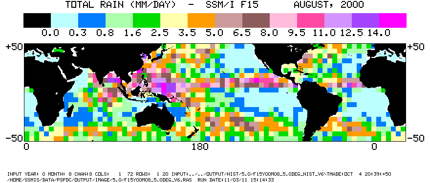
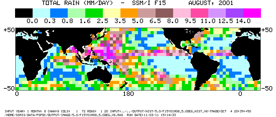
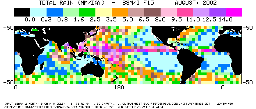
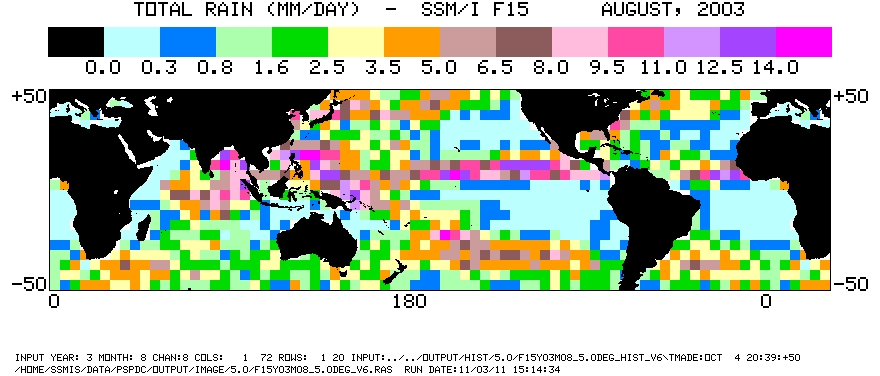
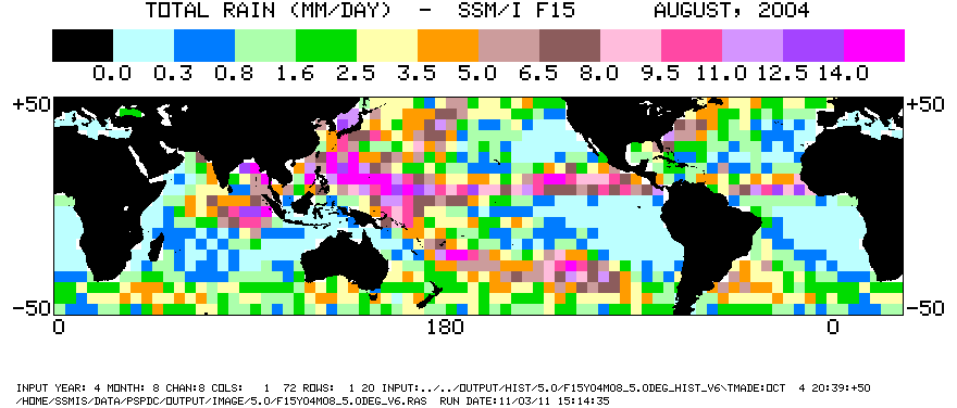
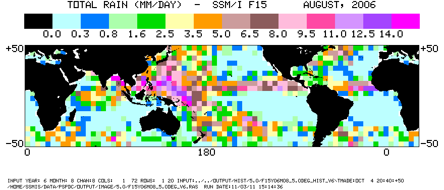
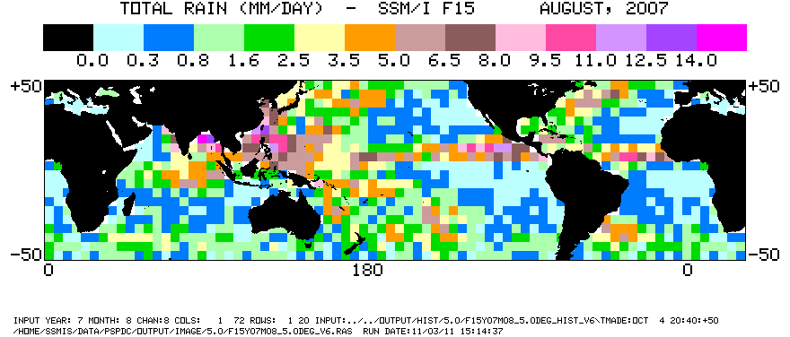
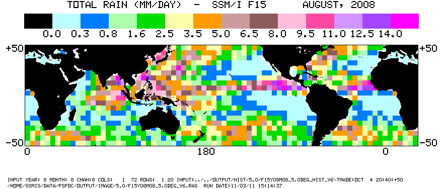
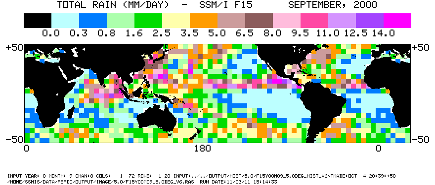
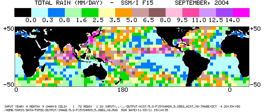
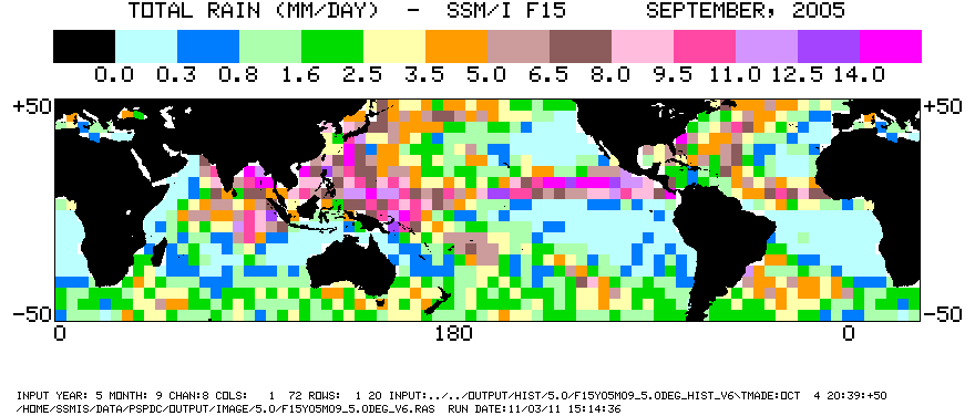
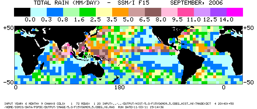
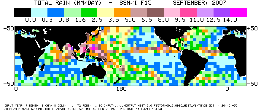
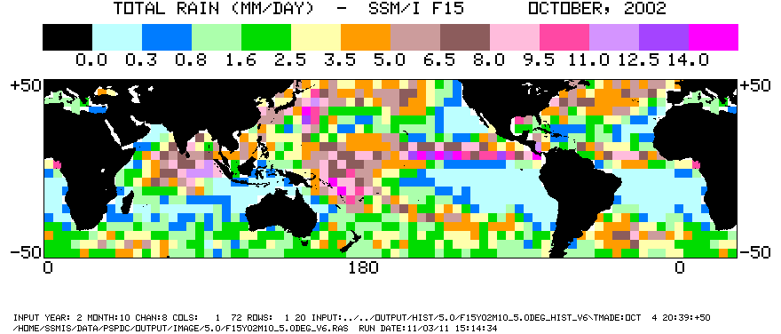
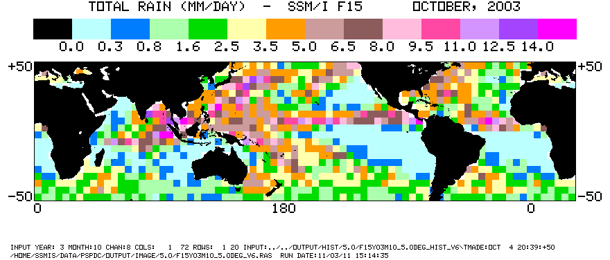
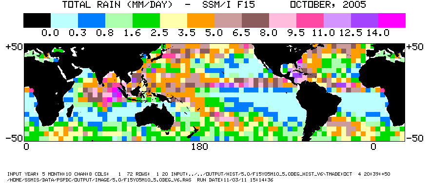
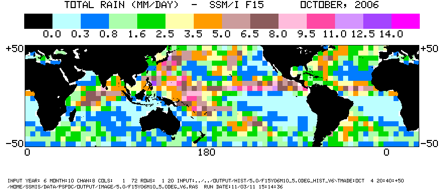
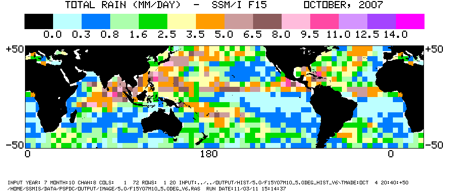
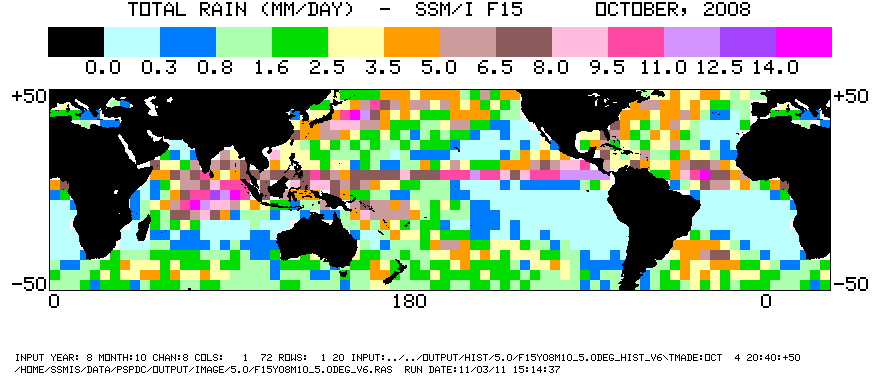
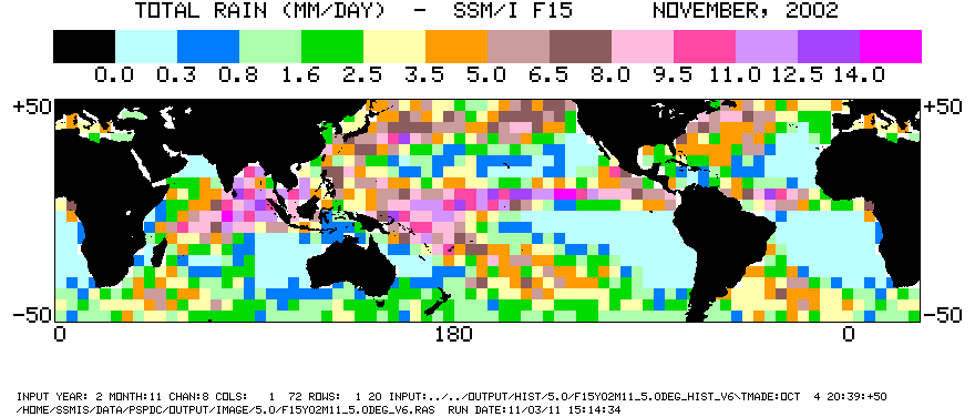
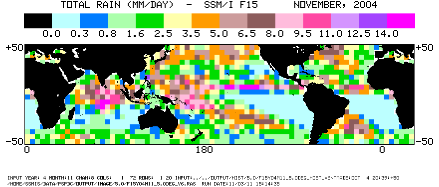
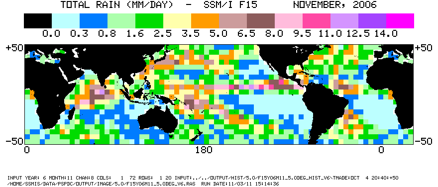
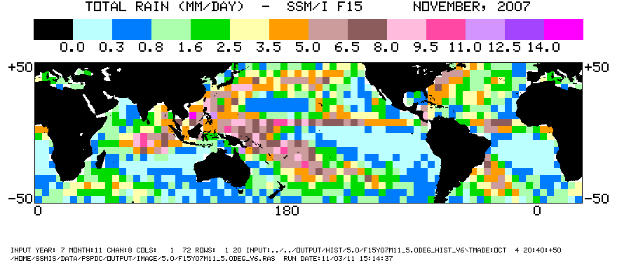
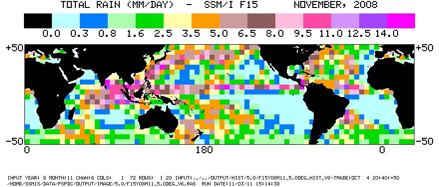
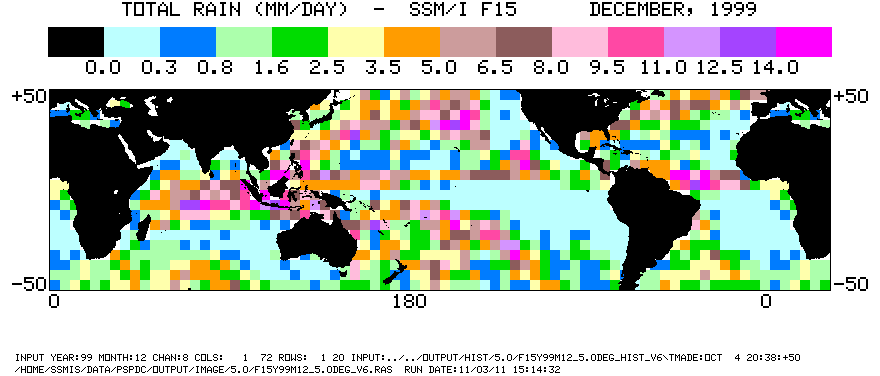
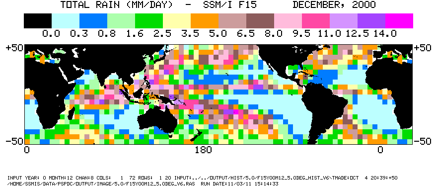
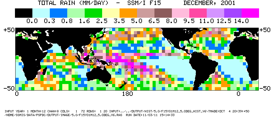
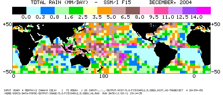
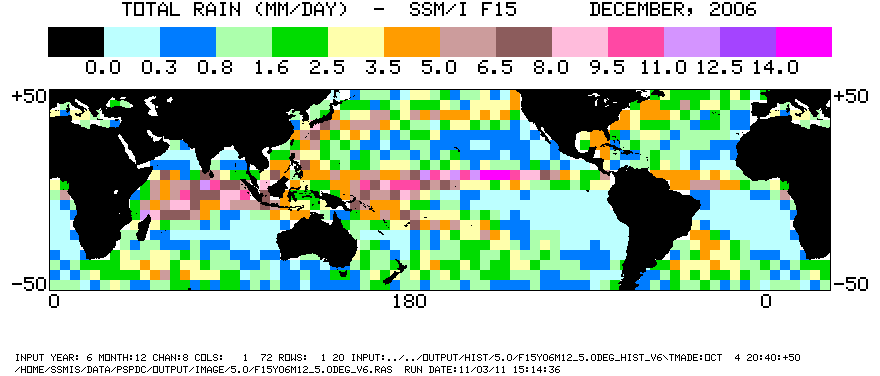
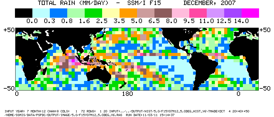
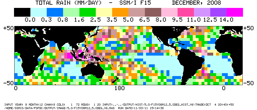
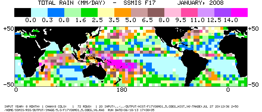
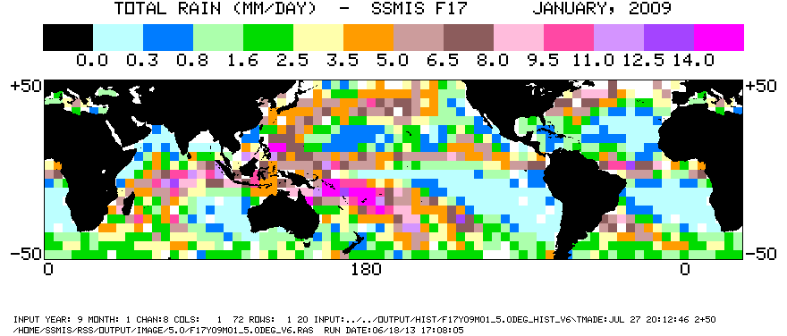
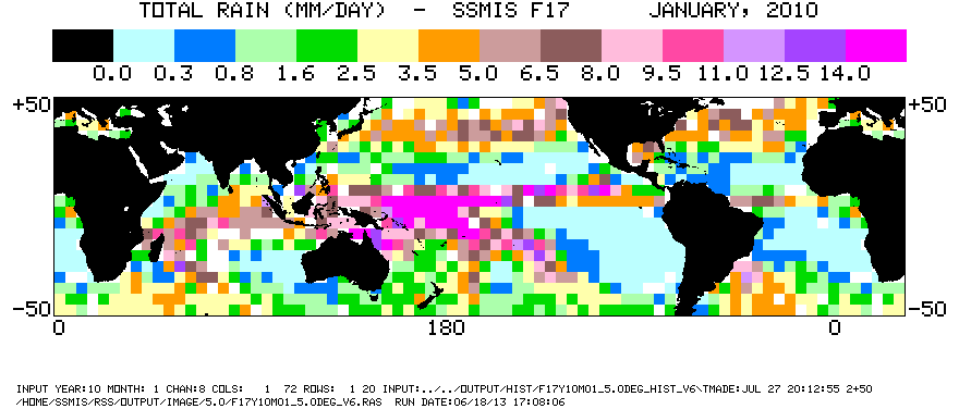
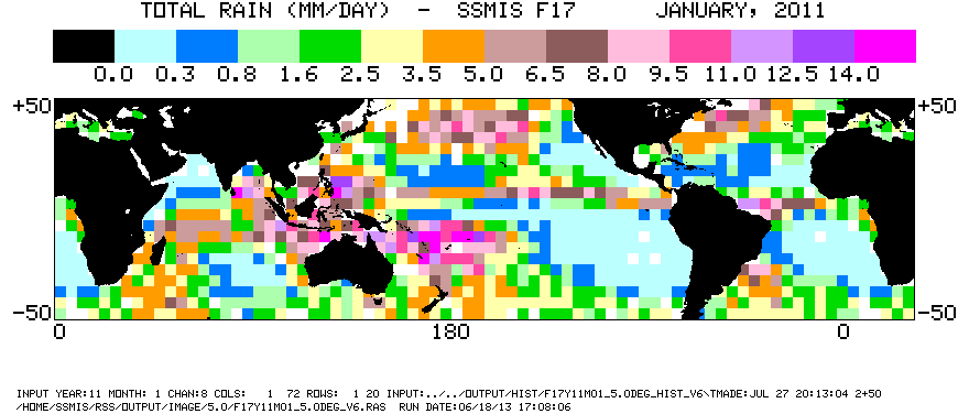
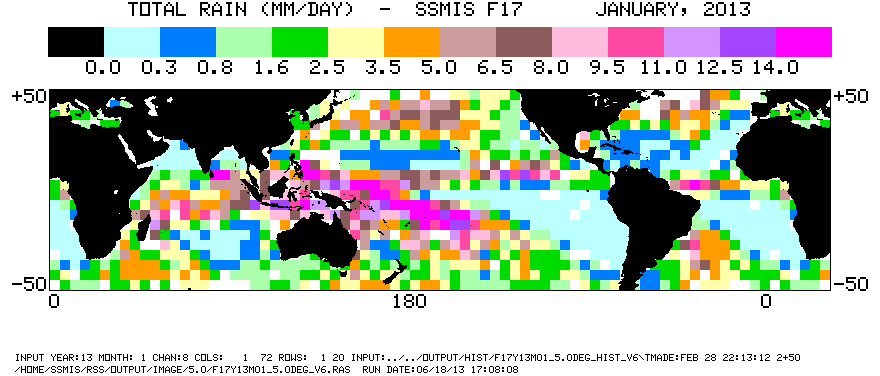
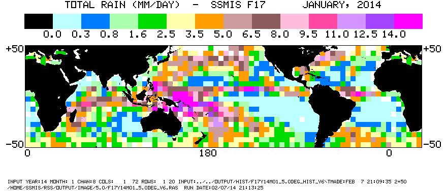
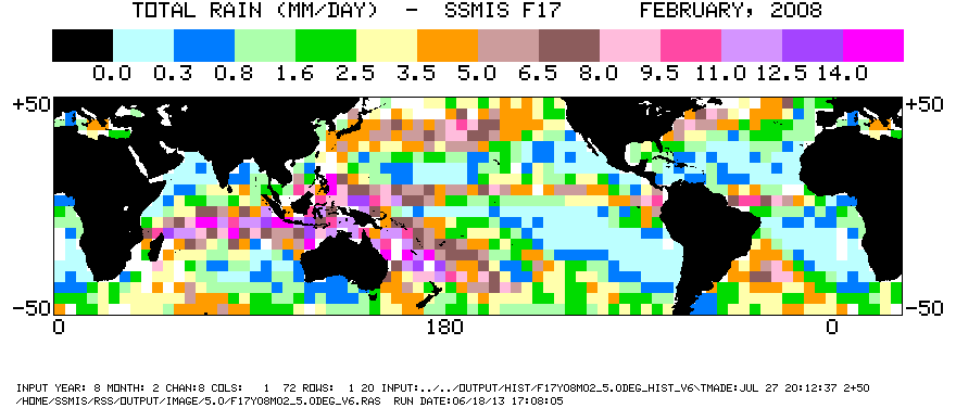
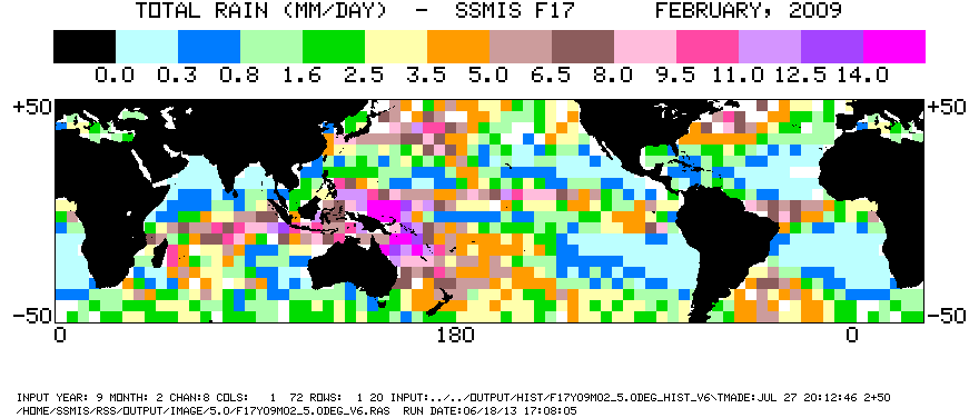
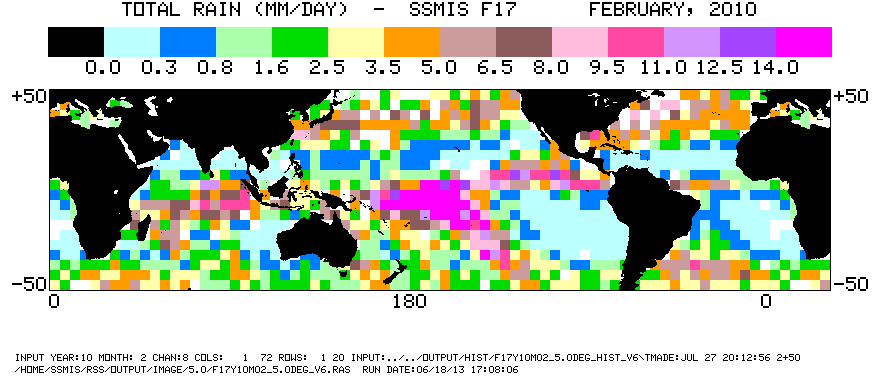
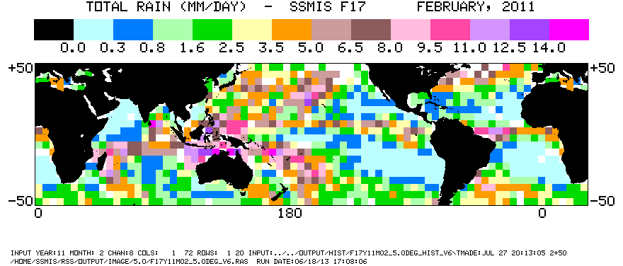
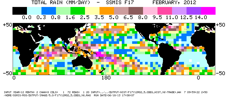
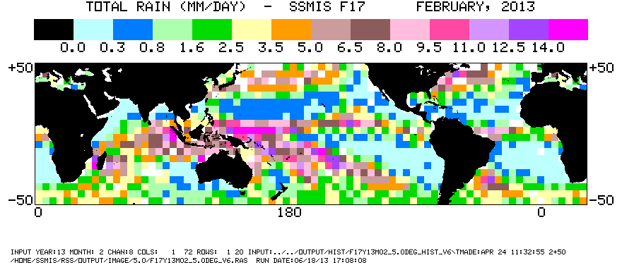
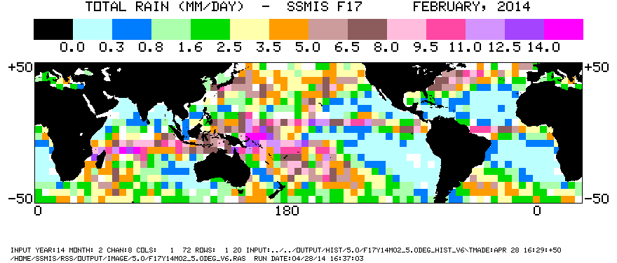
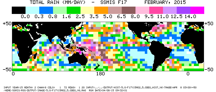
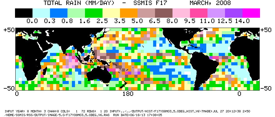
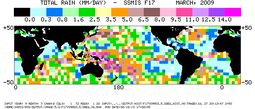
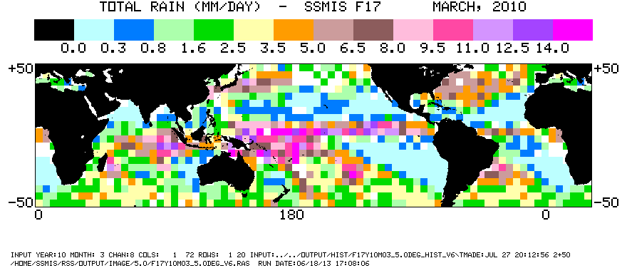
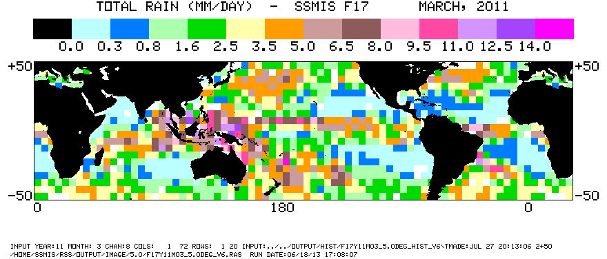
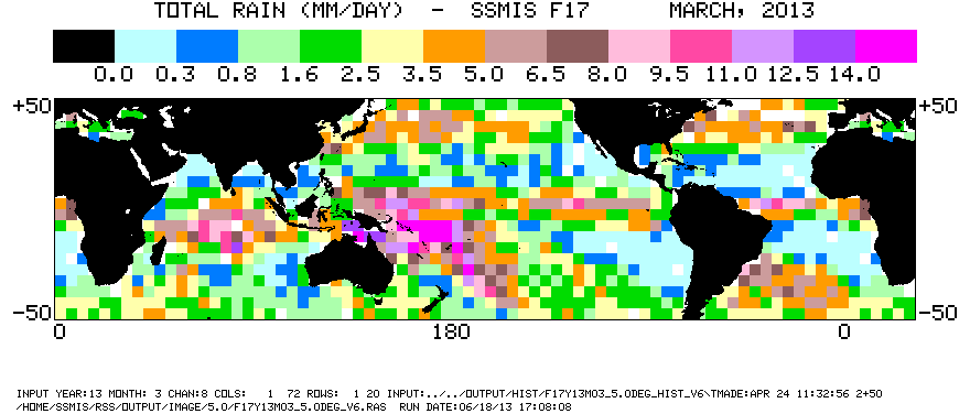
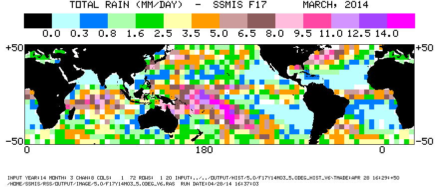
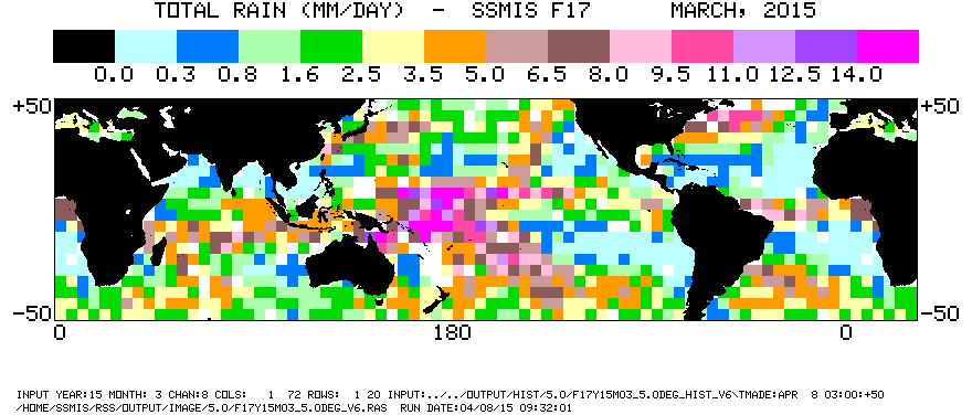
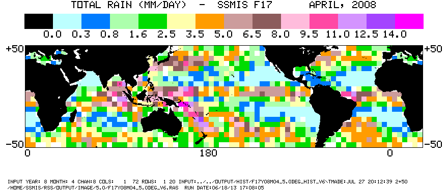
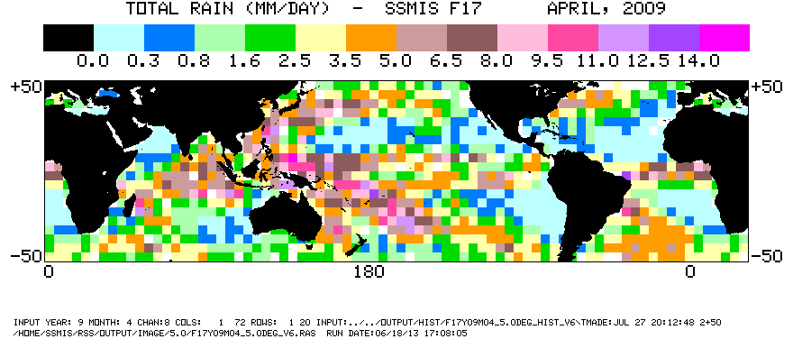
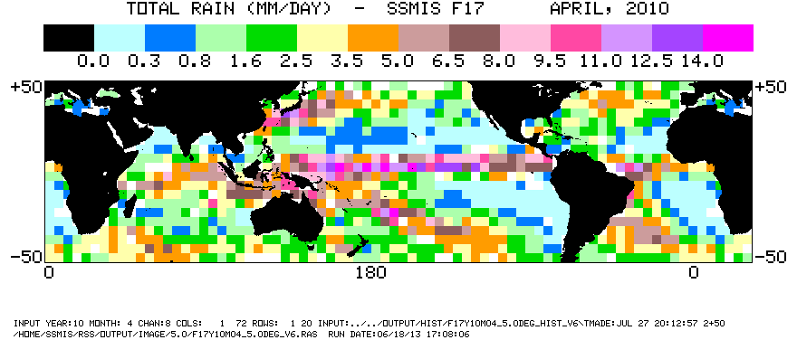
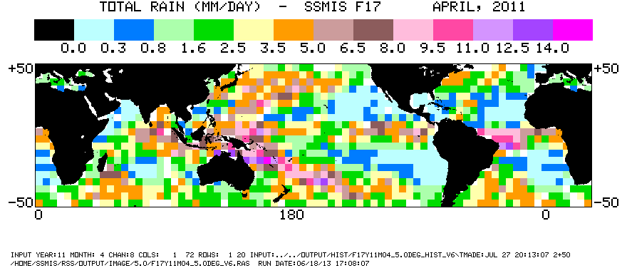
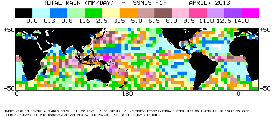
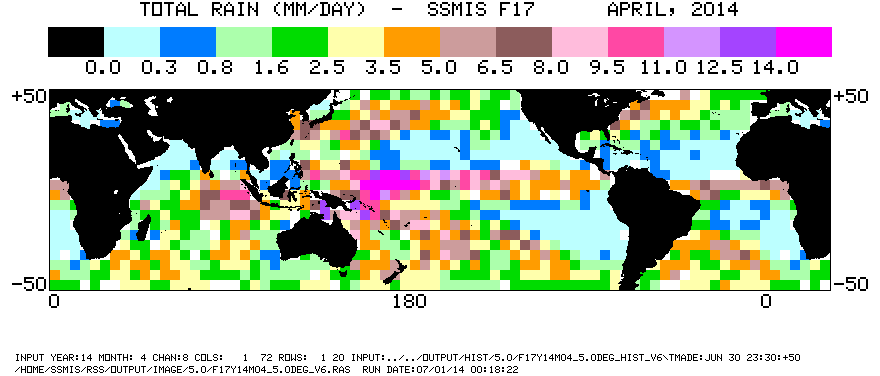
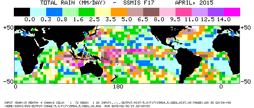
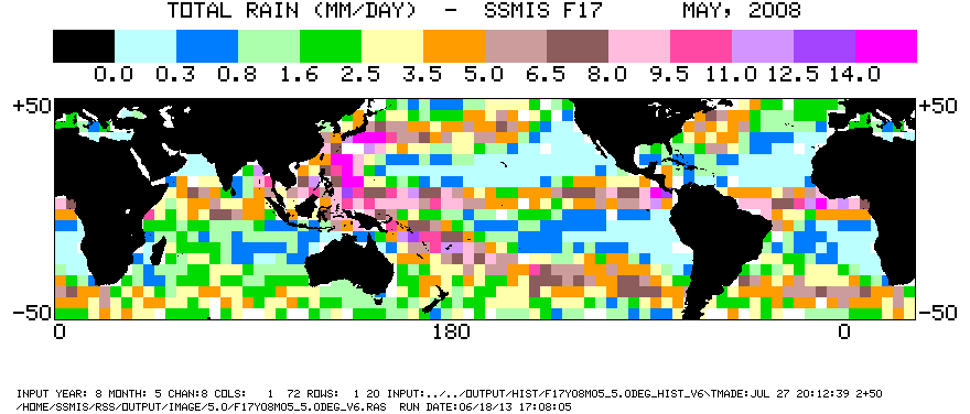
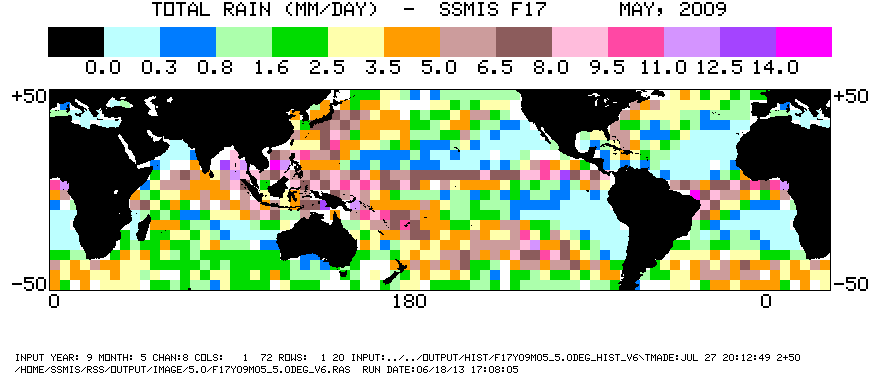
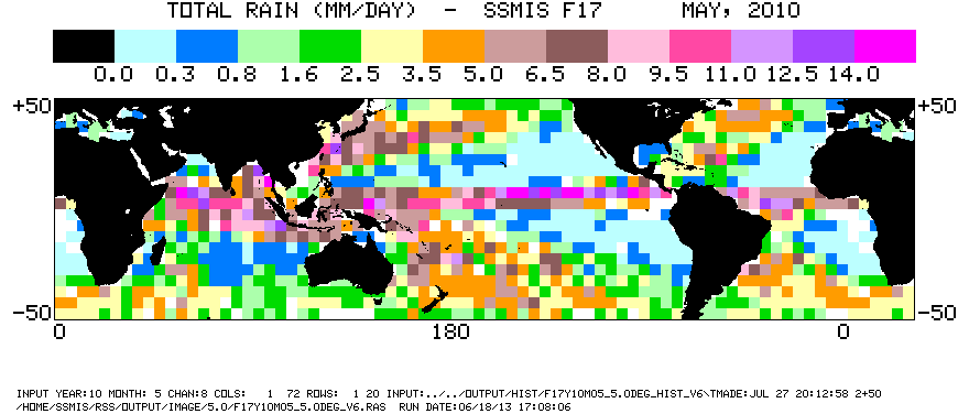
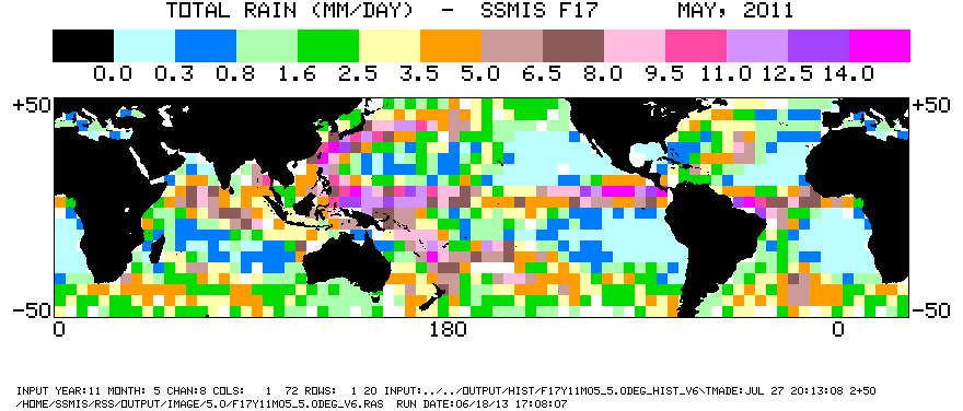
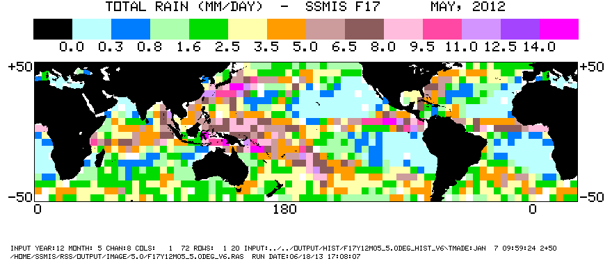
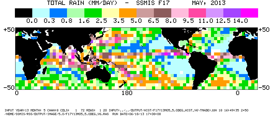
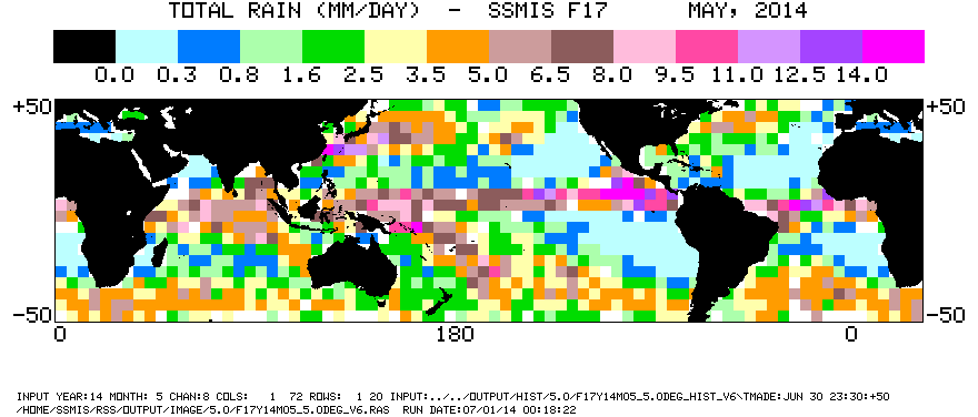
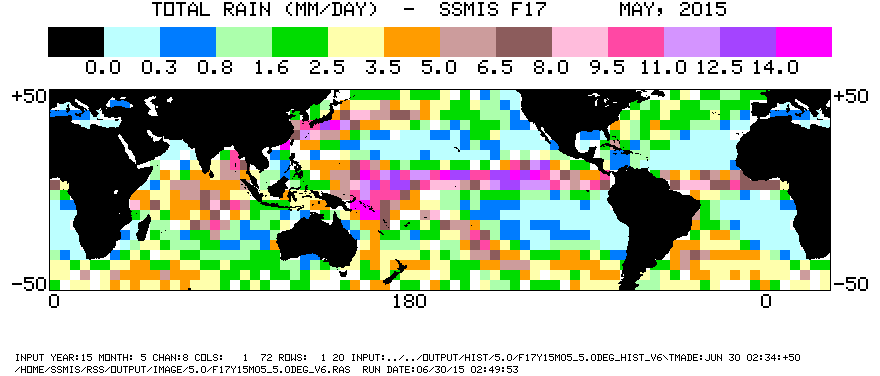
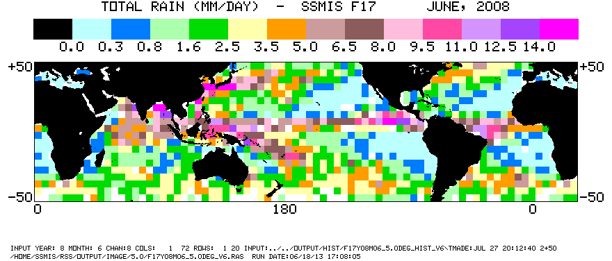
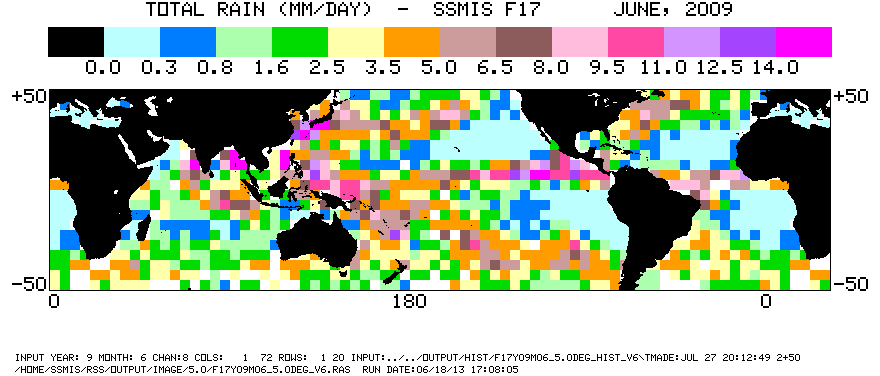
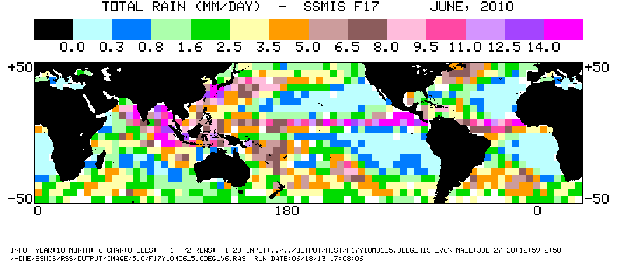
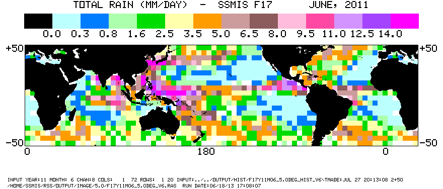
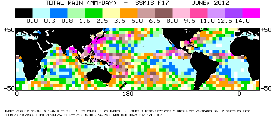
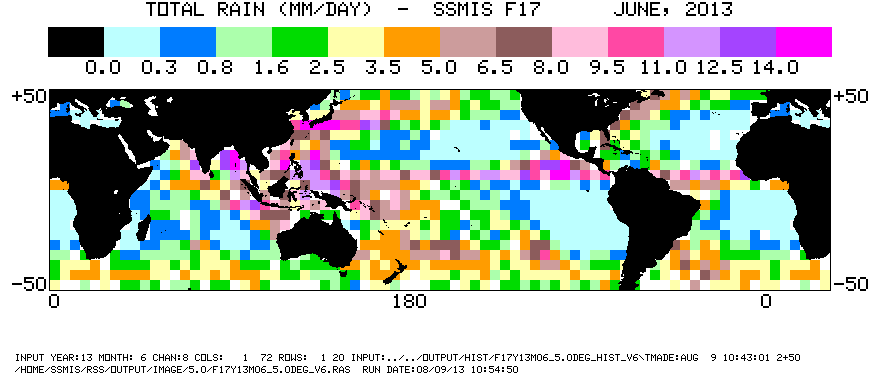
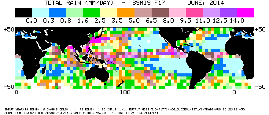
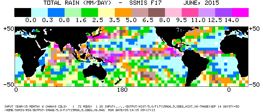
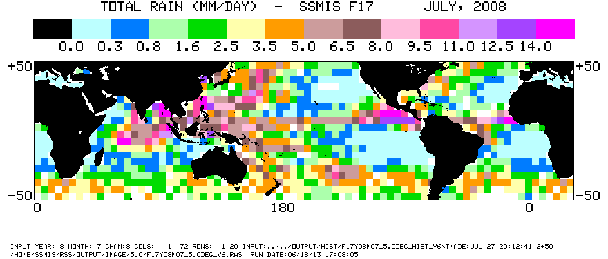
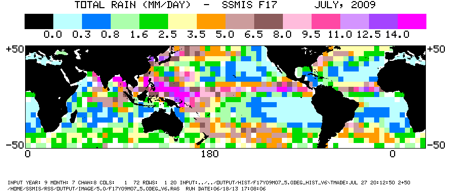
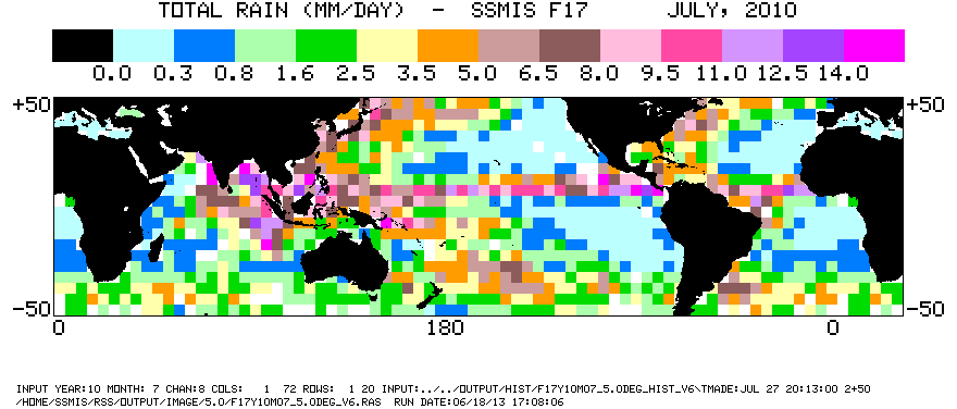
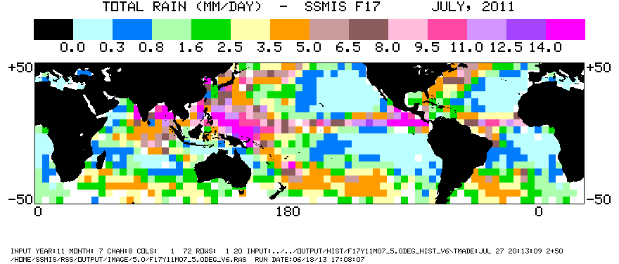
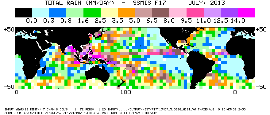
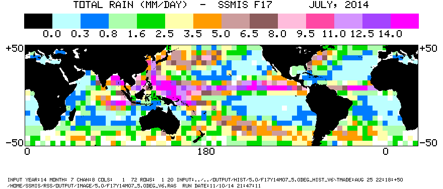
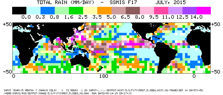
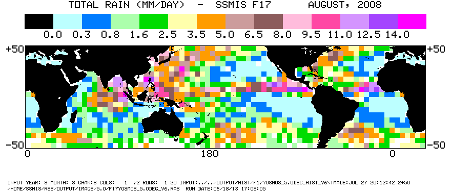
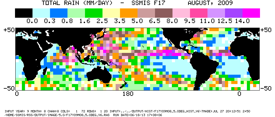
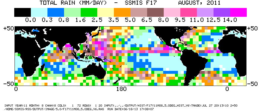
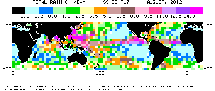
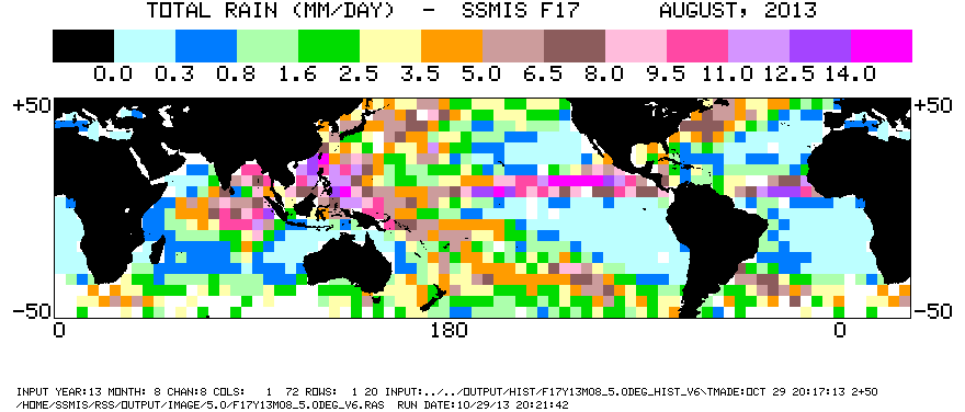
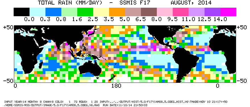
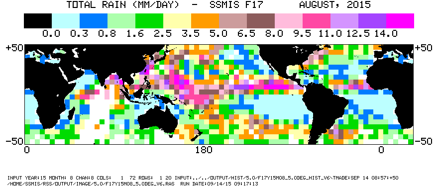
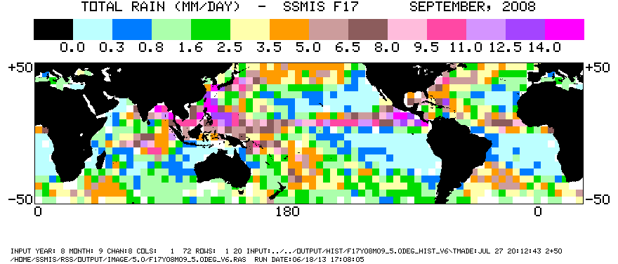
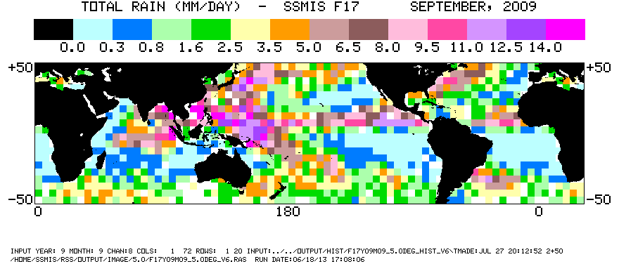
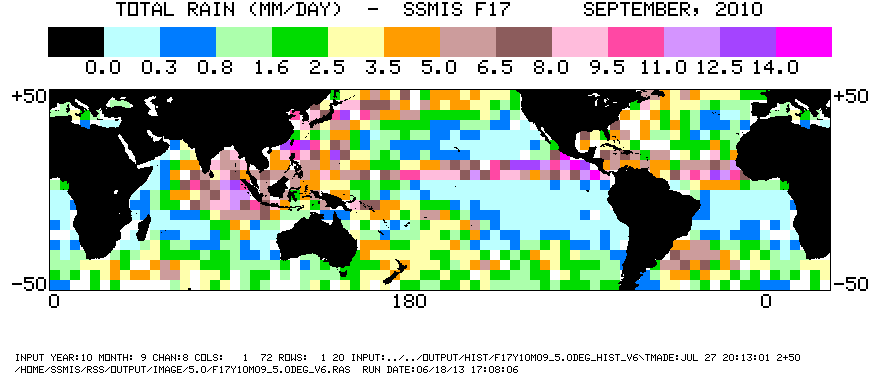
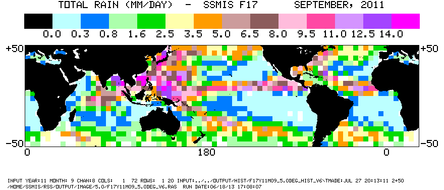
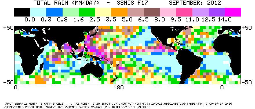
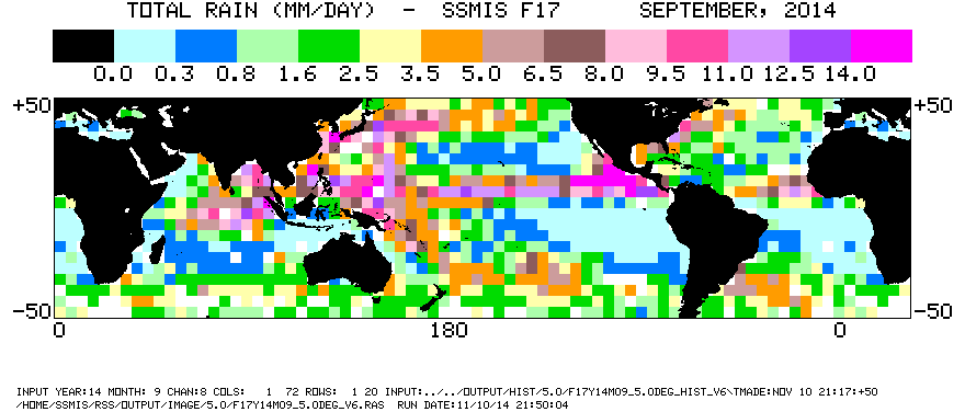
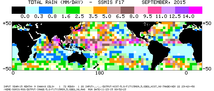
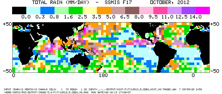
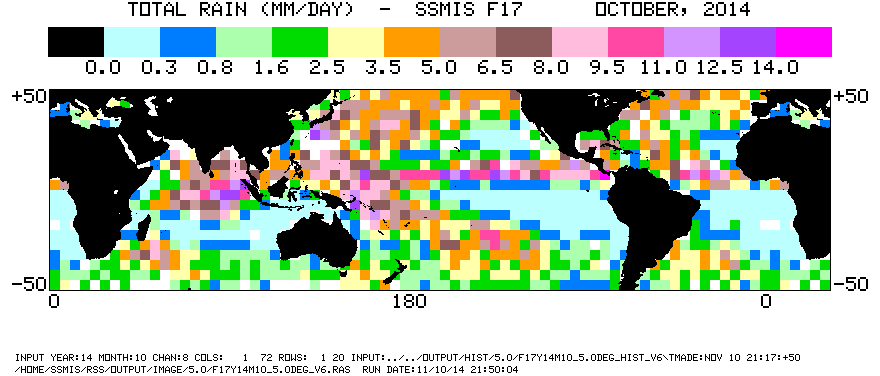
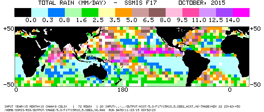
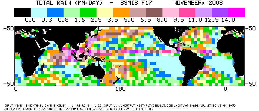
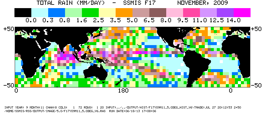
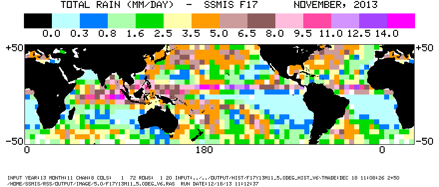
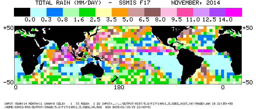
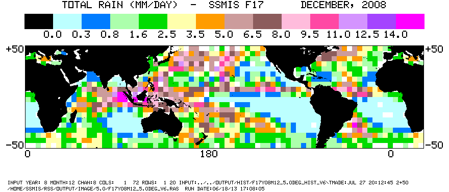
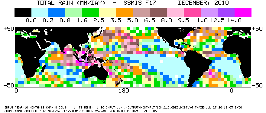
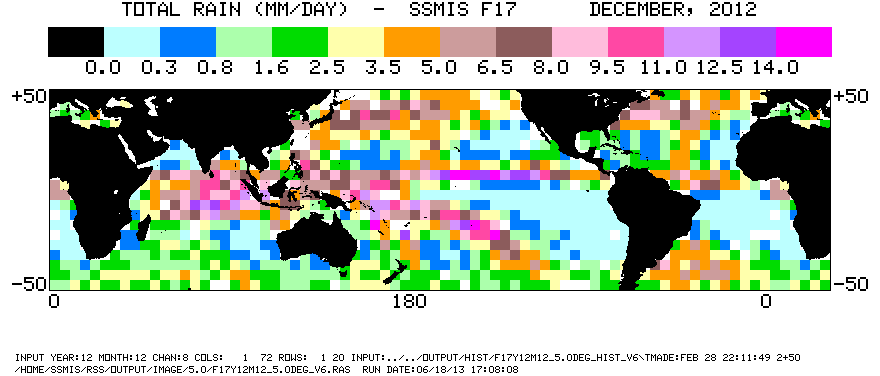
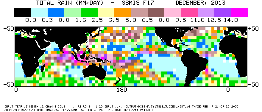
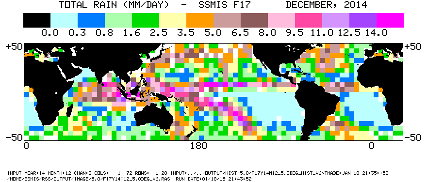
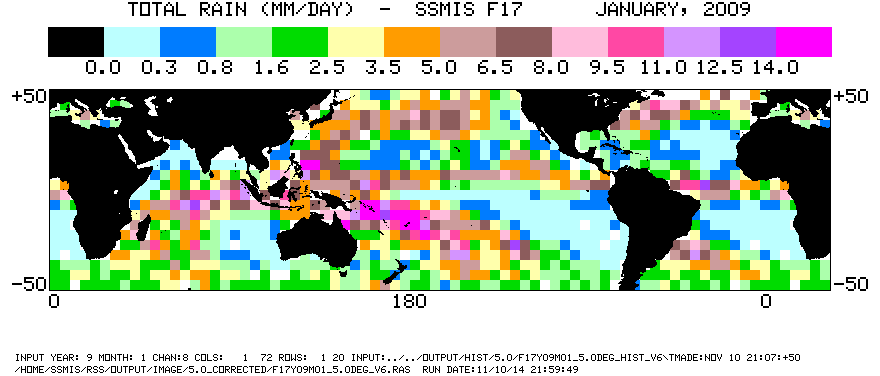
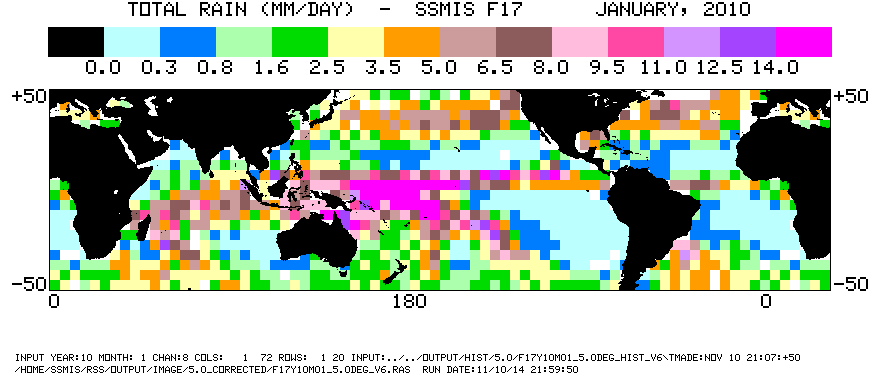
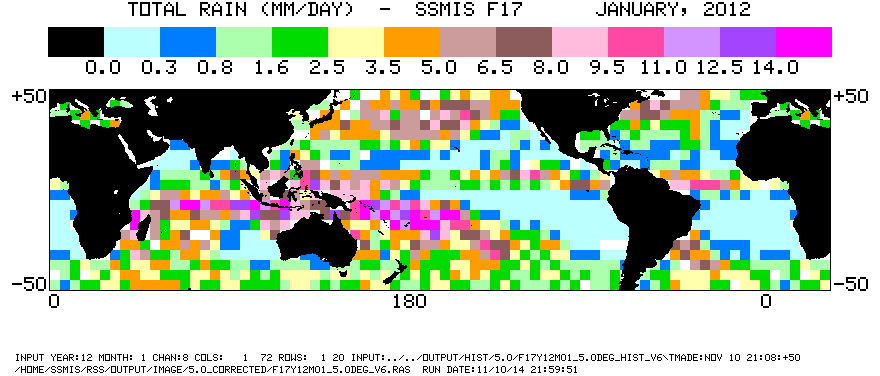
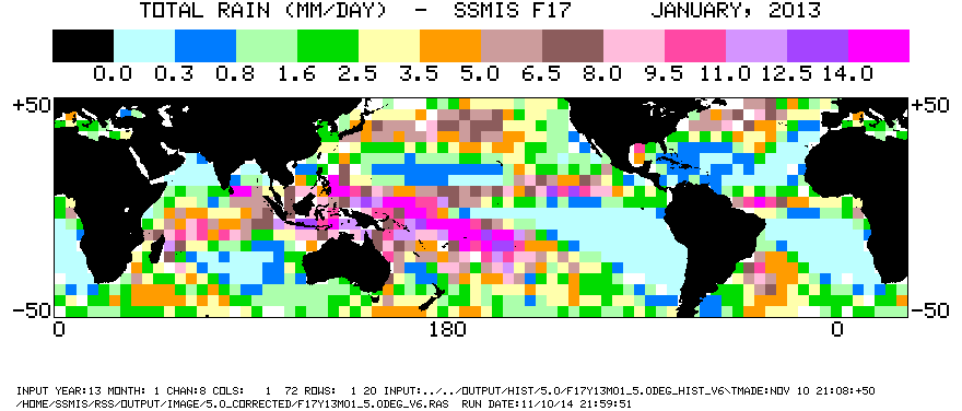
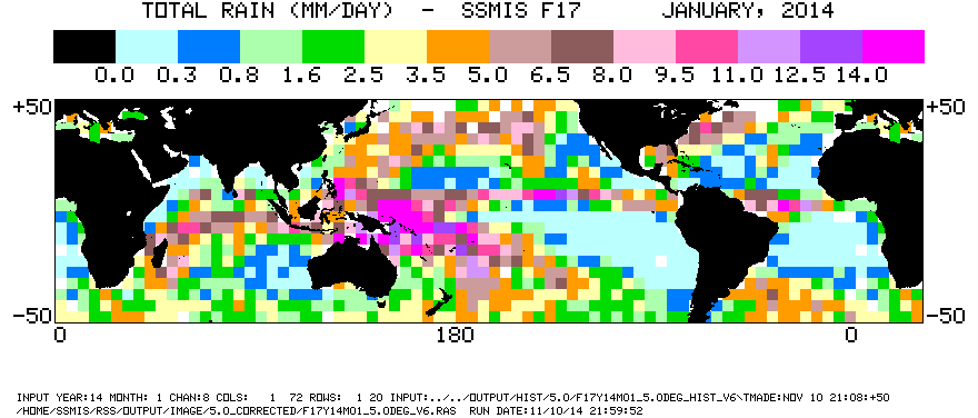
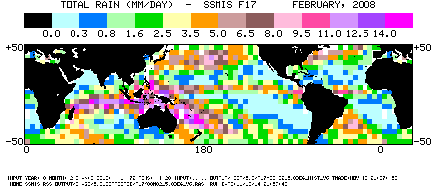
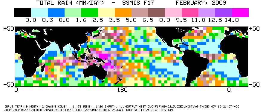
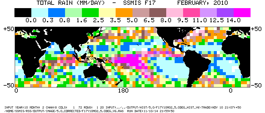
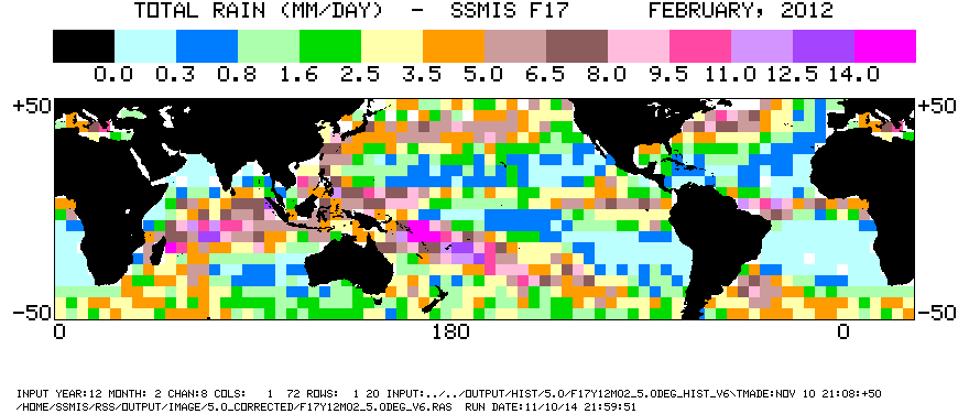
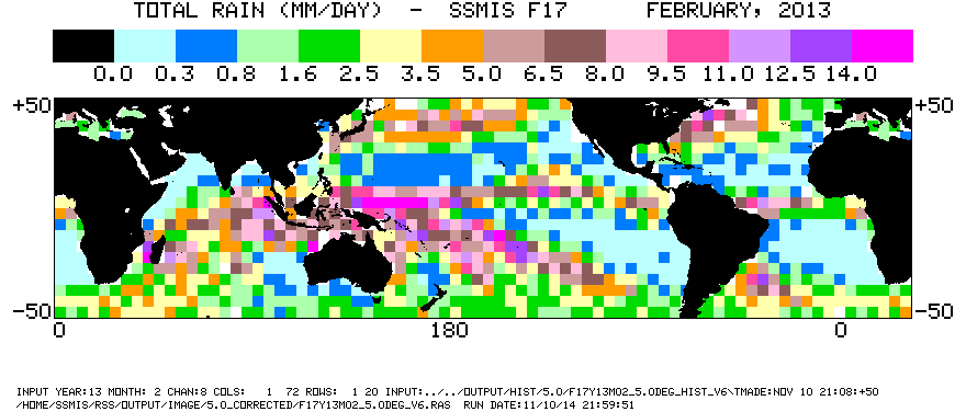
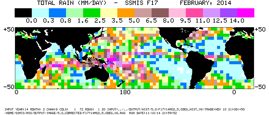
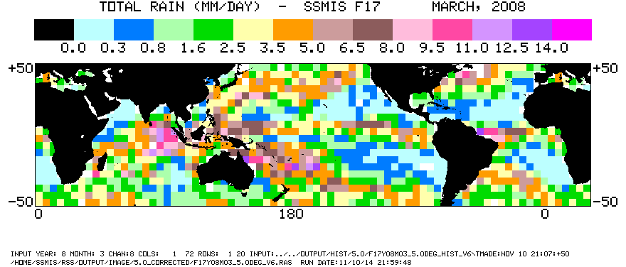
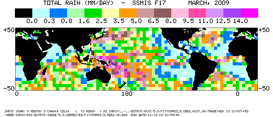
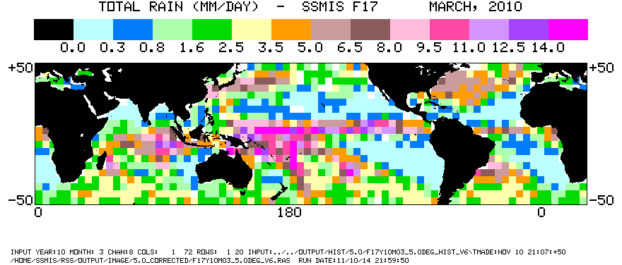
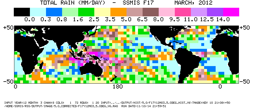
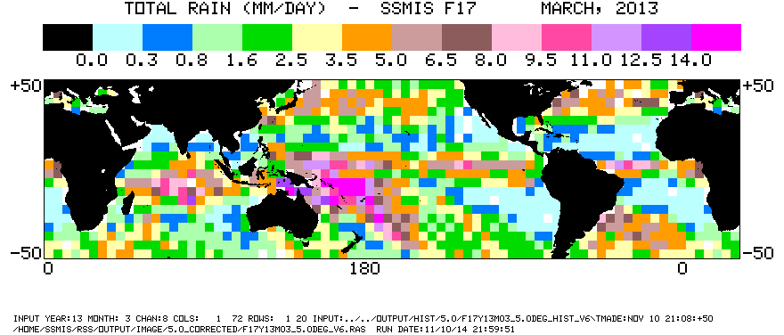
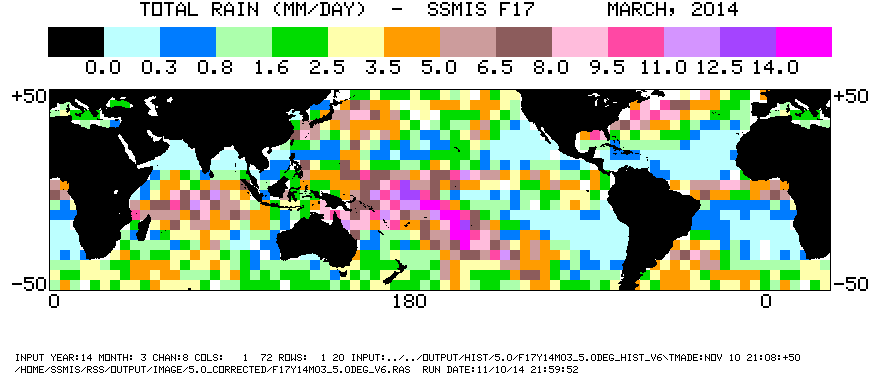
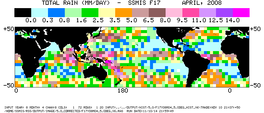
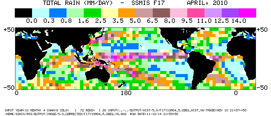
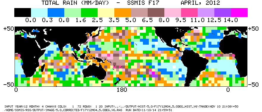
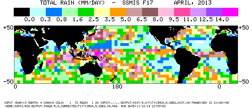
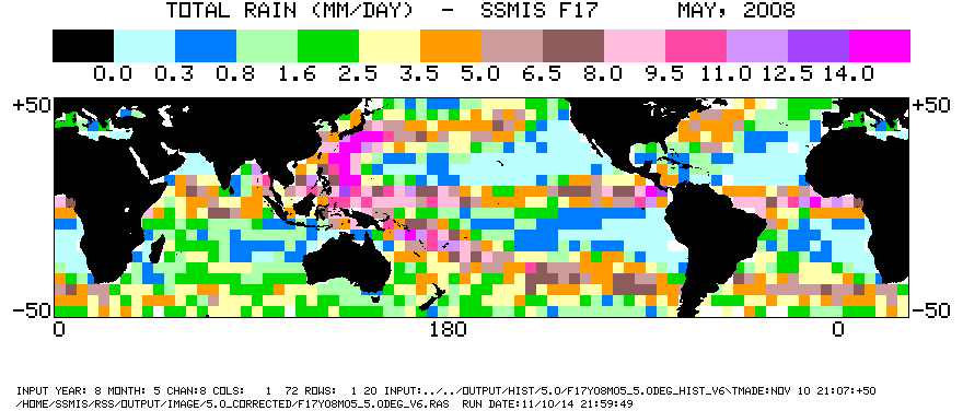
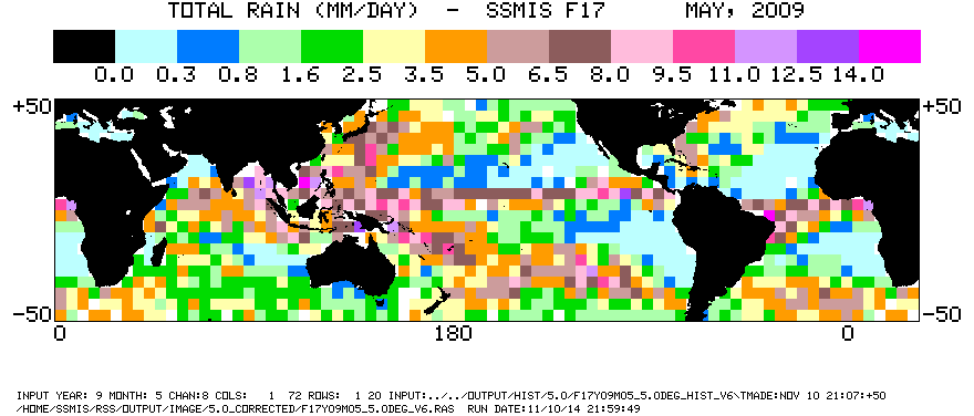
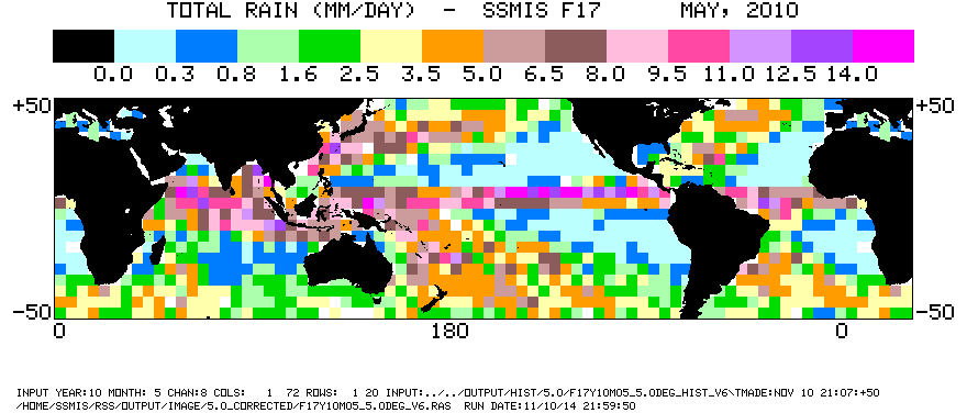
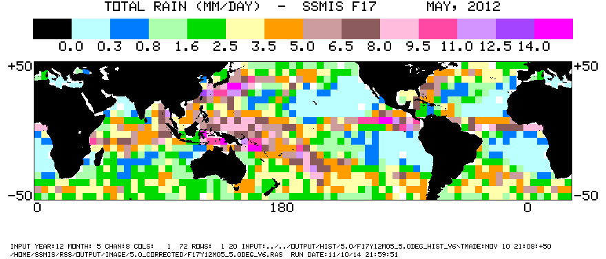
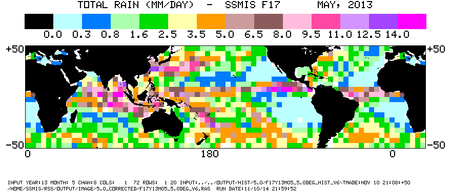
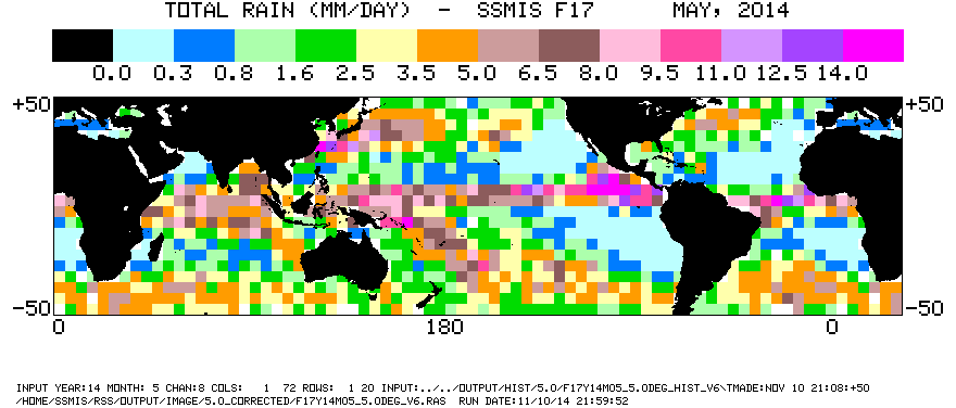
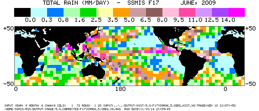
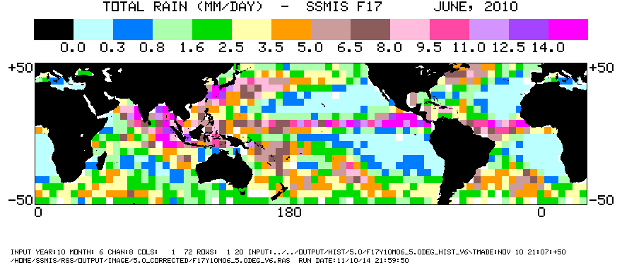
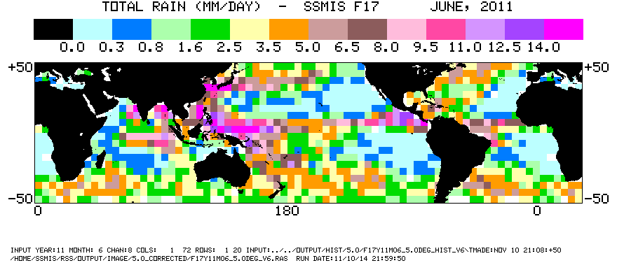
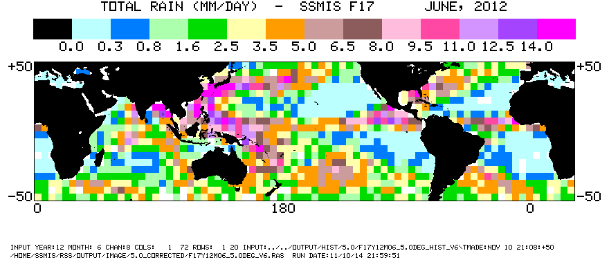
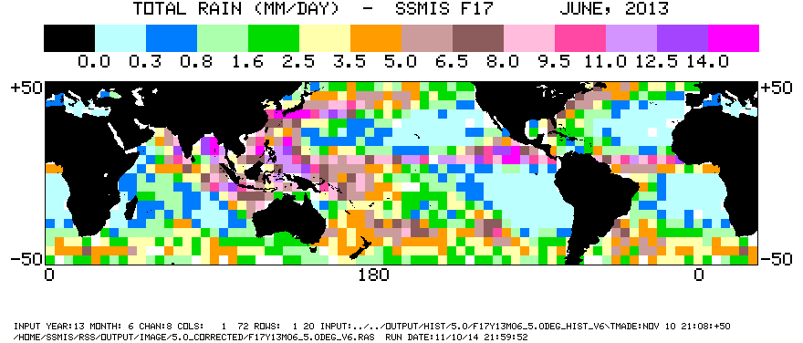
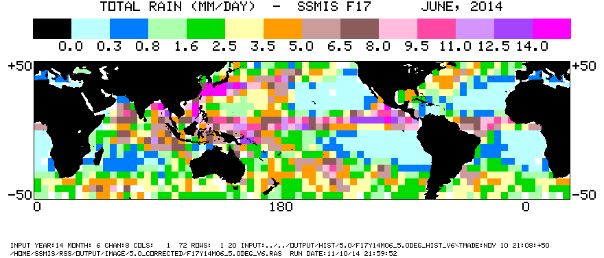
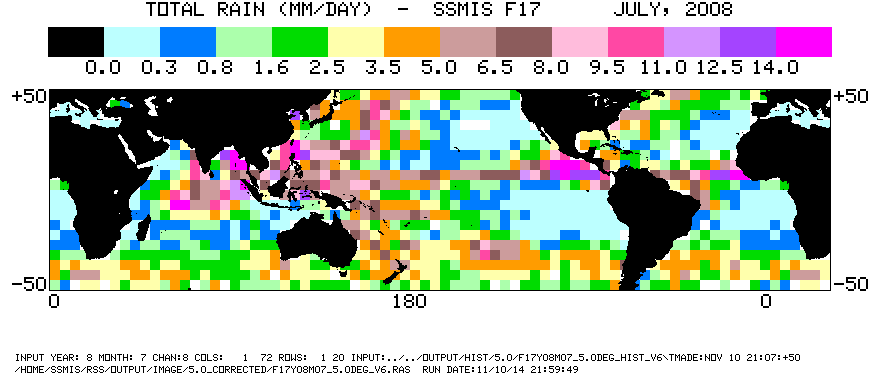
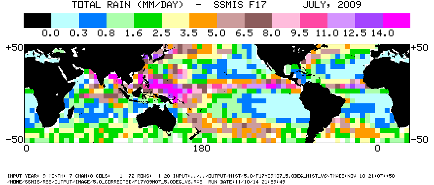
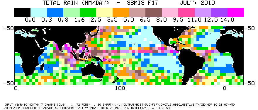
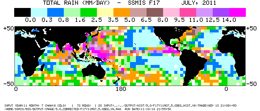
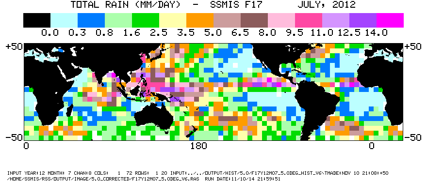
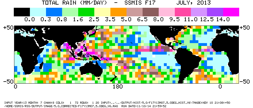
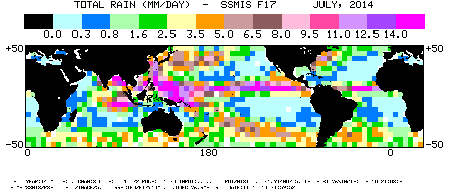
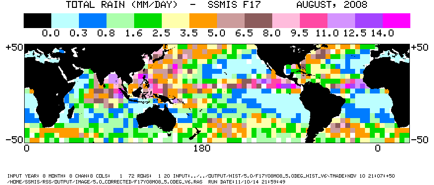
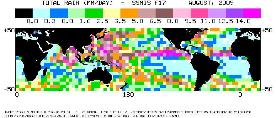
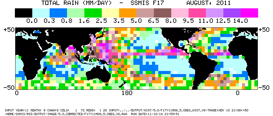
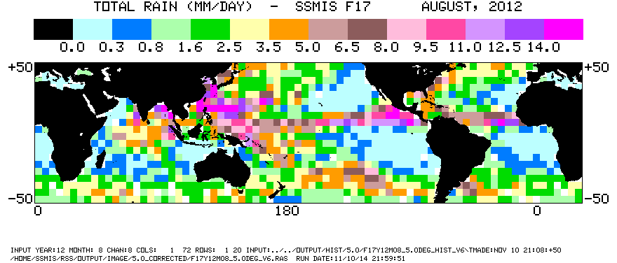
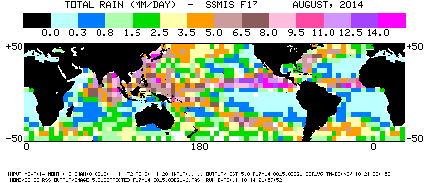
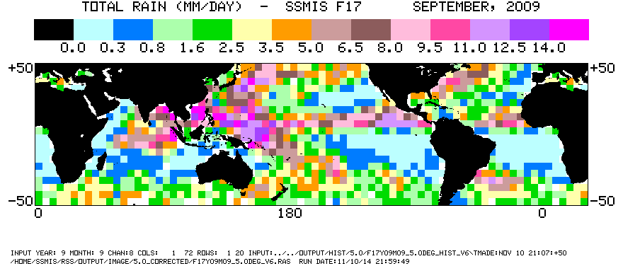
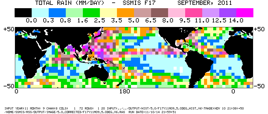
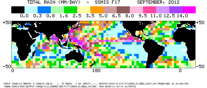
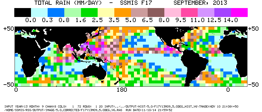
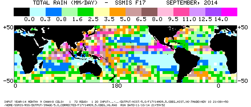
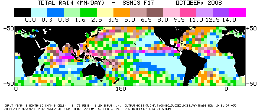
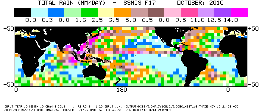
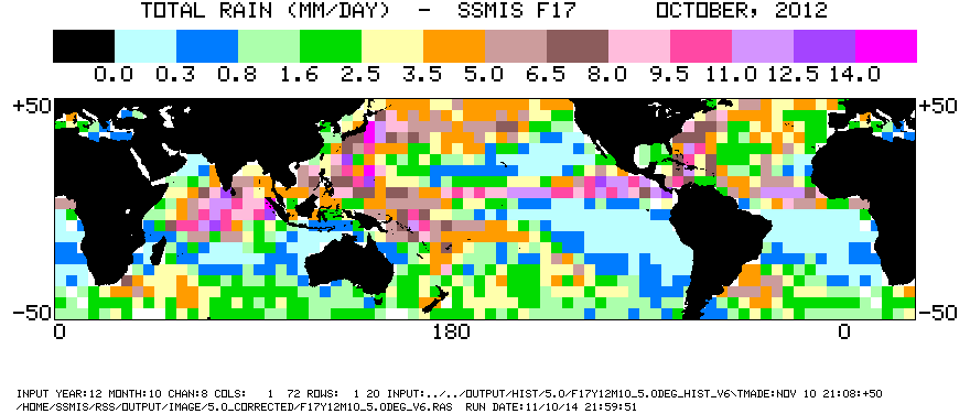
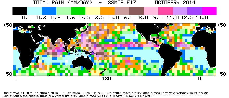
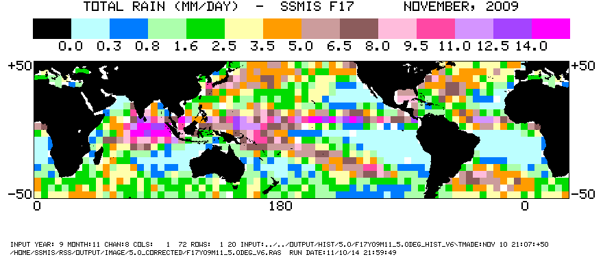
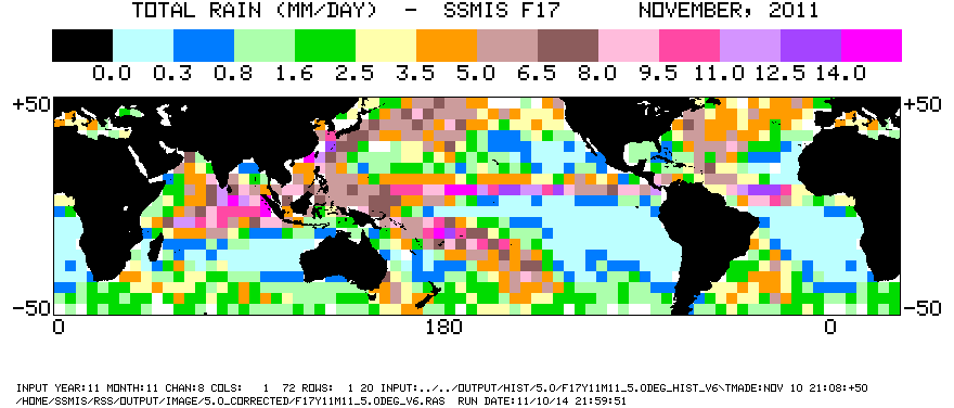
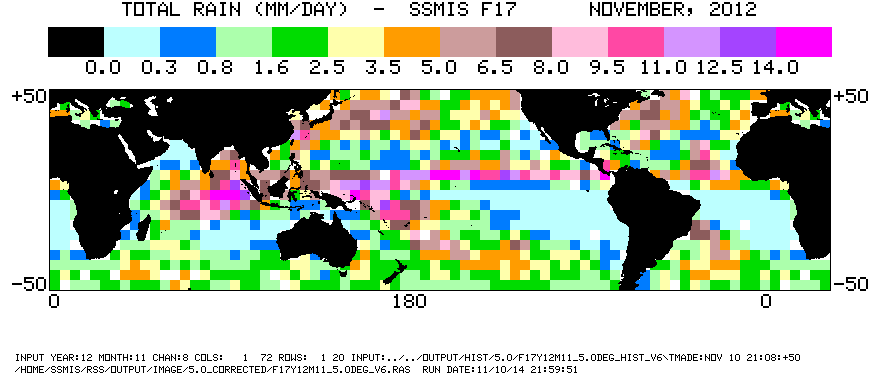
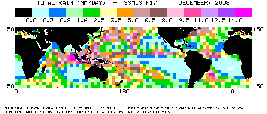
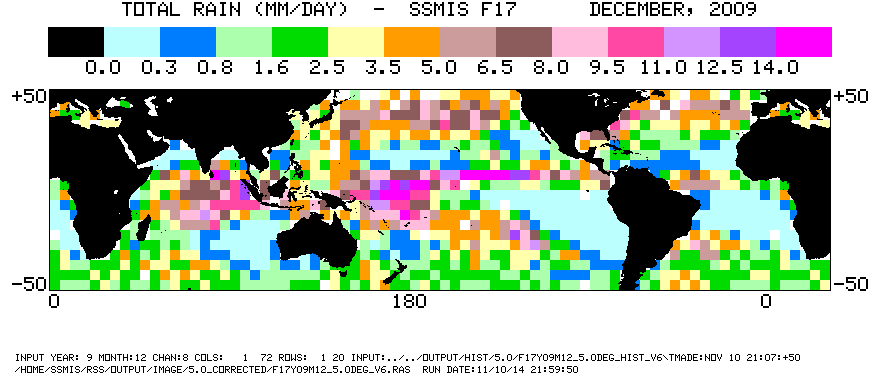
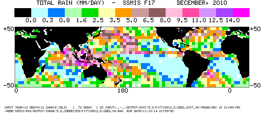
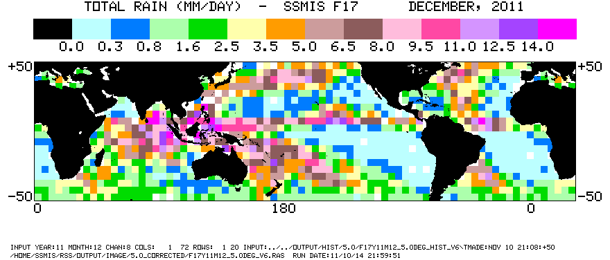
Oceanic Monthly V6 METH Rain Rates from SSM/I and SSMIS Data Summary The table below lists the Global Precipitation Climatology Project (GPCP) oceanic rain rate data as prepared by the Polar Satellite Processing Data Center (PSPDC). The hyperlinks are for viewing rain rate images. "RR" is a monthly oceanic rain rate image. "N/A" is data not available. Measurements from the Special Sensor Microwave Imager (SSM/I) and the Special Sensor Microwave Imager/Sounder (SSMIS) onboard the Defense Meteorological Satellite Program (DMSP) polar orbiting satellites were used as input to the rain rate algorithm. Monthly mean oceanic rain rates were calculated for each 2.5° latitude by 2.5° longitude gridbox for 65° degrees North to 65° South. PSPDC Monthly Rain Rate Data-5.0 degree resolution: Satellite F08
PSPDC Monthly Rain Rate Data-5.0 degree resolution: Satellite F10
PSPDC Monthly Rain Rate Data-5.0 degree resolution: Satellite F11
PSPDC Monthly Rain Rate Data-5.0 degree resolution: Satellite F13 PSPDC Monthly Rain Rate Data-5.0 degree resolution: Satellite F14
PSPDC Monthly Rain Rate Data-5.0 degree resolution: Satellite F15
PSPDC Monthly Rain Rate Data-5.0 degree resolution: Satellite F17
PSPDC Monthly Rain Rate Data-5.0 degree resolution: Satellite F17 Corrected
NOTES: |
|
Last Update: September 14, 2015
|
|||||
| Research Scientist: Dr. Si Gao, AOES/GMU | |||||
| Please send questions and comments to: Prof. Long S. Chiu |