Course Information
Title: GGS756-001 Physical Principles of Remote
Sensing
CRN: 82106
Time: Tuesday 4:30 - 7:10 PM
Classroom: Hanover Hall L002
Instructor: Dr.
John Qu
Telephone: (703) 993-3958
Office: Exploratory Hall, Room 2412
Office Hour: Stop by 1:30-3: & 3:30 PM on Tuesdays or make appointment
Course Description
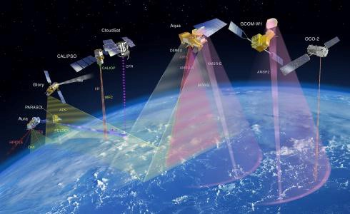
This course is designed to give students with limited Earth science satellite remote sensing background a thorough introduction to gather the basic concepts and fundamentals of physical principles of remote sensing. The main emphasis of this course is on the basic physical and mathematical principles underlying the satellite remote sensing techniques, including radiometric and geometric information, satellite orbit and geo-location simulation, science algorithm designing, atmosphere corrections, and in situ measurements in support of remote sensing. In addition, this class will provide a focus on the NASA current and future Earth Observing System (EOS) instruments, such as the Moderate Resolution Imaging Spectroradiometer (MODIS), NOAA JPSS Visible Infrared Imaging Radiometer Suite (VIIRS), and USGS Landsat missions. These students will understand not only what satellite remote sensing systems do, but also how they work. This course aims to provide students all-inclusive overview of the state of the art in physical principles of remote sensing not only for monitoring global and regional atmosphere, ocean and land surface, but also for detecting local targets, such as, urban and suburban areas.
Schedule
| Week one (08/27) |
Introduction to Earth science satellite remote sensing
|
| Week two (09/03) |
Physical fundamentals of remote sensing
|
| Week three (09/10) |
Top atmospheric solar radiation
|
| Week four (09/17) |
Atmospheric absorption and scattering
|
| Week five (09/24) |
Radiation transfer in the atmosphere
|
| Week six (10/01) |
Applications radiation transfer principles to remote sensing I
|
| Week seven (10/08) |
Applications radiation transfer principles to remote sensing II
|
| Week eight (10/15) |
Platform for remote sensing and Electro-optical systems
|
| Week nine (10/22) |
Satellite orbit and geo-location simulation
|
| Week ten (10/29) |
Sensor Data Record (SDR): data products
|
| Week eleven (11/05) |
SDR algorithms and calibrations
|
| Week twelve (11/12) |
Atmospheric correction and vegetation indices
|
| Week thirteen (11/19) |
Selected scientific Environmental Data Record (EDR) algorithms
|
| Week fourteen (11/26) |
Physical Principals of the “Earth Observation Big Data”
|
| Week fifteen (12/03) |
Student presentations
|
| Week sixteen (12/10) |
Final Term Paper Due
|
Final project
EOS, JPSS or NPP, Landsat related topics and focusing on physical principles of satellite remote sensing.
Grading
- Midterm
30%
- Homework
20%
- Final Project 50%
(A=90-100, B=80-89, C=70-79,
D=60-69, F=<60)
Prerequisite
Permission of the instructor
Required Textbook: None
Reference Books and Documents
- Kuo-Nan Liou, 2002, An Introduction to Atmospheric Radiation, Second Edition, Academic Press, ISBN 0-12-451451-0
- Charles Elachi, 1987, Introduction to the Physics of Remote Sensing Wiley Series in Remote Sensing, John Wiley & Sons Inc., ISBN-0-471-84810-7.
- Wiley J. Larson and James R. Wertz, 1997, Space Mission Analysis and Design, Space Technology Series. Kluwer Academic Publishers, ISBN 1-881883-01-9 (paperback), ISBN 0-7923-1998-2 (hardback).
- John J. Qu, Wei Gao, Menas Kafatos, Robert E. Murphy, Vincent V. Salomonson, 2006, Earth Science Satellite Remote Sensing Vol. 1: Science and Instruments http://link.springer.com/book/10.1007%2F978-3-540-37293-6
- John J. Qu, Wei Gao, Menas Kafatos, Robert E. Murphy, Vincent V. Salomonson, 2006, Earth Science Satellite Remote Sensing Vol. 2 Data, Computational Processing, and Tools. http://link.springer.com/book/10.1007%2F978-3-540-37294-3
- Some EOS, JPSS, and NPP Algorithm Theoretical Basis Documents (ATBDs) will be used during this class.
Useful Links
- NASA Earth Observing System
- Seleced
EOS instrument ATBDs
- NASA Visible Earth
- NASA/GSFC MODIS Direct
readout
- NASA Remote Sensing
Tutorial
- NPP Web Page
- JPSS Web Page
- NASA AERONET (AErosol
RObotic NETwork) program
- MODIS Rapid
Response System
- USGS Landsat website
|